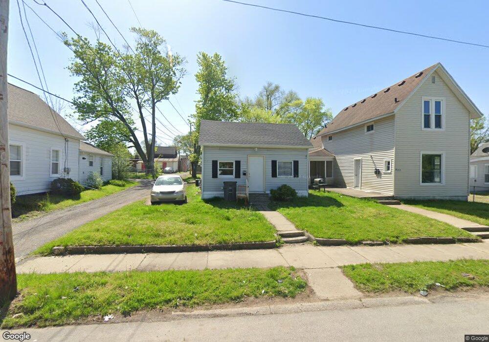
1213 Hudson St Elkhart, IN 46516
South Shore-Bridge Street NeighborhoodEstimated Value: $84,000 - $131,000
2
Beds
1
Bath
1,550
Sq Ft
$67/Sq Ft
Est. Value
About This Home
This home is located at 1213 Hudson St, Elkhart, IN 46516 and is currently estimated at $103,713, approximately $66 per square foot. 1213 Hudson St is a home located in Elkhart County with nearby schools including Mary Daly Elementary School, West Side Middle School, and Elkhart High School.
Ownership History
Date
Name
Owned For
Owner Type
Purchase Details
Closed on
Jul 10, 2020
Sold by
Ccbkt Family Partners Llc
Bought by
Lux Property Corporation
Current Estimated Value
Purchase Details
Closed on
Dec 20, 2004
Sold by
Yoder Cynthia R
Bought by
Ccbkt Family Partners Llc
Home Financials for this Owner
Home Financials are based on the most recent Mortgage that was taken out on this home.
Original Mortgage
$43,200
Interest Rate
5.78%
Mortgage Type
Purchase Money Mortgage
Purchase Details
Closed on
Dec 13, 2004
Sold by
Knowles Marjorie E and Knowles Forrest W
Bought by
Yoder Cynthia R
Home Financials for this Owner
Home Financials are based on the most recent Mortgage that was taken out on this home.
Original Mortgage
$43,200
Interest Rate
5.78%
Mortgage Type
Purchase Money Mortgage
Create a Home Valuation Report for This Property
The Home Valuation Report is an in-depth analysis detailing your home's value as well as a comparison with similar homes in the area
Home Values in the Area
Average Home Value in this Area
Purchase History
| Date | Buyer | Sale Price | Title Company |
|---|---|---|---|
| Lux Property Corporation | -- | Fidelity National Ttl Co Llc | |
| Ccbkt Family Partners Llc | -- | Stewart Title Of Elkhart Of | |
| Yoder Cynthia R | -- | Stewart Title Of Elkhart Of |
Source: Public Records
Mortgage History
| Date | Status | Borrower | Loan Amount |
|---|---|---|---|
| Previous Owner | Yoder Cynthia R | $43,200 |
Source: Public Records
Tax History Compared to Growth
Tax History
| Year | Tax Paid | Tax Assessment Tax Assessment Total Assessment is a certain percentage of the fair market value that is determined by local assessors to be the total taxable value of land and additions on the property. | Land | Improvement |
|---|---|---|---|---|
| 2024 | $1,289 | $66,600 | $8,000 | $58,600 |
| 2022 | $1,289 | $48,200 | $8,000 | $40,200 |
| 2021 | $263 | $12,000 | $8,000 | $4,000 |
| 2020 | $961 | $43,800 | $8,000 | $35,800 |
| 2019 | $712 | $32,400 | $3,000 | $29,400 |
| 2018 | $639 | $28,800 | $3,000 | $25,800 |
| 2017 | $635 | $28,800 | $3,000 | $25,800 |
| 2016 | $634 | $28,800 | $3,000 | $25,800 |
| 2014 | $572 | $27,000 | $3,000 | $24,000 |
| 2013 | $560 | $28,000 | $8,000 | $20,000 |
Source: Public Records
Map
Nearby Homes
- 1301 Harrison St
- 1309 Harrison St
- 1202 S Shore Dr
- 1007 Mason St
- 726 W Lexington Ave
- 124 S Vine St
- 721 Harrison St
- 709 Strong Ave
- 311 Hillside Ct
- 100 S Michigan St
- 1021 Strong Ave
- 607 W Marion St
- 1106 Strong Ave
- 915 Fulton St
- 154 N 6th St
- 419 W High St
- 00000 W Lexington Ave
- 626 Bower St
- 1803 W Indiana Ave
- 301 W Jackson Blvd
- 1215 Hudson St
- 1211 Hudson St
- 1209 Hudson St
- 304 Fremont St
- 307 Union St
- 301 Union St
- 309 Union St
- 1210 W Franklin St
- 1210 W Franklin St Unit 4
- 1206 Hudson St
- 1212 Hudson St
- 1218 Hudson St
- 1206 W Franklin St
- 1222 Hudson St
- 307 Fremont St
- 1200 Hudson St
- 301 Fremont St
- 311 Fremont St
- 1300 W Franklin St
- 308 Union St