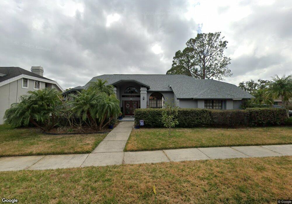
1213 Huntington Ln Safety Harbor, FL 34695
Estimated Value: $749,800 - $905,000
--
Bed
1
Bath
2,699
Sq Ft
$316/Sq Ft
Est. Value
About This Home
This home is located at 1213 Huntington Ln, Safety Harbor, FL 34695 and is currently estimated at $851,700, approximately $315 per square foot. 1213 Huntington Ln is a home located in Pinellas County with nearby schools including Safety Harbor Elementary School, Countryside High School, and Safety Harbor Middle School.
Ownership History
Date
Name
Owned For
Owner Type
Purchase Details
Closed on
Apr 24, 2002
Sold by
Ferrero Peter C and Ferrero Joan M
Bought by
Itschner Robert L and Itschner Amy L J
Current Estimated Value
Home Financials for this Owner
Home Financials are based on the most recent Mortgage that was taken out on this home.
Original Mortgage
$175,000
Outstanding Balance
$73,890
Interest Rate
7.07%
Mortgage Type
New Conventional
Estimated Equity
$777,810
Create a Home Valuation Report for This Property
The Home Valuation Report is an in-depth analysis detailing your home's value as well as a comparison with similar homes in the area
Home Values in the Area
Average Home Value in this Area
Purchase History
| Date | Buyer | Sale Price | Title Company |
|---|---|---|---|
| Itschner Robert L | $275,000 | -- |
Source: Public Records
Mortgage History
| Date | Status | Borrower | Loan Amount |
|---|---|---|---|
| Open | Itschner Robert L | $175,000 |
Source: Public Records
Tax History Compared to Growth
Tax History
| Year | Tax Paid | Tax Assessment Tax Assessment Total Assessment is a certain percentage of the fair market value that is determined by local assessors to be the total taxable value of land and additions on the property. | Land | Improvement |
|---|---|---|---|---|
| 2024 | $4,716 | $327,971 | -- | -- |
| 2023 | $4,716 | $318,418 | $0 | $0 |
| 2022 | $4,586 | $309,144 | $0 | $0 |
| 2021 | $4,648 | $300,140 | $0 | $0 |
| 2020 | $4,639 | $295,996 | $0 | $0 |
| 2019 | $4,559 | $289,341 | $0 | $0 |
| 2018 | $4,498 | $283,946 | $0 | $0 |
| 2017 | $4,461 | $278,106 | $0 | $0 |
| 2016 | $4,426 | $272,386 | $0 | $0 |
| 2015 | $4,518 | $270,493 | $0 | $0 |
| 2014 | $4,496 | $268,346 | $0 | $0 |
Source: Public Records
Map
Nearby Homes
- 1111 Chatham Ct
- 3321 Meander Ln
- 1005 Chatham Ct
- 2208 Hampstead Ct
- 1119 Huntington Ln
- 910 Kingscote Ct
- 2225 Windsong Ct
- 720 Earls Ct
- 1205 Hounds Run
- 647 Fairmont Ave Unit C
- 605 Quail Keep Dr
- 2363 Flanders Way Unit C
- 137 Woodcreek Dr E
- 2368 Flanders Way Unit D
- 615 Fairmont Ave Unit C
- 612 Fairmont Ave Unit D
- 603 Baldwin Ave Unit B
- 511 Haverhill Ln
- 1209 Roxbury Dr
- 511 Longfellow Ct Unit D
- 1211 Huntington Ln
- 1009 Chatham Ct
- 1215 Huntington Ln
- 1209 Huntington Ln
- 1214 Huntington Ln
- 1007 Chatham Ct
- 1212 Huntington Ln
- 1117 Wellington Way
- 1210 Huntington Ln
- 1201 Wellington Way
- 1110 Chatham Ct
- 1115 Wellington Way
- 1208 Huntington Ln
- 1204 Wellington Way
- 1205 Huntington Ln
- 1008 Chatham Ct
- 1003 Chatham Ct
- 1113 Wellington Way
- 1022 Chillum Ct
- 1002 Chillum Ct