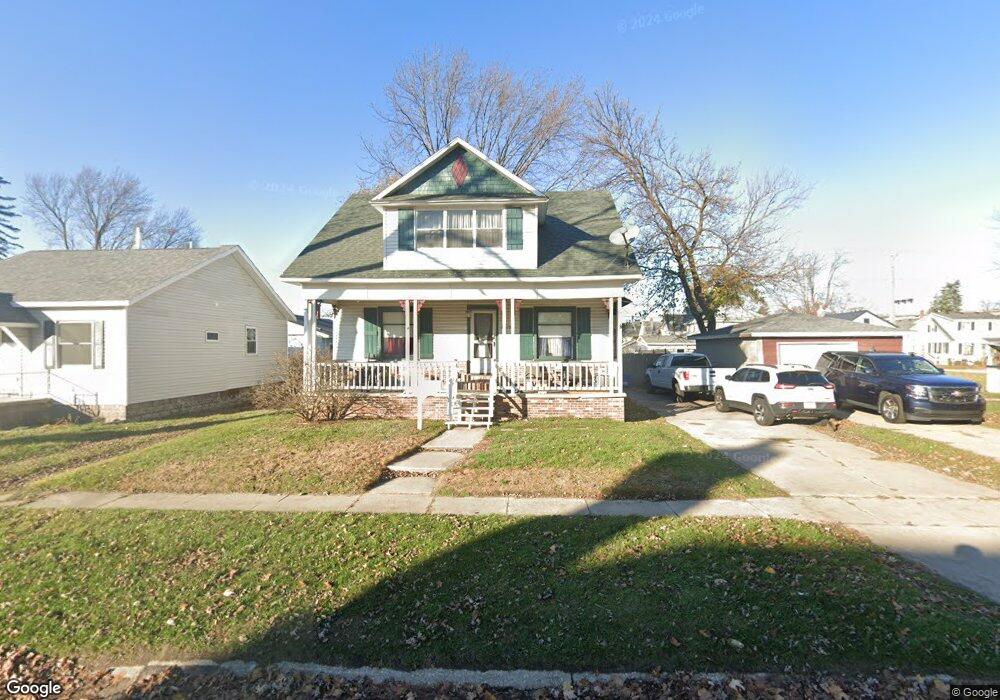
1213 Mansfield St Port Huron, MI 48060
Estimated Value: $129,000 - $164,000
3
Beds
2
Baths
1,278
Sq Ft
$115/Sq Ft
Est. Value
About This Home
This home is located at 1213 Mansfield St, Port Huron, MI 48060 and is currently estimated at $146,871, approximately $114 per square foot. 1213 Mansfield St is a home located in St. Clair County with nearby schools including H.D. Crull Elementary School, Holland Woods Middle School, and Port Huron Northern High School.
Create a Home Valuation Report for This Property
The Home Valuation Report is an in-depth analysis detailing your home's value as well as a comparison with similar homes in the area
Home Values in the Area
Average Home Value in this Area
Tax History Compared to Growth
Tax History
| Year | Tax Paid | Tax Assessment Tax Assessment Total Assessment is a certain percentage of the fair market value that is determined by local assessors to be the total taxable value of land and additions on the property. | Land | Improvement |
|---|---|---|---|---|
| 2025 | $1,376 | $59,700 | $0 | $0 |
| 2024 | $1,124 | $56,000 | $0 | $0 |
| 2023 | $1,062 | $49,700 | $0 | $0 |
| 2022 | $1,059 | $42,800 | $0 | $0 |
| 2021 | $1,006 | $39,400 | $0 | $0 |
| 2020 | $1,017 | $36,600 | $36,600 | $0 |
| 2019 | $999 | $25,000 | $0 | $0 |
| 2018 | $978 | $25,000 | $0 | $0 |
| 2017 | $874 | $23,500 | $0 | $0 |
| 2016 | $738 | $23,500 | $0 | $0 |
| 2015 | $724 | $21,300 | $21,300 | $0 |
| 2014 | $724 | $20,200 | $20,200 | $0 |
| 2013 | -- | $20,300 | $0 | $0 |
Source: Public Records
Map
Nearby Homes
- 2400 Stone St Unit 2414
- 2419 Cherry St
- 1116 Hancock St
- 1620 McBrady St
- 1649 Whipple St
- 1433 Poplar St
- 2431 Armour St
- 1907 Riverside Dr
- 1218 Garfield St
- 1733 Whipple St
- 1819 Riverside Dr
- 2215 Hancock St
- 2913 11th Ave
- 1531 Robinson St
- 1417 Kearney St
- 1202 Palmer Ct
- 0000 Campau Ave
- 2925 Linda Ct
- 2812 19th Ave
- 1828 Kennelworth Dr