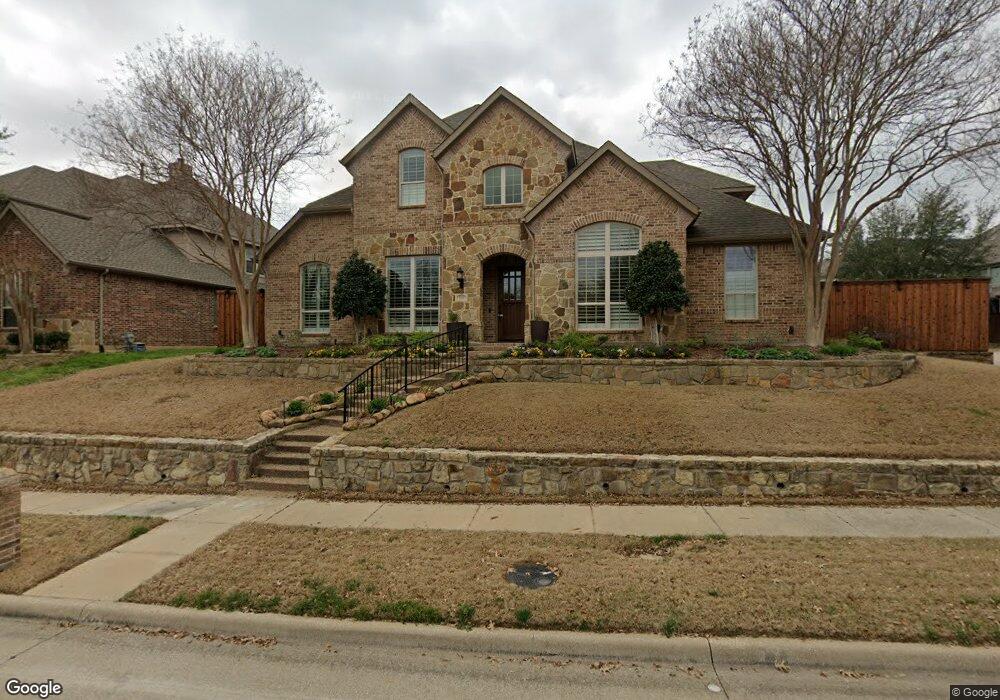
1213 Means Farm Rd Garland, TX 75044
Firewheel NeighborhoodEstimated Value: $810,000 - $878,000
5
Beds
5
Baths
4,647
Sq Ft
$181/Sq Ft
Est. Value
About This Home
This home is located at 1213 Means Farm Rd, Garland, TX 75044 and is currently estimated at $843,279, approximately $181 per square foot. 1213 Means Farm Rd is a home located in Dallas County with nearby schools including Oakhill Day School and Firewheel Christian Academy.
Ownership History
Date
Name
Owned For
Owner Type
Purchase Details
Closed on
Aug 10, 2020
Sold by
Bogue Scott B and Bogue Caroline F
Bought by
Whaley Kevin L and Whaley Jennifer A
Current Estimated Value
Home Financials for this Owner
Home Financials are based on the most recent Mortgage that was taken out on this home.
Original Mortgage
$510,400
Outstanding Balance
$452,761
Interest Rate
3%
Mortgage Type
New Conventional
Estimated Equity
$390,518
Purchase Details
Closed on
Jun 11, 2009
Sold by
Highland Homes Ltd
Bought by
Bogue Scott B and Bogue Caroline F
Home Financials for this Owner
Home Financials are based on the most recent Mortgage that was taken out on this home.
Original Mortgage
$332,000
Interest Rate
4.7%
Mortgage Type
Purchase Money Mortgage
Purchase Details
Closed on
Dec 22, 2008
Sold by
Provence At Firewheel Lp
Bought by
Highland Homes Ltd
Create a Home Valuation Report for This Property
The Home Valuation Report is an in-depth analysis detailing your home's value as well as a comparison with similar homes in the area
Home Values in the Area
Average Home Value in this Area
Purchase History
| Date | Buyer | Sale Price | Title Company |
|---|---|---|---|
| Whaley Kevin L | -- | None Available | |
| Bogue Scott B | -- | None Available | |
| Highland Homes Ltd | -- | Rtc |
Source: Public Records
Mortgage History
| Date | Status | Borrower | Loan Amount |
|---|---|---|---|
| Open | Whaley Kevin L | $510,400 | |
| Previous Owner | Bogue Scott B | $332,000 |
Source: Public Records
Tax History Compared to Growth
Tax History
| Year | Tax Paid | Tax Assessment Tax Assessment Total Assessment is a certain percentage of the fair market value that is determined by local assessors to be the total taxable value of land and additions on the property. | Land | Improvement |
|---|---|---|---|---|
| 2025 | $15,782 | $802,260 | $95,000 | $707,260 |
| 2024 | $15,782 | $802,260 | $95,000 | $707,260 |
| 2023 | $15,782 | $855,860 | $95,000 | $760,860 |
| 2022 | $18,628 | $757,580 | $95,000 | $662,580 |
| 2021 | $16,348 | $621,680 | $95,000 | $526,680 |
| 2020 | $13,313 | $499,410 | $95,000 | $404,410 |
| 2019 | $14,089 | $499,410 | $95,000 | $404,410 |
| 2018 | $13,391 | $474,620 | $80,000 | $394,620 |
| 2017 | $13,381 | $474,620 | $80,000 | $394,620 |
| 2016 | $13,936 | $494,320 | $80,000 | $414,320 |
| 2015 | $10,992 | $459,590 | $54,000 | $405,590 |
| 2014 | $10,992 | $459,590 | $54,000 | $405,590 |
Source: Public Records
Map
Nearby Homes
- 1214 Luna Ln
- 1205 Luna Ln
- 1313 Bobby Boyd Ln
- 5302 Murphy Rd
- 5100 Murphy Rd
- 5205 Jefferson Dr
- 5007 Jefferson Dr
- TBS Hwy78
- 1641 Ben Davis Rd
- 5117 Greensboro Dr
- 2006 Cornwall Ln
- 1230 Donegal Ln
- 2402 Ash Ln
- 2414 Ash Ln
- 2418 Ash Ln
- 1526 Bonanza Ct
- 2422 Ash Ln
- 2406 Bent Oak Trail
- 2402 Bent Oak Trail
- 4802 Walton Heath Dr
- 1209 Means Farm Rd
- 1210 Wynne Dr
- 1206 Wynne Dr
- 1122 Burnett Ct
- 1201 Means Farm Rd
- 1202 Wynne Dr
- 1210 Means Farm Rd
- 1118 Burnett Ct
- 1218 Means Farm Rd
- 1206 Means Farm Rd
- 1118 Wynne Dr
- 1121 Means Farm Rd
- 1202 Means Farm Rd
- 1114 Burnett Ct
- 1222 Means Farm Rd
- 1114 Wynne Dr
- 1209 Wynne Dr
- 1213 Wynne Dr
- 1205 Wynne Dr
- 1117 Means Farm Rd