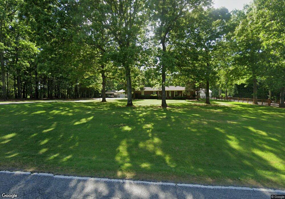
1213 Mount Zion Rd Spartanburg, SC 29303
Estimated Value: $304,000 - $338,000
3
Beds
2
Baths
1,744
Sq Ft
$186/Sq Ft
Est. Value
About This Home
This home is located at 1213 Mount Zion Rd, Spartanburg, SC 29303 and is currently estimated at $324,535, approximately $186 per square foot. 1213 Mount Zion Rd is a home located in Spartanburg County with nearby schools including Dorman High School Freshman Campus, Dorman High School, and High Point Academy.
Ownership History
Date
Name
Owned For
Owner Type
Purchase Details
Closed on
Mar 10, 2020
Sold by
Sellars Kenneth
Bought by
Sellars Jeffrey K
Current Estimated Value
Purchase Details
Closed on
Mar 2, 2020
Sold by
Sellars Kenneth
Bought by
Brady James H and Brady Rachel K
Purchase Details
Closed on
Aug 7, 2006
Sold by
Shook Freida M
Bought by
Sellars Harold and Sellars Mary
Purchase Details
Closed on
Feb 6, 2004
Sold by
Shook Tommy and Shook Tommy E
Bought by
Shook Freida M
Create a Home Valuation Report for This Property
The Home Valuation Report is an in-depth analysis detailing your home's value as well as a comparison with similar homes in the area
Home Values in the Area
Average Home Value in this Area
Purchase History
| Date | Buyer | Sale Price | Title Company |
|---|---|---|---|
| Sellars Jeffrey K | -- | None Available | |
| Brady James H | $220,000 | None Available | |
| Sellars Harold | $183,000 | None Available | |
| Shook Freida M | -- | -- |
Source: Public Records
Tax History Compared to Growth
Tax History
| Year | Tax Paid | Tax Assessment Tax Assessment Total Assessment is a certain percentage of the fair market value that is determined by local assessors to be the total taxable value of land and additions on the property. | Land | Improvement |
|---|---|---|---|---|
| 2025 | $1,550 | $11,480 | $1,440 | $10,040 |
| 2024 | $1,550 | $11,480 | $1,440 | $10,040 |
| 2023 | $1,550 | $11,480 | $1,440 | $10,040 |
| 2022 | $1,408 | $10,068 | $1,200 | $8,868 |
| 2021 | $1,398 | $10,008 | $1,200 | $8,808 |
| 2020 | $1,074 | $8,183 | $1,116 | $7,067 |
| 2019 | $1,074 | $8,182 | $2,845 | $5,337 |
| 2018 | $1,074 | $8,182 | $2,845 | $5,337 |
| 2017 | $886 | $7,115 | $2,746 | $4,369 |
| 2016 | $886 | $7,115 | $2,746 | $4,369 |
| 2015 | $881 | $7,115 | $2,746 | $4,369 |
| 2014 | $852 | $7,115 | $2,746 | $4,369 |
Source: Public Records
Map
Nearby Homes
- 355 Bluebird Ln
- 325 Bluebird Ln
- 255 Bluebird Ln
- 1224 Fox Hollow St
- 1212 Fox Hollow St
- 1180 Fox Hollow St
- 1172 Fox Hollow St
- 1211 Fox Hollow St
- 1176 Fox Hollow St
- 1215 Fox Hollow St
- Middleton Plan at Fox Hollow
- Parker Plan at Fox Hollow
- Beramont Plan at Fox Hollow
- Augusta Plan at Fox Hollow
- Cooper 3 Plan at Fox Hollow
- Drayton Plan at Fox Hollow
- Neroli Plan at Fox Hollow
- 1621 Vixen Dr
- 920 Tibetan St
- 1613 Vixen Dr
- 1219 Mount Zion Rd
- 1212 Mount Zion Rd
- 1205 Mount Zion Rd
- 1231 Mount Zion Rd
- 1231 Mount Zion Rd
- 1216 Mount Zion Rd
- 1224 Mount Zion Rd
- 1125 Mt Zion Rd
- 1125 Mount Zion Rd
- 1235 Mount Zion Rd
- 111 Goforth St
- 243 Hunters Pointe Dr
- 1117 Mount Zion Rd
- 239 Hunters Pointe Dr
- 247 Hunters Pointe Dr
- 290 Bluebird Ln
- 1113 Mount Zion Rd
- 110 Goforth St
- 1230 Mount Zion Rd
- 251 Hunters Pointe Dr