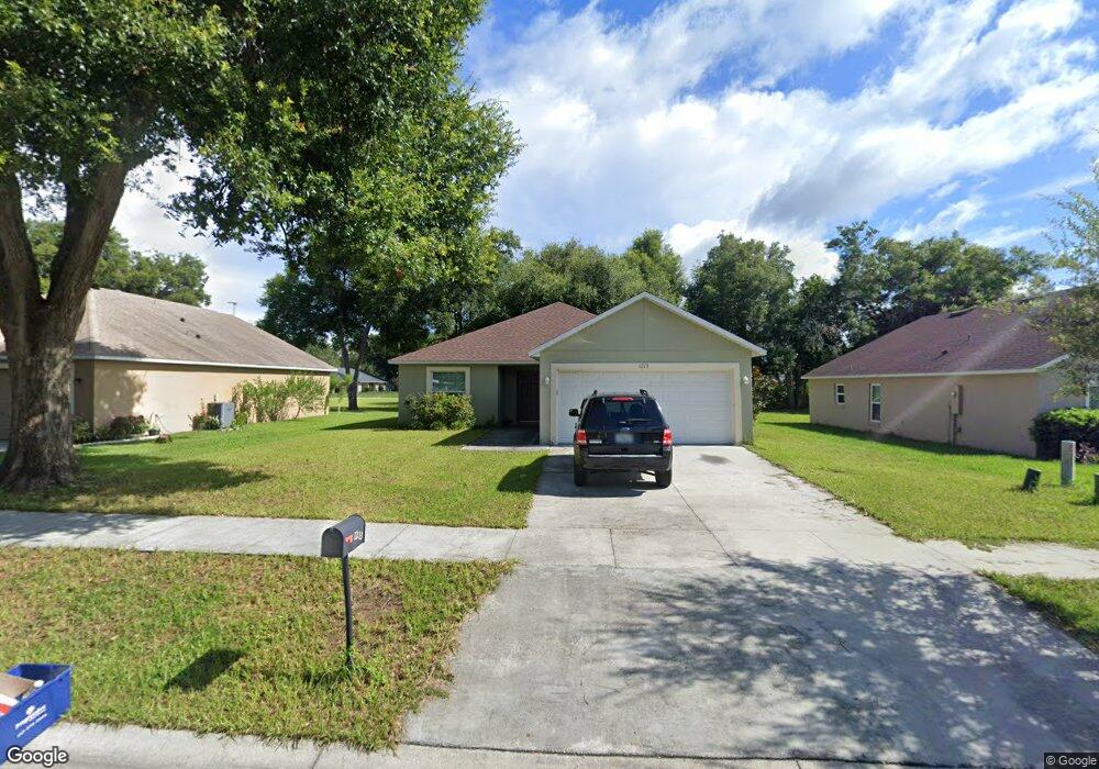
1213 Osprey Nest Cir Groveland, FL 34736
Estimated Value: $287,000 - $305,126
3
Beds
2
Baths
1,466
Sq Ft
$202/Sq Ft
Est. Value
About This Home
This home is located at 1213 Osprey Nest Cir, Groveland, FL 34736 and is currently estimated at $296,282, approximately $202 per square foot. 1213 Osprey Nest Cir is a home with nearby schools including Groveland Elementary School, Gray Middle School, and South Lake High School.
Ownership History
Date
Name
Owned For
Owner Type
Purchase Details
Closed on
Jun 4, 2014
Sold by
Homes In Partnership Inc
Bought by
Perez Eshban J Velez and Torres Shirley Padilla
Current Estimated Value
Home Financials for this Owner
Home Financials are based on the most recent Mortgage that was taken out on this home.
Original Mortgage
$132,280
Outstanding Balance
$106,081
Interest Rate
4.36%
Mortgage Type
USDA
Estimated Equity
$190,201
Create a Home Valuation Report for This Property
The Home Valuation Report is an in-depth analysis detailing your home's value as well as a comparison with similar homes in the area
Home Values in the Area
Average Home Value in this Area
Purchase History
| Date | Buyer | Sale Price | Title Company |
|---|---|---|---|
| Perez Eshban J Velez | $25,500 | Apple Title Ltd |
Source: Public Records
Mortgage History
| Date | Status | Borrower | Loan Amount |
|---|---|---|---|
| Open | Perez Eshban J Velez | $132,280 |
Source: Public Records
Tax History Compared to Growth
Tax History
| Year | Tax Paid | Tax Assessment Tax Assessment Total Assessment is a certain percentage of the fair market value that is determined by local assessors to be the total taxable value of land and additions on the property. | Land | Improvement |
|---|---|---|---|---|
| 2025 | $1,834 | $139,050 | -- | -- |
| 2024 | $1,834 | $139,050 | -- | -- |
| 2023 | $1,834 | $131,070 | $0 | $0 |
| 2022 | $1,750 | $127,260 | $0 | $0 |
| 2021 | $1,485 | $123,561 | $0 | $0 |
| 2020 | $1,466 | $121,856 | $0 | $0 |
| 2019 | $1,479 | $119,117 | $0 | $0 |
| 2018 | $1,407 | $116,896 | $0 | $0 |
| 2017 | $1,375 | $114,492 | $0 | $0 |
| 2016 | $1,383 | $112,138 | $0 | $0 |
| 2015 | $1,434 | $111,359 | $0 | $0 |
| 2014 | $312 | $15,168 | $0 | $0 |
Source: Public Records
Map
Nearby Homes
- 6310 Belle Isles Dr
- 165 Quail Oaks Cir
- XXX Greenwood St
- 15450 State Road 19
- 1527 White Hawk Way
- 15518 State Road 19
- 0 Florida 19
- 8715 Florida 33
- 322 First Ave
- 0 Bonsmara Dr Unit MFRG5102335
- 410 Catherine Ln
- 156 Ashley St
- 373 E Waldo St
- 1146 Bluegrass Dr
- 136 N James Place
- 2081 Newtown Rd
- 370 E Waldo St
- 1142 Bluegrass Dr
- 5729 Bible Camp Rd
- 16406 Blooming Cherry Dr
- 1211 Osprey Nest Cir
- 1215 Osprey Nest Cir
- 1217 Osprey Nest Cir
- 1209 Osprey Nest Cir
- 1079 Osprey Cove Cir
- 1207 Osprey Nest Cir
- 1314 Hawks Nest Ave
- 1219 Osprey Nest Cir
- 1077 Osprey Cove Cir
- 1205 Osprey Nest Cir
- 1312 Hawks Nest Ave
- 1075 Osprey Cove Cir
- 1203 Osprey Nest Cir
- 1076 Osprey Cove Cir
- 1313 Hawks Nest Ave
- 1221 Osprey Nest Cir
- 1308 Hawks Nest Ave
- 1201 Osprey Nest Cir
- 1311 Hawks Nest Ave