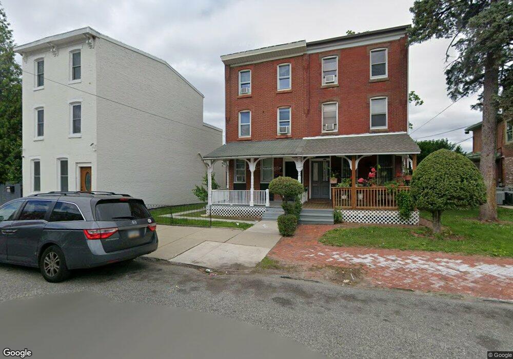
1213 Powell St Norristown, PA 19401
Estimated Value: $221,294 - $299,000
3
Beds
2
Baths
2,442
Sq Ft
$110/Sq Ft
Est. Value
About This Home
This home is located at 1213 Powell St, Norristown, PA 19401 and is currently estimated at $267,574, approximately $109 per square foot. 1213 Powell St is a home located in Montgomery County with nearby schools including Charles Blockson Middle School, Cole Manor Elementary School, and East Norriton Middle School.
Ownership History
Date
Name
Owned For
Owner Type
Purchase Details
Closed on
Dec 27, 2021
Sold by
Marchese Michael J
Bought by
Gleba Casey
Current Estimated Value
Home Financials for this Owner
Home Financials are based on the most recent Mortgage that was taken out on this home.
Original Mortgage
$218,250
Outstanding Balance
$201,145
Interest Rate
3.11%
Mortgage Type
New Conventional
Estimated Equity
$66,429
Purchase Details
Closed on
Feb 26, 2004
Sold by
Dedominic Joseph and Dedominic Debra
Bought by
Marchese Michael J and Marchese Deborah L
Create a Home Valuation Report for This Property
The Home Valuation Report is an in-depth analysis detailing your home's value as well as a comparison with similar homes in the area
Home Values in the Area
Average Home Value in this Area
Purchase History
| Date | Buyer | Sale Price | Title Company |
|---|---|---|---|
| Gleba Casey | $225,000 | Suburban Philadelphia Abstract | |
| Marchese Michael J | -- | -- |
Source: Public Records
Mortgage History
| Date | Status | Borrower | Loan Amount |
|---|---|---|---|
| Open | Gleba Casey | $218,250 |
Source: Public Records
Tax History Compared to Growth
Tax History
| Year | Tax Paid | Tax Assessment Tax Assessment Total Assessment is a certain percentage of the fair market value that is determined by local assessors to be the total taxable value of land and additions on the property. | Land | Improvement |
|---|---|---|---|---|
| 2025 | $3,816 | $62,160 | $27,040 | $35,120 |
| 2024 | $3,816 | $62,160 | $27,040 | $35,120 |
| 2023 | $3,781 | $62,160 | $27,040 | $35,120 |
| 2022 | $3,700 | $62,160 | $27,040 | $35,120 |
| 2021 | $3,681 | $62,160 | $27,040 | $35,120 |
| 2020 | $3,512 | $62,160 | $27,040 | $35,120 |
| 2019 | $3,448 | $62,160 | $27,040 | $35,120 |
| 2018 | $2,295 | $62,160 | $27,040 | $35,120 |
| 2017 | $3,166 | $62,160 | $27,040 | $35,120 |
| 2016 | $3,142 | $62,160 | $27,040 | $35,120 |
| 2015 | $3,010 | $62,160 | $27,040 | $35,120 |
| 2014 | $3,010 | $62,160 | $27,040 | $35,120 |
Source: Public Records
Map
Nearby Homes
- 52 W Basin St
- 16 W Spruce St
- 7 E Basin St
- 105 W Wood St
- 43 E Wood St
- 1035 Willow St
- 1031 Swede St
- 1313 Dekalb St
- 1009 Dekalb St
- 231 W Spruce St
- 1326 Markley St
- 1339 Dekalb St
- 1844 Arbor Place Dr Unit 45S
- 1836 Arbor Place Dr Unit 41W
- 1852 Arbor Place Dr Unit 49S
- 1000 Dekalb St Unit 6
- 1418 Pine St
- 332 James St
- 42 Jacoby St
- 239 W Fornance St