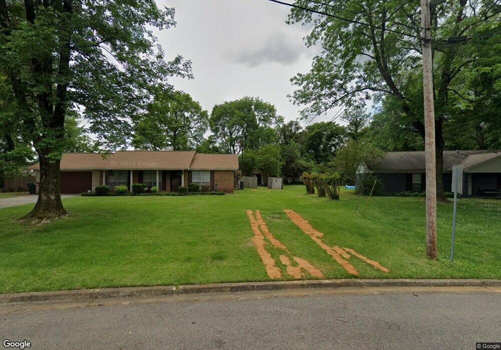
1213 Queensgate Dr Tupelo, MI 38801
Estimated Value: $179,000 - $217,000
3
Beds
2
Baths
1,958
Sq Ft
$101/Sq Ft
Est. Value
About This Home
This home is located at 1213 Queensgate Dr, Tupelo, MI 38801 and is currently estimated at $198,652, approximately $101 per square foot. 1213 Queensgate Dr is a home located in Lee County with nearby schools including Lawndale Elementary School, Parkway Elementary School, and Tupelo Middle School.
Ownership History
Date
Name
Owned For
Owner Type
Purchase Details
Closed on
Jan 17, 2017
Sold by
Braddock Timmy and Braddock Priscilla
Bought by
Braddock Priscilla
Current Estimated Value
Purchase Details
Closed on
May 1, 2008
Sold by
Haynes Paul M
Bought by
Braddock Priscilla and Braddock Timmy L
Home Financials for this Owner
Home Financials are based on the most recent Mortgage that was taken out on this home.
Original Mortgage
$117,063
Interest Rate
5.86%
Purchase Details
Closed on
Oct 9, 2002
Sold by
Haynes Michael Paul
Bought by
Haynes Paul M
Create a Home Valuation Report for This Property
The Home Valuation Report is an in-depth analysis detailing your home's value as well as a comparison with similar homes in the area
Home Values in the Area
Average Home Value in this Area
Purchase History
| Date | Buyer | Sale Price | Title Company |
|---|---|---|---|
| Braddock Priscilla | -- | -- | |
| Braddock Priscilla | -- | -- | |
| Haynes Paul M | -- | -- |
Source: Public Records
Mortgage History
| Date | Status | Borrower | Loan Amount |
|---|---|---|---|
| Previous Owner | Braddock Priscilla | $117,063 |
Source: Public Records
Tax History Compared to Growth
Tax History
| Year | Tax Paid | Tax Assessment Tax Assessment Total Assessment is a certain percentage of the fair market value that is determined by local assessors to be the total taxable value of land and additions on the property. | Land | Improvement |
|---|---|---|---|---|
| 2025 | $1,745 | $12,838 | $0 | $0 |
| 2024 | $1,745 | $12,838 | $0 | $0 |
| 2023 | $1,482 | $11,075 | $0 | $0 |
| 2022 | $1,263 | $11,075 | $0 | $0 |
| 2021 | $1,216 | $11,075 | $0 | $0 |
| 2020 | $1,482 | $11,075 | $0 | $0 |
| 2019 | $1,265 | $11,129 | $0 | $0 |
| 2018 | $1,265 | $11,129 | $0 | $0 |
| 2017 | $1,259 | $11,129 | $0 | $0 |
| 2016 | $1,259 | $11,129 | $0 | $0 |
| 2015 | $1,095 | $10,139 | $0 | $0 |
| 2014 | $1,095 | $10,139 | $0 | $0 |
Source: Public Records
Map
Nearby Homes
- Lot 1 Dunbarton Place
- 1501 Fillmore Dr
- 1304 Kennedy Dr
- 1005 Lawndale Dr
- 2010 Lawndale Dr
- 920 Eisenhower Dr
- 1913 Pheasant Run
- 1015 Taft St
- 2284 Kimbrough Ave
- 2006 Fillmore Dr
- 106 Wildwood Cir
- 623 Maynard Dr
- 1603 Boggan Dr
- 404 Smith St
- 400 Smith St
- 1303 Van Buren Ave
- 210 S Highland Dr
- 1219 Zentwood Rd
- 2102 Fillmore Dr
- 1525 Central Ave
- 1213 Queensgate Dr
- 1215 Queensgate Dr
- 1215 Queensgate Dr
- 1211 Queensgate Dr
- 1210 Queensgate Dr
- 4 Buckingham Place
- 1217 Queensgate Dr
- 1209 Queensgate Dr
- 1217 Queensgate Dr
- 1209 Queensgate Dr
- 1208 Queensgate Dr
- 3 Buckingham Place
- 5 Buckingham Place
- 1212 Queensgate Dr
- 1212 Queensgate Dr
- 2 Buckingham Place
- 2 Buckingham Place
- 11 Cambridge Dr
- 6 Buckingham Place
- 1207 Queensgate Dr