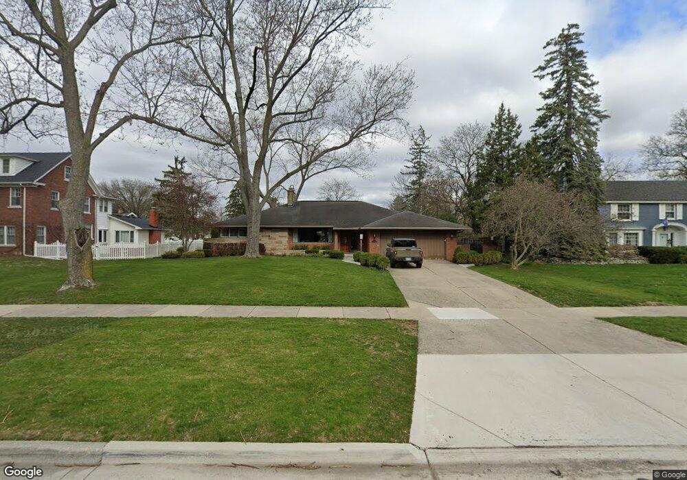
1213 Vinsetta Blvd Royal Oak, MI 48067
Estimated Value: $817,000 - $930,000
4
Beds
4
Baths
2,534
Sq Ft
$350/Sq Ft
Est. Value
About This Home
This home is located at 1213 Vinsetta Blvd, Royal Oak, MI 48067 and is currently estimated at $885,863, approximately $349 per square foot. 1213 Vinsetta Blvd is a home located in Oakland County with nearby schools including Northwood Elementary School, Royal Oak Middle School, and Royal Oak High School.
Ownership History
Date
Name
Owned For
Owner Type
Purchase Details
Closed on
Nov 1, 2024
Sold by
Jean N Chamberlain Revocable Trust and Chamberlain Jean N
Bought by
Mcdonald Meghan Chamberlain and Macdonald Jordan Keith
Current Estimated Value
Home Financials for this Owner
Home Financials are based on the most recent Mortgage that was taken out on this home.
Original Mortgage
$716,720
Outstanding Balance
$709,585
Interest Rate
6.12%
Mortgage Type
New Conventional
Estimated Equity
$176,278
Purchase Details
Closed on
Jan 27, 2012
Sold by
Chamberlain Jean M
Bought by
Chamberlain Jean N and Jean N Chamberlain Revocable Trust
Create a Home Valuation Report for This Property
The Home Valuation Report is an in-depth analysis detailing your home's value as well as a comparison with similar homes in the area
Home Values in the Area
Average Home Value in this Area
Purchase History
| Date | Buyer | Sale Price | Title Company |
|---|---|---|---|
| Mcdonald Meghan Chamberlain | $895,900 | None Listed On Document | |
| Mcdonald Meghan Chamberlain | $895,900 | None Listed On Document | |
| Chamberlain Jean N | -- | None Available |
Source: Public Records
Mortgage History
| Date | Status | Borrower | Loan Amount |
|---|---|---|---|
| Open | Mcdonald Meghan Chamberlain | $716,720 | |
| Closed | Mcdonald Meghan Chamberlain | $716,720 |
Source: Public Records
Tax History Compared to Growth
Tax History
| Year | Tax Paid | Tax Assessment Tax Assessment Total Assessment is a certain percentage of the fair market value that is determined by local assessors to be the total taxable value of land and additions on the property. | Land | Improvement |
|---|---|---|---|---|
| 2024 | $6,558 | $316,130 | $0 | $0 |
| 2022 | $7,749 | $285,080 | $0 | $0 |
| 2020 | $6,373 | $245,470 | $0 | $0 |
| 2018 | $7,749 | $223,830 | $0 | $0 |
| 2017 | $7,447 | $223,830 | $0 | $0 |
| 2015 | -- | $209,720 | $0 | $0 |
| 2014 | -- | $197,510 | $0 | $0 |
| 2011 | -- | $173,680 | $0 | $0 |
Source: Public Records
Map
Nearby Homes
- 1319 Woodsboro Dr
- 1022 Maplegrove Ave
- 1402 Catalpa Dr
- 1103 Fernwood Rd
- 1630 W 12 Mile Rd
- 1718 W 12 Mile Rd
- 1197 Catalpa Dr
- 1363 Edgewood Blvd
- 1828 W 12 Mile Rd
- 1808 W 12 Mile Rd
- 820 Oakridge Ave
- 1721 Forestdale Ct
- 1450 Wiltshire Rd
- 821 Forestdale Rd
- 934 Lockwood Rd
- 817 Fernwood Rd
- 1381 West Blvd
- 2856 Central St
- 1185 Oxford Rd
- 1915 Northwood Blvd
- 1224 Fairlawn Rd
- 1205 Vinsetta Blvd
- 1223 Vinsetta Blvd
- 1234 Fairlawn Rd
- 1704 Bassett Rd
- 1233 Vinsetta Blvd
- 1244 Fairlawn Rd
- 1125 Vinsetta Blvd
- 1714 Bassett Rd
- 1241 Fairlawn Rd
- 1623 Greenleaf Dr
- 1705 Greenleaf Dr
- 1713 Greenleaf Dr
- 1815 Vinton Rd
- 1115 Vinsetta Blvd
- 1315 Vinsetta Blvd
- 1723 Greenleaf Dr
- 1140 Vinsetta Blvd
- 1729 Greenleaf Dr
- 1204 Vinsetta Blvd