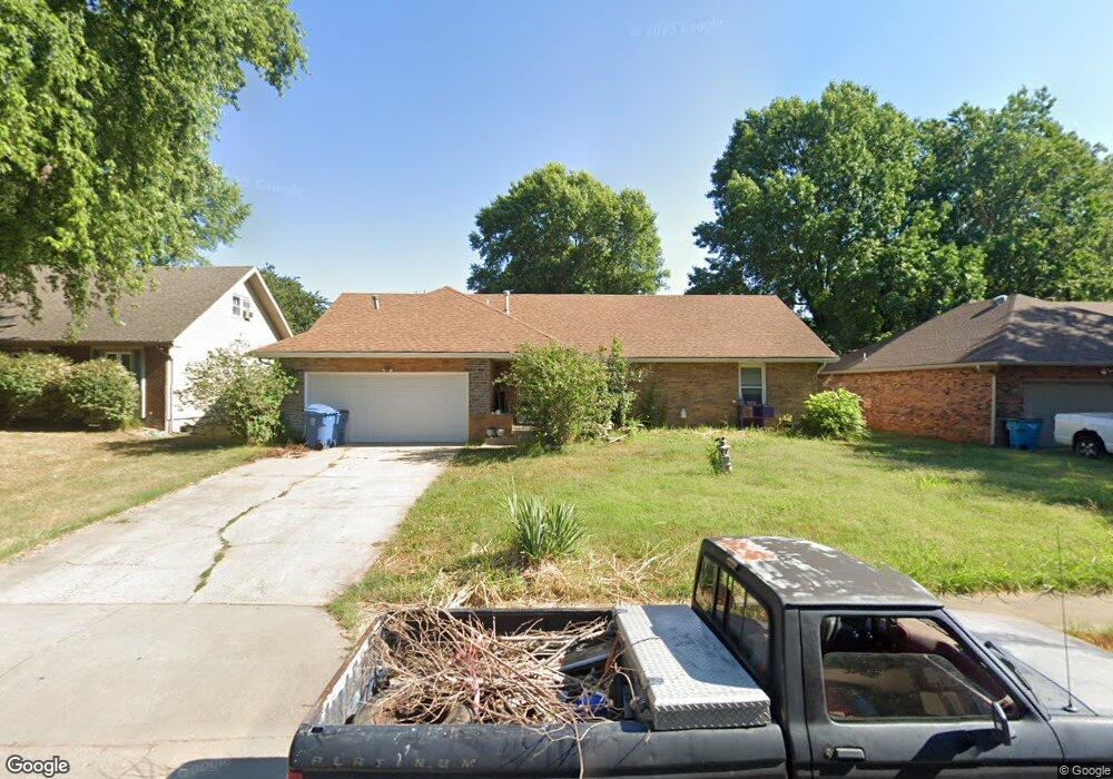
1213 W Wayland St Springfield, MO 65807
Mark Twain NeighborhoodEstimated Value: $220,000 - $326,000
4
Beds
3
Baths
2,216
Sq Ft
$117/Sq Ft
Est. Value
About This Home
This home is located at 1213 W Wayland St, Springfield, MO 65807 and is currently estimated at $258,316, approximately $116 per square foot. 1213 W Wayland St is a home located in Greene County with nearby schools including Mark Twain Elementary School, Jarrett Middle, and Parkview High School.
Ownership History
Date
Name
Owned For
Owner Type
Purchase Details
Closed on
May 19, 2021
Sold by
Jlbconstruction Enterprises Llc
Bought by
Mgup Llc
Current Estimated Value
Home Financials for this Owner
Home Financials are based on the most recent Mortgage that was taken out on this home.
Original Mortgage
$104,000
Outstanding Balance
$94,250
Interest Rate
3.1%
Mortgage Type
Future Advance Clause Open End Mortgage
Estimated Equity
$164,066
Purchase Details
Closed on
Jan 28, 2009
Sold by
Federal Home Loan Mortgage Corporation
Bought by
Pats Properties Llc
Purchase Details
Closed on
Jun 12, 2008
Sold by
Coulter Nathan L and Coulter Judy J
Bought by
Federal Home Loan Mortgage Cop
Create a Home Valuation Report for This Property
The Home Valuation Report is an in-depth analysis detailing your home's value as well as a comparison with similar homes in the area
Home Values in the Area
Average Home Value in this Area
Purchase History
| Date | Buyer | Sale Price | Title Company |
|---|---|---|---|
| Mgup Llc | -- | None Available | |
| Pats Properties Llc | -- | None Available | |
| Federal Home Loan Mortgage Cop | $103,821 | None Available |
Source: Public Records
Mortgage History
| Date | Status | Borrower | Loan Amount |
|---|---|---|---|
| Open | Mgup Llc | $104,000 |
Source: Public Records
Tax History
| Year | Tax Paid | Tax Assessment Tax Assessment Total Assessment is a certain percentage of the fair market value that is determined by local assessors to be the total taxable value of land and additions on the property. | Land | Improvement |
|---|---|---|---|---|
| 2025 | $1,485 | $29,810 | $5,700 | $24,110 |
| 2024 | $1,420 | $26,470 | $4,470 | $22,000 |
| 2023 | $1,412 | $26,470 | $4,470 | $22,000 |
| 2022 | $1,267 | $23,200 | $4,470 | $18,730 |
| 2021 | $1,267 | $23,200 | $4,470 | $18,730 |
| 2020 | $1,246 | $21,820 | $4,470 | $17,350 |
| 2019 | $1,211 | $21,820 | $4,470 | $17,350 |
| 2018 | $1,104 | $19,900 | $4,470 | $15,430 |
| 2017 | $1,093 | $18,760 | $4,470 | $14,290 |
| 2016 | $1,028 | $18,760 | $4,470 | $14,290 |
| 2015 | $1,019 | $18,760 | $4,470 | $14,290 |
| 2014 | $1,002 | $18,320 | $4,470 | $13,850 |
Source: Public Records
Map
Nearby Homes
- 1116 W Broadmoor St
- 1107 W Tracy St
- 1503 W Broadmoor St
- 1419 W Whiteside St
- 2546 S Fort Ave
- 2550 S Fort Ave
- 2449 S Westwood Ave
- 1632 W Berkeley St
- 1010 W Cherokee St
- 1948 S Weaver Ave
- 1949 S Broadway Ave
- 1962 S Westwood Ave
- 933 W Morningside St
- 1846 S Nettleton Ave
- 1825 S Weaver Ave
- 618 W Greenwood St
- 306 W McGee St
- 519 W Woodland St
- 220 E Berkeley St
- 1733 S Lancaster Ave
- 1219 W Wayland St
- 1209 W Wayland St
- 1214 W Tracy St
- 1225 W Wayland St
- 1218 W Tracy St
- 1143 W Wayland St
- 1210 W Tracy St
- 1214 W Wayland St
- 1210 W Wayland St
- 1220 W Wayland St
- 1142 W Tracy St
- 1233 W Wayland St
- 2246 S Fort Ave
- 1224 W Wayland St
- 1133 W Wayland St
- 1132 W Tracy St
- 1232 W Wayland St
- 1132 W Wayland St
- 1217 W Tracy St
Your Personal Tour Guide
Ask me questions while you tour the home.