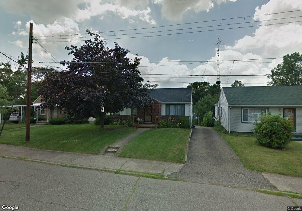
1214 21st St NE Canton, OH 44714
Colonial Heights NeighborhoodEstimated Value: $120,000 - $145,000
3
Beds
1
Bath
1,024
Sq Ft
$129/Sq Ft
Est. Value
About This Home
This home is located at 1214 21st St NE, Canton, OH 44714 and is currently estimated at $131,949, approximately $128 per square foot. 1214 21st St NE is a home located in Stark County with nearby schools including Belle Stone Elementary School, Early Learning Center @ Schreiber, and Youtz Intermediate School.
Ownership History
Date
Name
Owned For
Owner Type
Purchase Details
Closed on
Jan 31, 2005
Sold by
Mara Michael J and Mara Christine M
Bought by
Allison Michelle R
Current Estimated Value
Home Financials for this Owner
Home Financials are based on the most recent Mortgage that was taken out on this home.
Original Mortgage
$66,400
Interest Rate
5.77%
Mortgage Type
Purchase Money Mortgage
Purchase Details
Closed on
Mar 18, 2002
Sold by
Russo Dino M
Bought by
Russo Christine M
Purchase Details
Closed on
Mar 28, 1988
Create a Home Valuation Report for This Property
The Home Valuation Report is an in-depth analysis detailing your home's value as well as a comparison with similar homes in the area
Home Values in the Area
Average Home Value in this Area
Purchase History
| Date | Buyer | Sale Price | Title Company |
|---|---|---|---|
| Allison Michelle R | $83,000 | -- | |
| Russo Christine M | -- | -- | |
| -- | $41,500 | -- |
Source: Public Records
Mortgage History
| Date | Status | Borrower | Loan Amount |
|---|---|---|---|
| Previous Owner | Allison Michelle R | $66,400 |
Source: Public Records
Tax History Compared to Growth
Tax History
| Year | Tax Paid | Tax Assessment Tax Assessment Total Assessment is a certain percentage of the fair market value that is determined by local assessors to be the total taxable value of land and additions on the property. | Land | Improvement |
|---|---|---|---|---|
| 2025 | -- | $34,650 | $10,850 | $23,800 |
| 2024 | -- | $34,650 | $10,850 | $23,800 |
| 2023 | $1,559 | $26,080 | $7,000 | $19,080 |
| 2022 | $1,515 | $26,080 | $7,000 | $19,080 |
| 2021 | $1,531 | $26,080 | $7,000 | $19,080 |
| 2020 | $1,396 | $21,290 | $5,640 | $15,650 |
| 2019 | $1,213 | $21,290 | $5,640 | $15,650 |
| 2018 | $1,225 | $21,290 | $5,640 | $15,650 |
| 2017 | $1,226 | $19,390 | $5,320 | $14,070 |
| 2016 | $1,230 | $19,390 | $5,320 | $14,070 |
| 2015 | $1,224 | $19,180 | $5,320 | $13,860 |
| 2014 | $1,388 | $20,440 | $5,670 | $14,770 |
| 2013 | $668 | $20,440 | $5,670 | $14,770 |
Source: Public Records
Map
Nearby Homes
- 0 Rowland Ave NE Unit 5089960
- 918 19th St NE
- 1126 18th St NE
- 2219 Rowland Ave NE
- 1734 Rowland Ave NE
- 908 22nd St NE
- 1219 17th St NE
- 1513 22nd St NE
- 1210 17th St NE
- 1220 25th St NE
- 1607 18th St NE
- 1602 18th St NE
- 1631 Shriver Ave NE
- 1611 Rowland Ave NE
- 802 17th St NE
- 2015 Maple Ave NE
- 1517 16th St NE
- 1540 Miami Ct NE
- 2100 Maple Ave NE
- 0 Dover Ave NE
- 1210 21st St NE
- 1220 21st St NE
- 1204 21st St NE
- 2025 Rowland Ave NE
- 1200 21st St NE
- 2017 Rowland Ave NE
- 1217 20th St NE
- 1211 20th St NE
- 1207 20th St NE
- 2011 Rowland Ave NE
- 1213 21st St NE
- 1221 21st St NE
- 1203 20th St NE
- 1209 21st St NE
- 2105 Rowland Ave NE
- 0 Rowland Ave NE Unit 3399700
- 0 Rowland Ave NE Unit 3399698
- 0 Rowland Ave NE Unit 3399696
- 0 Rowland Ave NE Unit 3399691
- 0 Rowland Ave NE Unit 3399689