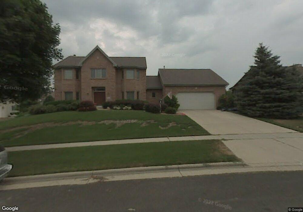
1214 Boundary Rd Middleton, WI 53562
Stonefield NeighborhoodEstimated Value: $653,000 - $1,218,000
5
Beds
3
Baths
4,226
Sq Ft
$239/Sq Ft
Est. Value
About This Home
This home is located at 1214 Boundary Rd, Middleton, WI 53562 and is currently estimated at $1,009,452, approximately $238 per square foot. 1214 Boundary Rd is a home located in Dane County with nearby schools including Elm Lawn Elementary School, Kromrey Middle School, and Middleton High School.
Ownership History
Date
Name
Owned For
Owner Type
Purchase Details
Closed on
May 12, 2011
Sold by
U S Bank National Association
Bought by
Mazur David Michael and Mazur Tiffany Rose
Current Estimated Value
Purchase Details
Closed on
Dec 21, 2010
Sold by
Haley Thomas J and Haley Diana R
Bought by
U S Bank National Association
Create a Home Valuation Report for This Property
The Home Valuation Report is an in-depth analysis detailing your home's value as well as a comparison with similar homes in the area
Home Values in the Area
Average Home Value in this Area
Purchase History
| Date | Buyer | Sale Price | Title Company |
|---|---|---|---|
| Mazur David Michael | $437,500 | None Available | |
| U S Bank National Association | $415,000 | None Available |
Source: Public Records
Tax History Compared to Growth
Tax History
| Year | Tax Paid | Tax Assessment Tax Assessment Total Assessment is a certain percentage of the fair market value that is determined by local assessors to be the total taxable value of land and additions on the property. | Land | Improvement |
|---|---|---|---|---|
| 2024 | $14,662 | $819,500 | $162,900 | $656,600 |
| 2023 | $13,641 | $819,500 | $162,900 | $656,600 |
| 2021 | $12,586 | $629,100 | $162,900 | $466,200 |
| 2020 | $12,709 | $629,100 | $162,900 | $466,200 |
| 2019 | $11,986 | $629,100 | $162,900 | $466,200 |
| 2018 | $10,892 | $621,700 | $162,900 | $458,800 |
| 2017 | $11,014 | $546,100 | $155,500 | $390,600 |
| 2016 | $10,926 | $545,700 | $155,500 | $390,200 |
| 2015 | $11,172 | $545,700 | $155,500 | $390,200 |
| 2014 | $11,176 | $515,900 | $133,200 | $382,700 |
| 2013 | $10,857 | $515,900 | $133,200 | $382,700 |
Source: Public Records
Map
Nearby Homes
- 6341 Briarcliff Ln
- 1030 Rooster Run Unit 19
- 2 Hidden Hollow Trail
- 1222 N Gammon Rd
- 7009 Fortune Dr
- 6233 Countryside Ln
- 6322 Elmwood Ave
- 6829 Cooper Ave
- 6251 Charing Cross Ln Unit D
- 6242 University Ave
- 21 Torrey Pines Ct
- 2051 Allen Blvd Unit 402
- 30 Morningdale Cir
- 1705 Camelot Dr
- 2146 Allen Blvd Unit 3
- 6907 Old Sauk Ct
- 517 Isle Royal Dr
- 1626 Laurel Crest
- 1634 Norman Way Unit 6
- 6205 Mendota Ave
- 1210 Boundary Rd
- 1218 Boundary Rd
- 6349 Briarcliff Ln
- 1215 Boundary Rd
- 6346 Stonefield Rd
- 1206 Boundary Rd
- 6352 Stonefield Rd
- 6342 Stonefield Rd
- 6356 Stonefield Rd
- 1207 Boundary Rd
- 6337 Briarcliff Ln
- 6338 Stonefield Rd
- 6402 Stonefield Rd
- 6346 Briarcliff Ln
- 6353 Briarcliff Ln
- 6334 Stonefield Rd
- 1203 Boundary Rd
- 6333 Briarcliff Ln
- 1403 Granite Ct
- 6406 Stonefield Rd