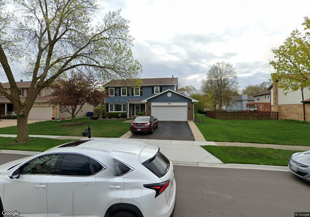
1214 Bridgeport Dr Schaumburg, IL 60193
South Schaumburg NeighborhoodEstimated Value: $616,050 - $718,000
4
Beds
4
Baths
2,671
Sq Ft
$244/Sq Ft
Est. Value
About This Home
This home is located at 1214 Bridgeport Dr, Schaumburg, IL 60193 and is currently estimated at $652,763, approximately $244 per square foot. 1214 Bridgeport Dr is a home located in Cook County with nearby schools including Frederick Nerge Elementary School, Margaret Mead Junior High School, and J B Conant High School.
Ownership History
Date
Name
Owned For
Owner Type
Purchase Details
Closed on
Jun 3, 2010
Sold by
Ha Kenneth C and Ha Lydia M
Bought by
Stoner Brian D and Stoner Wendy
Current Estimated Value
Home Financials for this Owner
Home Financials are based on the most recent Mortgage that was taken out on this home.
Original Mortgage
$352,000
Outstanding Balance
$236,835
Interest Rate
5.05%
Mortgage Type
New Conventional
Estimated Equity
$415,928
Purchase Details
Closed on
Nov 1, 2008
Sold by
Omalley Terrence P and Omalley Linda J
Bought by
Ha Kenneth C and Ha Lydia M
Home Financials for this Owner
Home Financials are based on the most recent Mortgage that was taken out on this home.
Original Mortgage
$354,000
Interest Rate
6.3%
Mortgage Type
Unknown
Create a Home Valuation Report for This Property
The Home Valuation Report is an in-depth analysis detailing your home's value as well as a comparison with similar homes in the area
Home Values in the Area
Average Home Value in this Area
Purchase History
| Date | Buyer | Sale Price | Title Company |
|---|---|---|---|
| Stoner Brian D | $440,000 | Ticor Title | |
| Ha Kenneth C | $442,500 | Bt |
Source: Public Records
Mortgage History
| Date | Status | Borrower | Loan Amount |
|---|---|---|---|
| Open | Stoner Brian D | $352,000 | |
| Previous Owner | Ha Kenneth C | $354,000 |
Source: Public Records
Tax History Compared to Growth
Tax History
| Year | Tax Paid | Tax Assessment Tax Assessment Total Assessment is a certain percentage of the fair market value that is determined by local assessors to be the total taxable value of land and additions on the property. | Land | Improvement |
|---|---|---|---|---|
| 2024 | $10,311 | $38,550 | $10,313 | $28,237 |
| 2023 | $10,480 | $42,001 | $10,313 | $31,688 |
| 2022 | $10,480 | $42,001 | $10,313 | $31,688 |
| 2021 | $9,254 | $33,861 | $5,625 | $28,236 |
| 2020 | $9,450 | $34,826 | $5,625 | $29,201 |
| 2019 | $9,453 | $38,696 | $5,625 | $33,071 |
| 2018 | $9,357 | $34,614 | $4,921 | $29,693 |
| 2017 | $9,227 | $34,614 | $4,921 | $29,693 |
| 2016 | $8,872 | $34,614 | $4,921 | $29,693 |
| 2015 | $11,088 | $39,687 | $4,218 | $35,469 |
| 2014 | $10,983 | $39,687 | $4,218 | $35,469 |
| 2013 | $10,684 | $39,687 | $4,218 | $35,469 |
Source: Public Records
Map
Nearby Homes
- 620 S Point Dr
- 426 E Niagara Ave
- 421 E Wise Rd
- 826 Thornton Ct Unit 2AL
- 833 Thornton Ct Unit 2B
- 1100 Boston Harbor Unit 7004
- 1910 Baltimore Dr
- 718 N Point Dr
- 1810 Hawk Ln
- 205 Nantucket Harbor Unit 104
- 916 Manchester Cir Unit 91A
- 126 Manchester Ct Unit 61B
- 124 E Monterey Ave
- 630 Cross Creek Dr W Unit BB2
- 382 Newberry Dr
- 966 Cumberland Ct Unit B2
- 722 Merlin Dr Unit 16
- 1022 Tennessee Ln
- 492 Canterbury Trail
- 36 Shore Dr
- 1218 Bridgeport Dr
- 1208 Bridgeport Dr
- 615 Scott Dr
- 1215 Salford Dr
- 1222 Bridgeport Dr Unit 3A
- 1219 Salford Dr
- 611 Scott Dr
- 1217 Bridgeport Dr
- 1213 Bridgeport Dr
- 1223 Salford Dr
- 1221 Bridgeport Dr
- 1209 Bridgeport Dr
- 1226 Bridgeport Dr Unit 3A
- 1227 Salford Dr
- 1225 Bridgeport Dr
- 616 Scott Dr
- 620 Scott Dr
- 1230 Bridgeport Dr
- 1229 Bridgeport Dr
- 612 Scott Dr