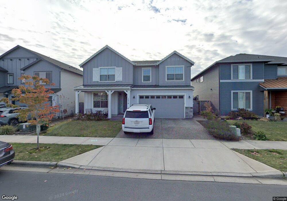
1214 Brookside Ave Forest Grove, OR 97116
Estimated Value: $681,520 - $730,000
4
Beds
3
Baths
2,968
Sq Ft
$236/Sq Ft
Est. Value
About This Home
This home is located at 1214 Brookside Ave, Forest Grove, OR 97116 and is currently estimated at $699,630, approximately $235 per square foot. 1214 Brookside Ave is a home with nearby schools including Harvey Clarke Elementary School, Tom McCall Upper Elementary School, and Neil Armstrong Middle School.
Ownership History
Date
Name
Owned For
Owner Type
Purchase Details
Closed on
Mar 26, 2018
Sold by
Stone Bridge Homes Nw Llc
Bought by
Bates David and Bates Stephanie
Current Estimated Value
Home Financials for this Owner
Home Financials are based on the most recent Mortgage that was taken out on this home.
Original Mortgage
$399,200
Outstanding Balance
$341,745
Interest Rate
4.43%
Mortgage Type
New Conventional
Estimated Equity
$357,885
Create a Home Valuation Report for This Property
The Home Valuation Report is an in-depth analysis detailing your home's value as well as a comparison with similar homes in the area
Home Values in the Area
Average Home Value in this Area
Purchase History
| Date | Buyer | Sale Price | Title Company |
|---|---|---|---|
| Bates David | $499,000 | First American Title |
Source: Public Records
Mortgage History
| Date | Status | Borrower | Loan Amount |
|---|---|---|---|
| Open | Bates David | $399,200 |
Source: Public Records
Tax History Compared to Growth
Tax History
| Year | Tax Paid | Tax Assessment Tax Assessment Total Assessment is a certain percentage of the fair market value that is determined by local assessors to be the total taxable value of land and additions on the property. | Land | Improvement |
|---|---|---|---|---|
| 2026 | $6,309 | $354,270 | -- | -- |
| 2025 | $6,309 | $343,960 | -- | -- |
| 2024 | $6,086 | $333,950 | -- | -- |
| 2023 | $6,086 | $324,230 | $0 | $0 |
| 2022 | $5,322 | $324,230 | $0 | $0 |
| 2021 | $5,253 | $305,630 | $0 | $0 |
| 2020 | $5,225 | $296,730 | $0 | $0 |
| 2019 | $5,108 | $288,090 | $0 | $0 |
| 2018 | $1,727 | $97,580 | $0 | $0 |
| 2017 | $1,027 | $58,100 | $0 | $0 |
| 2016 | $360 | $20,360 | $0 | $0 |
Source: Public Records
Map
Nearby Homes
- 1222 Brookside Ave
- 1078 Vista Oaks Dr
- 2517 Sweetwood Ct
- 1315 Begonia Ave
- 2440 Heather Way
- 1104 Magnolia Way
- 1316 19th Place
- 1609 Camino Dr
- 1611 Camino Dr
- 2108 D St
- 1294 19th Ave
- 1419 19th Ave
- 1425 Willamina Ave
- 2341 Turnbull Ct
- 1718 23rd Ave
- 2327 Turnbull Ct
- 1569 19th Ave
- 1540 19th Ave
- 1931 D St
- 0 C St Unit Lot 1
- 1136 Brookside Ave
- 1242 Brookside Ave
- 1132 Brookside Ave
- 2313 Windstream St
- 1223 Vista Oaks Dr
- 1141 Vista Oaks Dr
- 1219 Brookside Ave
- 1229 Vista Oaks Dr
- 1254 Brookside Ave
- 2307 Windstream St
- 1137 Brookside Ave
- 2310 Falls St
- 2403 Windstream St
- 1249 Brookside Ave
- 2263 Windstream St
- 2302 Falls St
- 2409 Windstream St
- 1261 Brookside Ave
- 2326 Falls St