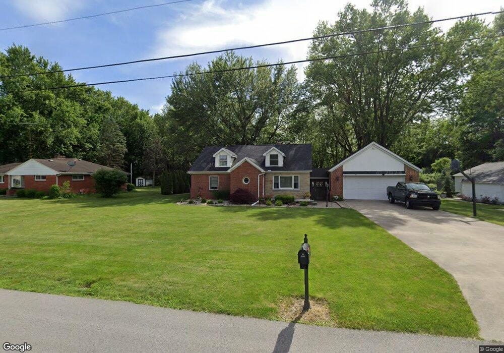
1214 Buchman Rd Fremont, OH 43420
Estimated Value: $247,000 - $299,000
4
Beds
2
Baths
1,877
Sq Ft
$142/Sq Ft
Est. Value
About This Home
This home is located at 1214 Buchman Rd, Fremont, OH 43420 and is currently estimated at $267,141, approximately $142 per square foot. 1214 Buchman Rd is a home located in Sandusky County with nearby schools including Fremont Ross High School, St. Joseph School, and Bishop Hoffman Catholic School - This is St Joe's School now.
Ownership History
Date
Name
Owned For
Owner Type
Purchase Details
Closed on
Nov 20, 2018
Sold by
Lewis Linda K
Bought by
Sherman Ronald L and Grate Sherman Marsha T
Current Estimated Value
Home Financials for this Owner
Home Financials are based on the most recent Mortgage that was taken out on this home.
Original Mortgage
$152,000
Outstanding Balance
$133,380
Interest Rate
4.7%
Mortgage Type
New Conventional
Estimated Equity
$133,761
Purchase Details
Closed on
Jan 21, 2016
Sold by
Brown Mark D
Bought by
Lewis Linda K and Brown Linda K
Purchase Details
Closed on
Jan 19, 2007
Sold by
Dicker Phillip L and Dicker Marlene
Bought by
Brown Mark D and Lewis Brown Linda K
Home Financials for this Owner
Home Financials are based on the most recent Mortgage that was taken out on this home.
Original Mortgage
$168,000
Interest Rate
6.21%
Mortgage Type
Purchase Money Mortgage
Purchase Details
Closed on
Aug 1, 1991
Sold by
Dicker Phillip L and Dicker Marl
Bought by
Lewis Linda K
Create a Home Valuation Report for This Property
The Home Valuation Report is an in-depth analysis detailing your home's value as well as a comparison with similar homes in the area
Home Values in the Area
Average Home Value in this Area
Purchase History
| Date | Buyer | Sale Price | Title Company |
|---|---|---|---|
| Sherman Ronald L | $175,000 | None Available | |
| Lewis Linda K | -- | Attorney | |
| Brown Mark D | -- | First American Title | |
| Lewis Linda K | $55,000 | -- |
Source: Public Records
Mortgage History
| Date | Status | Borrower | Loan Amount |
|---|---|---|---|
| Open | Sherman Ronald L | $152,000 | |
| Previous Owner | Brown Mark D | $168,000 |
Source: Public Records
Tax History Compared to Growth
Tax History
| Year | Tax Paid | Tax Assessment Tax Assessment Total Assessment is a certain percentage of the fair market value that is determined by local assessors to be the total taxable value of land and additions on the property. | Land | Improvement |
|---|---|---|---|---|
| 2024 | $2,793 | $71,860 | $15,260 | $56,600 |
| 2023 | $2,793 | $61,430 | $13,060 | $48,370 |
| 2022 | $2,550 | $61,430 | $13,060 | $48,370 |
| 2021 | $2,627 | $61,430 | $13,060 | $48,370 |
| 2020 | $2,359 | $54,080 | $13,060 | $41,020 |
| 2019 | $2,186 | $50,160 | $13,060 | $37,100 |
| 2018 | $2,167 | $51,110 | $13,060 | $38,050 |
| 2017 | $1,967 | $46,140 | $13,060 | $33,080 |
| 2016 | $1,724 | $46,140 | $13,060 | $33,080 |
| 2015 | $1,696 | $46,140 | $13,060 | $33,080 |
| 2014 | $1,837 | $47,880 | $12,740 | $35,140 |
| 2013 | $1,799 | $47,880 | $12,740 | $35,140 |
Source: Public Records
Map
Nearby Homes
- 2484 Buckland Ave
- 1719 Buckland Ave
- 1485 Autumn Woods Dr
- 1420 Center St
- 10 Meadowbrook Dr
- 10 Meadowbrook Ln
- 64 River Run Dr Unit J
- 1611 Mcpherson Blvd
- 704 County Road 126
- 1028 June St
- 1013 Whittlesey St
- 515 Everett Rd
- 135 Briarwood Cir
- 905 Twinn St
- 1015 Hayes Ave
- 2119 Lake St
- 1037 Buckland Ave
- 350 Conner Dr
- 1818 Finley Dr
- 815 South St
- 1208 Buchman Rd
- 1232 Buchman Rd
- 1192 Buchman Rd
- 1215 Buchman Rd
- 1205 Buchman Rd
- 1225 Buchman Rd
- 1304 Buchman Rd
- 1195 Buchman Rd
- 1119 Buchman Rd
- 1314 Buchman Rd
- 1303 Buchman Rd
- 1116 Buchman Rd
- 1210 Tucker Rd
- 1115 Buchman Rd
- 1320 Buchman Rd
- 1214 Tucker Rd
- 1222 Tucker Rd
- 1302 Tucker Rd
- 1228 Tucker Rd
- 1200 Tucker Rd