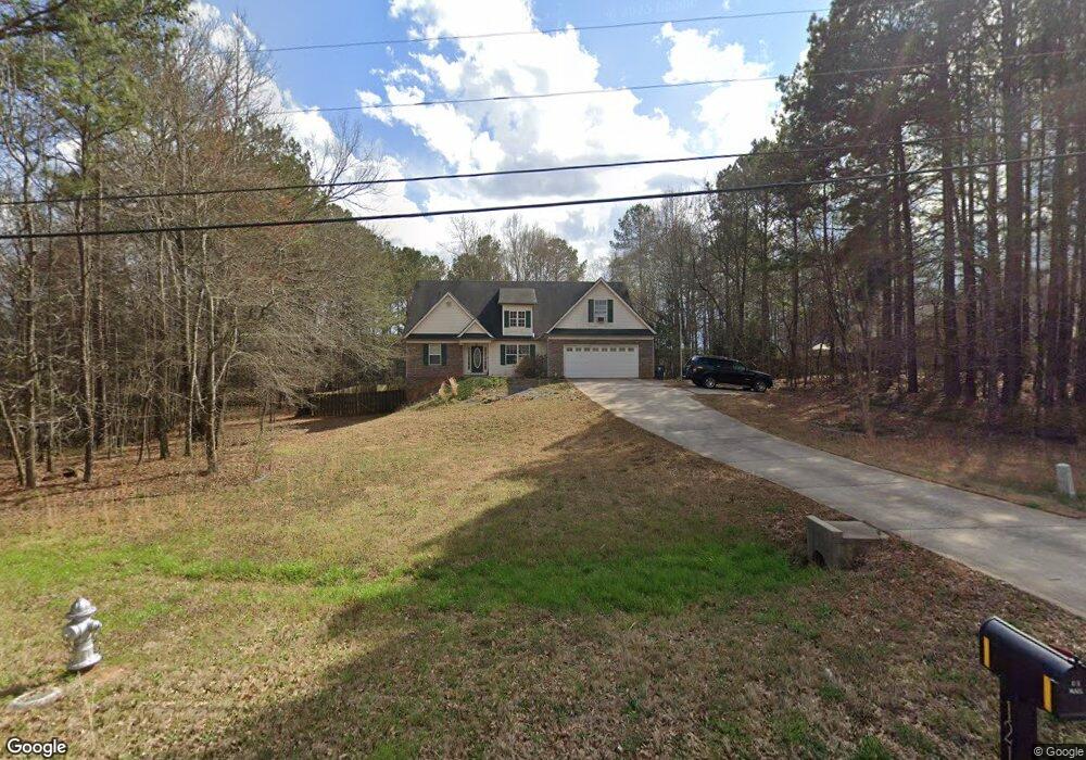
1214 Coan Dr Locust Grove, GA 30248
Estimated Value: $325,986 - $381,000
3
Beds
2
Baths
2,442
Sq Ft
$145/Sq Ft
Est. Value
About This Home
This home is located at 1214 Coan Dr, Locust Grove, GA 30248 and is currently estimated at $355,247, approximately $145 per square foot. 1214 Coan Dr is a home located in Henry County with nearby schools including Unity Grove Elementary School, Locust Grove Middle School, and Locust Grove High School.
Ownership History
Date
Name
Owned For
Owner Type
Purchase Details
Closed on
Apr 11, 2016
Sold by
Conklin Timothy C
Bought by
Conklin Sarah E
Current Estimated Value
Purchase Details
Closed on
Jun 2, 2006
Sold by
Easler Const Co Llc
Bought by
Conklin Timothy C and Conklin Sarah
Home Financials for this Owner
Home Financials are based on the most recent Mortgage that was taken out on this home.
Original Mortgage
$41,980
Interest Rate
6.51%
Mortgage Type
New Conventional
Create a Home Valuation Report for This Property
The Home Valuation Report is an in-depth analysis detailing your home's value as well as a comparison with similar homes in the area
Home Values in the Area
Average Home Value in this Area
Purchase History
| Date | Buyer | Sale Price | Title Company |
|---|---|---|---|
| Conklin Sarah E | -- | -- | |
| Conklin Timothy C | $209,900 | -- |
Source: Public Records
Mortgage History
| Date | Status | Borrower | Loan Amount |
|---|---|---|---|
| Previous Owner | Conklin Timothy C | $41,980 | |
| Previous Owner | Conklin Timothy C | $167,920 |
Source: Public Records
Tax History Compared to Growth
Tax History
| Year | Tax Paid | Tax Assessment Tax Assessment Total Assessment is a certain percentage of the fair market value that is determined by local assessors to be the total taxable value of land and additions on the property. | Land | Improvement |
|---|---|---|---|---|
| 2025 | $4,238 | $155,560 | $14,000 | $141,560 |
| 2024 | $4,238 | $150,240 | $14,000 | $136,240 |
| 2023 | $4,039 | $141,560 | $14,000 | $127,560 |
| 2022 | $3,798 | $114,440 | $14,000 | $100,440 |
| 2021 | $3,309 | $96,720 | $14,000 | $82,720 |
| 2020 | $3,008 | $85,480 | $12,000 | $73,480 |
| 2019 | $2,971 | $84,160 | $12,000 | $72,160 |
| 2018 | $2,715 | $76,800 | $10,800 | $66,000 |
| 2016 | $2,546 | $72,400 | $10,000 | $62,400 |
| 2015 | $2,563 | $71,080 | $10,000 | $61,080 |
| 2014 | $2,468 | $68,040 | $10,000 | $58,040 |
Source: Public Records
Map
Nearby Homes
- 601 Amerigo Ct
- 604 Onieda Dr
- 521 Deadwood Trail
- 218 Baxter Ln
- 1000 Coan Dr
- 705 Seabolt Rd
- 143 Kimbell Farm Dr
- 678 Seabolt Rd
- 165 Caraway Rd
- 305 Annie Ln Unit 2
- 1850 Old Jackson Rd
- 1627 Leguin Mill Rd
- 108 Caraway Rd
- 100 Harbin Trail
- 230 Leguin Mill Rd
- 1126 Old Jackson Rd
- 121, 125, 129 Case Dr
- 1680 Leguin Mill Rd
- 995 Old Jackson Rd
- 281 Laney Dr
- 102 Kimbell Farm Dr
- 1216 Coan Dr
- 515 Miles Ct
- 525 Miles Ct
- 505 Miles Ct Unit 561
- 505 Miles Ct
- 1218 Coan Dr
- 535 Miles Ct Unit 5
- 99 Kimbell Farm Dr
- 1223 Coan Dr
- 1219 Coan Dr
- 1219 Coan Dr Unit I
- 1227 Coan Dr
- 1227 Coan Dr Unit 1
- 97 Kimbell Farm Dr
- 0 Miles Ct Unit 8165690
- 0 Miles Ct Unit 8918104
- 545 Miles Ct
- 95 Kimbell Farm Dr
- 101 Kimbell Farm Dr Unit I