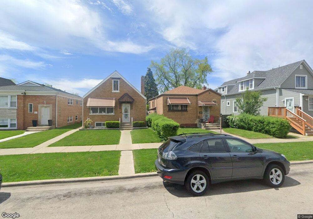
1214 Euclid Ave Berwyn, IL 60402
Estimated Value: $274,000 - $294,000
3
Beds
1
Bath
1,020
Sq Ft
$280/Sq Ft
Est. Value
About This Home
This home is located at 1214 Euclid Ave, Berwyn, IL 60402 and is currently estimated at $285,873, approximately $280 per square foot. 1214 Euclid Ave is a home located in Cook County with nearby schools including Prairie Oak School, Lincoln Middle School, and J. Sterling Morton High School West.
Ownership History
Date
Name
Owned For
Owner Type
Purchase Details
Closed on
Dec 22, 2003
Sold by
Yoder Supin L
Bought by
Yoder Supin L and Li Surong
Current Estimated Value
Purchase Details
Closed on
May 8, 2003
Sold by
Li Surong and Yoder Supin L
Bought by
Yoder Supin L
Purchase Details
Closed on
Jul 5, 2001
Sold by
Kasal Robert F and Kasal Donna
Bought by
Li Surong and Yoder Supin L
Home Financials for this Owner
Home Financials are based on the most recent Mortgage that was taken out on this home.
Original Mortgage
$125,000
Interest Rate
7.27%
Create a Home Valuation Report for This Property
The Home Valuation Report is an in-depth analysis detailing your home's value as well as a comparison with similar homes in the area
Home Values in the Area
Average Home Value in this Area
Purchase History
| Date | Buyer | Sale Price | Title Company |
|---|---|---|---|
| Yoder Supin L | -- | -- | |
| Yoder Supin L | -- | Chicago Title Insurance Co | |
| Yoder Supin L | -- | Chicago Title Insurance Co | |
| Li Surong | $163,000 | 1St American Title |
Source: Public Records
Mortgage History
| Date | Status | Borrower | Loan Amount |
|---|---|---|---|
| Closed | Li Surong | $125,000 |
Source: Public Records
Tax History Compared to Growth
Tax History
| Year | Tax Paid | Tax Assessment Tax Assessment Total Assessment is a certain percentage of the fair market value that is determined by local assessors to be the total taxable value of land and additions on the property. | Land | Improvement |
|---|---|---|---|---|
| 2024 | $5,329 | $20,264 | $4,607 | $15,657 |
| 2023 | $5,057 | $20,264 | $4,607 | $15,657 |
| 2022 | $5,057 | $16,039 | $3,993 | $12,046 |
| 2021 | $4,851 | $16,038 | $3,992 | $12,046 |
| 2020 | $4,809 | $16,038 | $3,992 | $12,046 |
| 2019 | $4,738 | $14,918 | $3,583 | $11,335 |
| 2018 | $4,549 | $14,918 | $3,583 | $11,335 |
| 2017 | $4,432 | $14,918 | $3,583 | $11,335 |
| 2016 | $4,267 | $12,586 | $2,968 | $9,618 |
| 2015 | $4,135 | $12,586 | $2,968 | $9,618 |
| 2014 | $3,301 | $12,586 | $2,968 | $9,618 |
| 2013 | $4,038 | $13,887 | $2,968 | $10,919 |
Source: Public Records
Map
Nearby Homes
- 1156 Wesley Ave
- 1135 S Oak Park Ave
- 1335 Wesley Ave
- 1183 S Scoville Ave
- 1321 East Ave
- 1341 Kenilworth Ave
- 1143 Clinton Ave
- 1333 Clinton Ave
- 1324 Clinton Ave
- 1125 Gunderson Ave
- 7011 Roosevelt Rd
- 1101 S Oak Park Ave
- 1342 Clinton Ave
- 1442 Oak Park Ave
- 1223 S Elmwood Ave Unit TWO
- 1243 Elmwood Ave
- 1216 Wenonah Ave
- 915 S Oak Park Ave Unit 1-B
- 924 Wesley Ave Unit 2
- 920 Wesley Ave Unit 1
- 1216 Euclid Ave
- 1212 Euclid Ave
- 1224 Euclid Ave
- 1218 Euclid Ave
- 1215 Oak Park Ave
- 1217 Oak Park Ave
- 1211 Oak Park Ave
- 1219 Oak Park Ave
- 6735 Roosevelt Rd
- 1223 Oak Park Ave
- 1213 Euclid Ave
- 1215 Euclid Ave Unit 2
- 1215 Euclid Ave
- 1225 Oak Park Ave
- 6737 Roosevelt Rd
- 1221 Euclid Ave
- 1227 Oak Park Ave
- 1225 Euclid Ave
- 1227 S Oak Park Ave
- 1236 Euclid Ave