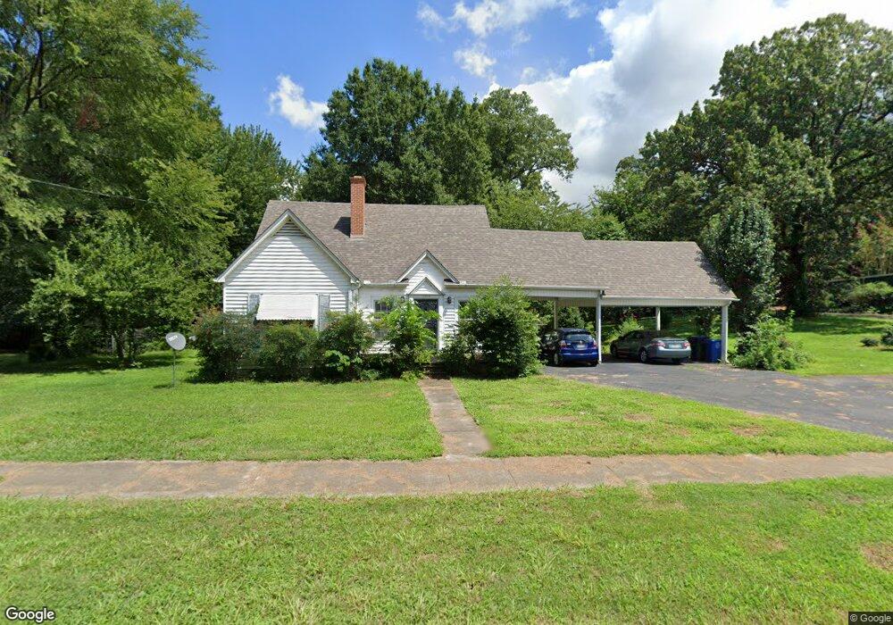
1214 Flint St Jonesboro, AR 72401
Estimated Value: $188,000 - $255,000
4
Beds
2
Baths
2,344
Sq Ft
$97/Sq Ft
Est. Value
About This Home
This home is located at 1214 Flint St, Jonesboro, AR 72401 and is currently estimated at $226,870, approximately $96 per square foot. 1214 Flint St is a home located in Craighead County with nearby schools including Annie Camp Junior High School, The Academies at Jonesboro High School, and Montessori School of Jonesboro.
Ownership History
Date
Name
Owned For
Owner Type
Purchase Details
Closed on
Oct 23, 2019
Sold by
Hansard James William
Bought by
Hansard James William and Hansard Ruth B
Current Estimated Value
Purchase Details
Closed on
Nov 12, 2009
Sold by
Dyeanns House Inc
Bought by
White Tommy and Cox Bill
Purchase Details
Closed on
Nov 14, 2003
Bought by
Dyeanns House Inc
Purchase Details
Closed on
Jun 30, 2003
Bought by
Hannah
Create a Home Valuation Report for This Property
The Home Valuation Report is an in-depth analysis detailing your home's value as well as a comparison with similar homes in the area
Home Values in the Area
Average Home Value in this Area
Purchase History
| Date | Buyer | Sale Price | Title Company |
|---|---|---|---|
| Hansard James William | -- | Professional Title | |
| White Tommy | $130,000 | Professional Title Services | |
| Dyeanns House Inc | $140,000 | -- | |
| Hannah | $126,000 | -- |
Source: Public Records
Tax History Compared to Growth
Tax History
| Year | Tax Paid | Tax Assessment Tax Assessment Total Assessment is a certain percentage of the fair market value that is determined by local assessors to be the total taxable value of land and additions on the property. | Land | Improvement |
|---|---|---|---|---|
| 2025 | $1,414 | $42,432 | $3,500 | $38,932 |
| 2024 | $1,414 | $42,432 | $3,500 | $38,932 |
| 2023 | $1,266 | $42,432 | $3,500 | $38,932 |
| 2022 | $776 | $42,432 | $3,500 | $38,932 |
| 2021 | $804 | $33,130 | $3,200 | $29,930 |
| 2020 | $804 | $33,130 | $3,200 | $29,930 |
| 2019 | $804 | $33,130 | $3,200 | $29,930 |
| 2018 | $829 | $33,130 | $3,200 | $29,930 |
| 2017 | $829 | $33,130 | $3,200 | $29,930 |
| 2016 | $829 | $27,930 | $3,000 | $24,930 |
| 2015 | $829 | $27,930 | $3,000 | $24,930 |
| 2014 | $829 | $27,930 | $3,000 | $24,930 |
Source: Public Records
Map
Nearby Homes
- 1233 Flint St
- 507 Elm Ave
- 606 Elm Ave
- 635 Poplar Ave
- 1117 S Madison St
- 637 W Oak Ave
- 1105 S Madison St
- 622 W Oak Ave
- 1226 S Madison St
- 628 W Oak Ave
- 715 W Oak Ave
- 637 Warner Ave
- 730 W Cherry Ave
- 701 W Nettleton Ave
- 1217 Olive St
- 1411 S Madison St
- 735 W Oak Ave
- 636 Warner Ave
- 515 W Thomas Ave
- 1130 Vine St
- 512 Poplar Ave
- 515 Elm Ave
- 511 Elm Ave
- 1230 Flint St
- 510 Poplar Ave
- 602 Poplar Ave
- 1207 Flint St
- 509 Elm Ave
- 1233 Flint St Unit 1235 Flint and 603 p
- 1233 Flint St Unit 1235 Flint, 603 Popl
- 508 Poplar Ave
- 601 Elm Ave
- 507 W Elm Ave
- W Elm
- 604 Poplar Ave Unit 606 POPLAR
- 604 Poplar Ave
- 1235 Flint St Unit 1233 Flint and 603 P
- 1235 Flint St
- 1244 Flint St
- 505 Elm Ave