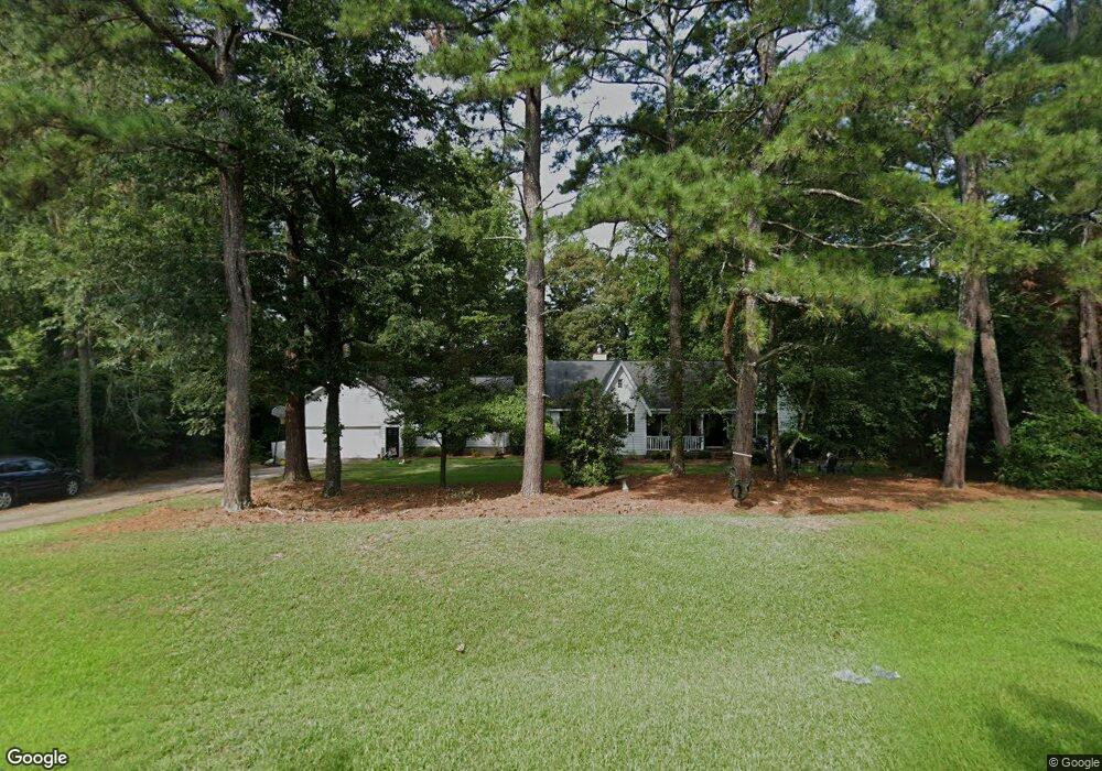
1214 Forsyth Landing Dr Forsyth, GA 31029
Estimated Value: $307,749 - $385,000
3
Beds
3
Baths
2,372
Sq Ft
$150/Sq Ft
Est. Value
About This Home
This home is located at 1214 Forsyth Landing Dr, Forsyth, GA 31029 and is currently estimated at $354,687, approximately $149 per square foot. 1214 Forsyth Landing Dr is a home located in Monroe County with nearby schools including Katherine B. Sutton Elementary School and Mary Persons High School.
Ownership History
Date
Name
Owned For
Owner Type
Purchase Details
Closed on
Feb 4, 2010
Sold by
Goodwin Jeremy
Bought by
Brown Brandon S
Current Estimated Value
Home Financials for this Owner
Home Financials are based on the most recent Mortgage that was taken out on this home.
Original Mortgage
$186,224
Outstanding Balance
$123,495
Interest Rate
5.07%
Mortgage Type
New Conventional
Estimated Equity
$231,192
Create a Home Valuation Report for This Property
The Home Valuation Report is an in-depth analysis detailing your home's value as well as a comparison with similar homes in the area
Home Values in the Area
Average Home Value in this Area
Purchase History
| Date | Buyer | Sale Price | Title Company |
|---|---|---|---|
| Brown Brandon S | $182,500 | -- | |
| Brown Brandon S | $182,500 | -- |
Source: Public Records
Mortgage History
| Date | Status | Borrower | Loan Amount |
|---|---|---|---|
| Open | Brown Brandon S | $186,224 | |
| Closed | Brown Brandon S | $186,224 |
Source: Public Records
Tax History Compared to Growth
Tax History
| Year | Tax Paid | Tax Assessment Tax Assessment Total Assessment is a certain percentage of the fair market value that is determined by local assessors to be the total taxable value of land and additions on the property. | Land | Improvement |
|---|---|---|---|---|
| 2024 | $2,194 | $77,920 | $13,920 | $64,000 |
| 2023 | $2,105 | $67,240 | $13,920 | $53,320 |
| 2022 | $1,758 | $64,920 | $11,600 | $53,320 |
| 2021 | $1,820 | $64,920 | $11,600 | $53,320 |
| 2020 | $1,865 | $64,920 | $11,600 | $53,320 |
| 2019 | $1,880 | $64,920 | $11,600 | $53,320 |
| 2018 | $1,886 | $64,920 | $11,600 | $53,320 |
| 2017 | $1,887 | $64,920 | $11,600 | $53,320 |
| 2016 | $1,794 | $64,920 | $11,600 | $53,320 |
| 2015 | $1,701 | $64,920 | $11,600 | $53,320 |
| 2014 | $1,641 | $64,920 | $11,600 | $53,320 |
Source: Public Records
Map
Nearby Homes
- 80 Wilder Dr
- 436 Magnolia Ct
- Cypress Plan at Juliette Crossing
- Jackson Plan at Juliette Crossing
- Cannaberra Plan at Juliette Crossing
- Oakwood Plan at Juliette Crossing
- Delilah Plan at Juliette Crossing
- Maple Plan at Juliette Crossing
- Hawthorne Plan at Juliette Crossing
- Harrison Plan at Juliette Crossing
- Camden Plan at Juliette Crossing
- Ash II Plan at Juliette Crossing
- Belmont Plan at Juliette Crossing
- Dogwood Plan at Juliette Crossing
- Aspen Plan at Juliette Crossing
- 5387 Felles Way
- 5387 Felles Way Unit 360
- 5393 Felles Way Unit 359
- 5399 Felles Way Unit 358
- 5399 Felles Way
- 1184 Forsyth Landing Dr
- 1228 Forsyth Landing Dr
- 1185 Forsyth Landing Dr
- 1227 Forsyth Landing Dr
- 1183 Forsyth Landing Dr
- 1166 Forsyth Landing Dr
- 1250 Forsyth Landing Dr
- 1163 Forsyth Landing Dr
- 1251 Forsyth Landing Dr
- 226 Wilder Dr
- 250 Wilder Dr
- 210 Wilder Dr
- 1148 Forsyth Landing Dr
- 274 Wilder Dr
- 1137 Forsyth Landing Dr
- 186 Wilder Dr
- 1271 Forsyth Landing Dr Unit 21
- 1122 Forsyth Landing Dr
- 251 Wilder Dr
- 170 Wilder Dr