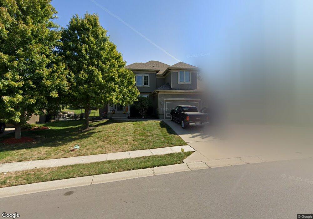
1214 Hampton Dr Raymore, MO 64083
Estimated Value: $512,000 - $559,000
4
Beds
4
Baths
2,810
Sq Ft
$190/Sq Ft
Est. Value
About This Home
This home is located at 1214 Hampton Dr, Raymore, MO 64083 and is currently estimated at $533,814, approximately $189 per square foot. 1214 Hampton Dr is a home located in Cass County with nearby schools including Creekmoor Elementary School, Raymore-Peculiar East Middle School, and Raymore-Peculiar Senior High School.
Ownership History
Date
Name
Owned For
Owner Type
Purchase Details
Closed on
Feb 28, 2008
Sold by
C & M Builders Inc
Bought by
Mansur Scott A and Mansur Lori A
Current Estimated Value
Home Financials for this Owner
Home Financials are based on the most recent Mortgage that was taken out on this home.
Original Mortgage
$340,000
Interest Rate
5.68%
Mortgage Type
Purchase Money Mortgage
Purchase Details
Closed on
May 4, 2007
Sold by
Cooper Land Development Inc
Bought by
C & M Builders Inc
Create a Home Valuation Report for This Property
The Home Valuation Report is an in-depth analysis detailing your home's value as well as a comparison with similar homes in the area
Home Values in the Area
Average Home Value in this Area
Purchase History
| Date | Buyer | Sale Price | Title Company |
|---|---|---|---|
| Mansur Scott A | -- | -- | |
| C & M Builders Inc | -- | -- |
Source: Public Records
Mortgage History
| Date | Status | Borrower | Loan Amount |
|---|---|---|---|
| Closed | Mansur Scott A | $340,000 |
Source: Public Records
Tax History
| Year | Tax Paid | Tax Assessment Tax Assessment Total Assessment is a certain percentage of the fair market value that is determined by local assessors to be the total taxable value of land and additions on the property. | Land | Improvement |
|---|---|---|---|---|
| 2025 | $5,417 | $75,550 | $12,290 | $63,260 |
| 2024 | $5,417 | $66,570 | $11,170 | $55,400 |
| 2023 | $5,410 | $66,570 | $11,170 | $55,400 |
| 2022 | $4,849 | $59,270 | $11,170 | $48,100 |
| 2021 | $4,850 | $59,270 | $11,170 | $48,100 |
| 2020 | $4,778 | $57,360 | $11,170 | $46,190 |
| 2019 | $4,613 | $57,360 | $11,170 | $46,190 |
| 2018 | $4,587 | $55,090 | $11,170 | $43,920 |
| 2017 | $4,238 | $55,090 | $11,170 | $43,920 |
| 2016 | $4,238 | $52,820 | $11,170 | $41,650 |
| 2015 | $4,240 | $52,820 | $11,170 | $41,650 |
| 2014 | $4,242 | $52,820 | $11,170 | $41,650 |
| 2013 | -- | $52,820 | $11,170 | $41,650 |
Source: Public Records
Map
Nearby Homes
- 1217 Hampton Dr
- 851 Creekmoor Pond Ln
- 835 Reed Dr
- 901 Reed Dr
- 838 Reed Dr
- 1000 Vera Dr
- 827 Reed Dr
- 903 Reed Dr
- 911 Zennor Ln
- 518 Andypaul Ct
- 614 Foxglove Ln
- 1323 W Johns Blvd
- 1106 James Creek Cir
- 708 Blazing Star Dr
- 710 Blazing Star Dr
- 706 Blazing Star Dr
- 602 Foxglove Ln
- 604 Foxglove Ln
- 502 Foxglove Ln
- 809 Glenn Cir
- 1216 Hampton Dr
- 1212 Hampton Dr
- 815 Creekmoor Pond Ln
- 1220 Deaton Cir
- 1215 Hampton Dr
- 1208 Hampton Dr
- 1222 Deaton Cir
- 819 Creekmoor Pond Ln
- 1206 Hampton Dr
- 1221 Deaton Cir
- 1224 Deaton Cir
- 821 Creekmoor Pond Ln
- 1205 High Ridge Ct
- 812 Creekmoor Pond Ln
- 1204 Hampton Dr
- 809 Creekmoor Pond Ln
- 1207 High Ridge Ct
- 1226 Deaton Cir
- 1223 Deaton Cir
- 810 Creekmoor Pond Ln
Your Personal Tour Guide
Ask me questions while you tour the home.