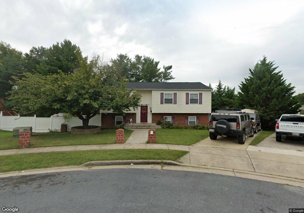
1214 Marton St Laurel, MD 20707
Estimated Value: $359,500 - $419,000
Studio
2
Baths
1,164
Sq Ft
$341/Sq Ft
Est. Value
About This Home
This home is located at 1214 Marton St, Laurel, MD 20707 and is currently estimated at $396,625, approximately $340 per square foot. 1214 Marton St is a home located in Prince George's County with nearby schools including Scotchtown Hills Elementary School, Dwight D. Eisenhower Middle School, and Laurel High School.
Ownership History
Date
Name
Owned For
Owner Type
Purchase Details
Closed on
Feb 22, 2005
Sold by
Khoury Yousef
Bought by
Khoury Yousef
Current Estimated Value
Home Financials for this Owner
Home Financials are based on the most recent Mortgage that was taken out on this home.
Original Mortgage
$175,000
Outstanding Balance
$86,009
Interest Rate
5.25%
Mortgage Type
Adjustable Rate Mortgage/ARM
Estimated Equity
$310,616
Purchase Details
Closed on
Jan 22, 1990
Sold by
Nudd Conrad T
Bought by
Khoury Yousef
Create a Home Valuation Report for This Property
The Home Valuation Report is an in-depth analysis detailing your home's value as well as a comparison with similar homes in the area
Home Values in the Area
Average Home Value in this Area
Purchase History
| Date | Buyer | Sale Price | Title Company |
|---|---|---|---|
| Khoury Yousef | -- | -- | |
| Khoury Yousef | $126,000 | -- |
Source: Public Records
Mortgage History
| Date | Status | Borrower | Loan Amount |
|---|---|---|---|
| Open | Khoury Yousef | $175,000 |
Source: Public Records
Tax History
| Year | Tax Paid | Tax Assessment Tax Assessment Total Assessment is a certain percentage of the fair market value that is determined by local assessors to be the total taxable value of land and additions on the property. | Land | Improvement |
|---|---|---|---|---|
| 2025 | $5,476 | $367,700 | $100,600 | $267,100 |
| 2024 | $5,476 | $340,267 | -- | -- |
| 2023 | $5,159 | $312,833 | $0 | $0 |
| 2022 | $4,719 | $285,400 | $100,600 | $184,800 |
| 2021 | $4,450 | $269,567 | $0 | $0 |
| 2020 | $4,276 | $253,733 | $0 | $0 |
| 2019 | $4,093 | $237,900 | $75,300 | $162,600 |
| 2018 | $3,994 | $232,333 | $0 | $0 |
| 2017 | $3,917 | $226,767 | $0 | $0 |
| 2016 | -- | $221,200 | $0 | $0 |
| 2015 | $3,236 | $212,133 | $0 | $0 |
| 2014 | $3,236 | $203,067 | $0 | $0 |
Source: Public Records
Map
Nearby Homes
- 1202 Marton St
- 15307 Arbory Way
- 7601 Carissa Ln
- 7712 Erica Ln
- 7651 E Arbory Ct
- 7620 S Arbory Ln
- 14811 Belle Ami Dr
- 15046 Cherrywood Dr
- 15020 Cherrywood Dr
- 1028 Ward St
- 14910 Cherrywood Dr
- 7816 Aylesford Ln
- 8218 Londonderry Ct
- 1012 Ward St
- 14633 Cambridge Cir
- 15603 Dorset Rd Unit 101
- 8030 Ashford Blvd
- 15008 Courtland Place
- 8040 Sandy Spring Rd
- 14717 Exbury Ln
- 1216 Marton St
- 1212 Marton St
- 7804 Carissa Ln
- 7806 Carissa Ln
- 7802 Carissa Ln
- 7808 Carissa Ln
- 7800 Carissa Ln
- 7710 Carissa Ln
- 7810 Carissa Ln
- 7708 Carissa Ln
- 7812 Carissa Ln
- 1210 Marton St
- 1217 Marton St
- 7706 Carissa Ln
- 7814 Carissa Ln
- 1215 Marton St
- 1213 Marton St
- 7816 Carissa Ln
- 7704 Carissa Ln
- 7818 Carissa Ln
Your Personal Tour Guide
Ask me questions while you tour the home.