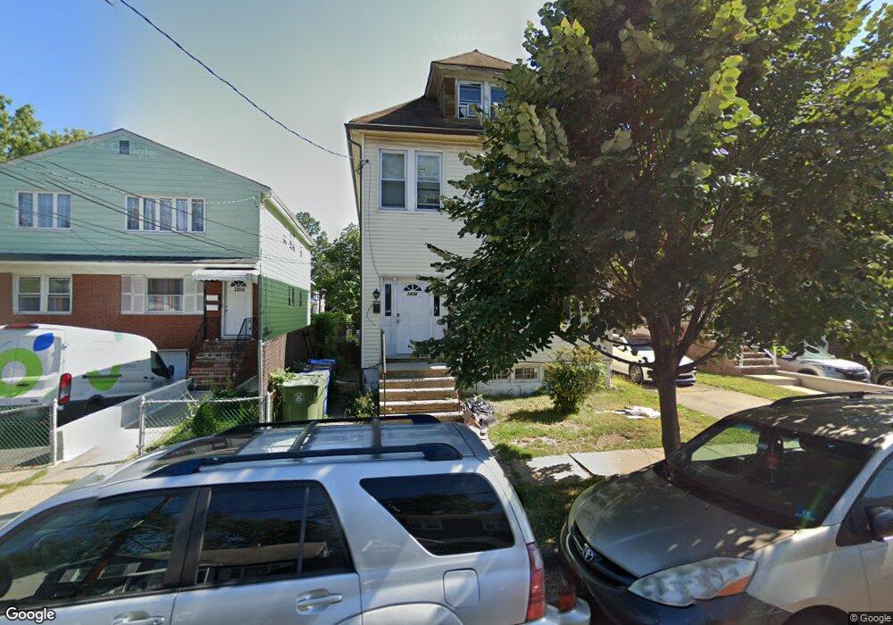
1214 Middlesex St Unit 1 Linden, NJ 07036
Estimated Value: $540,460 - $705,000
3
Beds
1
Bath
2,622
Sq Ft
$246/Sq Ft
Est. Value
About This Home
This home is located at 1214 Middlesex St Unit 1, Linden, NJ 07036 and is currently estimated at $644,115, approximately $245 per square foot. 1214 Middlesex St Unit 1 is a home located in Union County with nearby schools including Dr Charles C Polk School, Grace Wilday Junior High School, and Leonard V. Moore Middle School.
Ownership History
Date
Name
Owned For
Owner Type
Purchase Details
Closed on
Oct 24, 2002
Sold by
Green Rochelle
Bought by
Ervin Michael
Current Estimated Value
Home Financials for this Owner
Home Financials are based on the most recent Mortgage that was taken out on this home.
Original Mortgage
$248,472
Outstanding Balance
$103,255
Interest Rate
6.04%
Mortgage Type
FHA
Estimated Equity
$540,860
Purchase Details
Closed on
Apr 25, 1996
Sold by
Kulacz Henry
Bought by
Green Rochelle A and Shabazz Suzette
Purchase Details
Closed on
Jun 23, 1994
Sold by
Froehlich Ralph
Bought by
Va
Create a Home Valuation Report for This Property
The Home Valuation Report is an in-depth analysis detailing your home's value as well as a comparison with similar homes in the area
Home Values in the Area
Average Home Value in this Area
Purchase History
| Date | Buyer | Sale Price | Title Company |
|---|---|---|---|
| Ervin Michael | $255,000 | -- | |
| Green Rochelle A | $160,000 | -- | |
| Va | $5,000 | -- |
Source: Public Records
Mortgage History
| Date | Status | Borrower | Loan Amount |
|---|---|---|---|
| Open | Ervin Michael | $248,472 |
Source: Public Records
Tax History Compared to Growth
Tax History
| Year | Tax Paid | Tax Assessment Tax Assessment Total Assessment is a certain percentage of the fair market value that is determined by local assessors to be the total taxable value of land and additions on the property. | Land | Improvement |
|---|---|---|---|---|
| 2025 | $8,860 | $126,000 | $44,000 | $82,000 |
| 2024 | $8,666 | $126,000 | $44,000 | $82,000 |
| 2023 | $8,666 | $126,000 | $44,000 | $82,000 |
| 2022 | $8,712 | $126,000 | $44,000 | $82,000 |
| 2021 | $8,756 | $126,000 | $44,000 | $82,000 |
| 2020 | $8,709 | $126,000 | $44,000 | $82,000 |
| 2019 | $8,680 | $126,000 | $44,000 | $82,000 |
| 2018 | $8,678 | $126,000 | $44,000 | $82,000 |
| 2017 | $8,490 | $126,000 | $44,000 | $82,000 |
| 2016 | $8,223 | $126,000 | $44,000 | $82,000 |
| 2015 | $7,909 | $126,000 | $44,000 | $82,000 |
| 2014 | $7,755 | $126,000 | $44,000 | $82,000 |
Source: Public Records
Map
Nearby Homes
- 1116 Dill Ave
- 1105 Dill Ave
- 807 Carnegie St
- 1005 Nora Dr
- 1107 Drake Ave
- 1215 Bergen Ave
- 217 Chandler Ave
- 812 Lincoln St
- 1121 Frank St
- 1115 Frank St
- 1204 Warren St
- 1220 Lincoln St
- 1202 Warren St
- 1120 Morris St
- 1112 Morris St
- 13 Carolyn Terrace Unit A
- 930 Drake Ave
- 909 Bergen Ave
- 31 Carolynn Rd
- 119 Grant St
- 1214 Middlesex St
- 1214 Middlesex St Unit 2
- 1210 Middlesex St Unit 1
- 1210 Middlesex St
- 1220 Middlesex St
- 1211 E Henry St
- 1226 Middlesex St
- 1223 E Henry St
- 908 Chandler Ave
- 908 Chandler Ave Unit 1
- 1225 E Henry St
- 1225 E Henry St Unit 2 F
- 1225 E Henry St Unit 2B
- 906 Chandler Ave
- 1230 Middlesex St
- 1215 Middlesex St
- 1211 Middlesex St
- 1221 Middlesex St
- 1002 Chandler Ave
- 1002 Chandler Ave Unit 2R