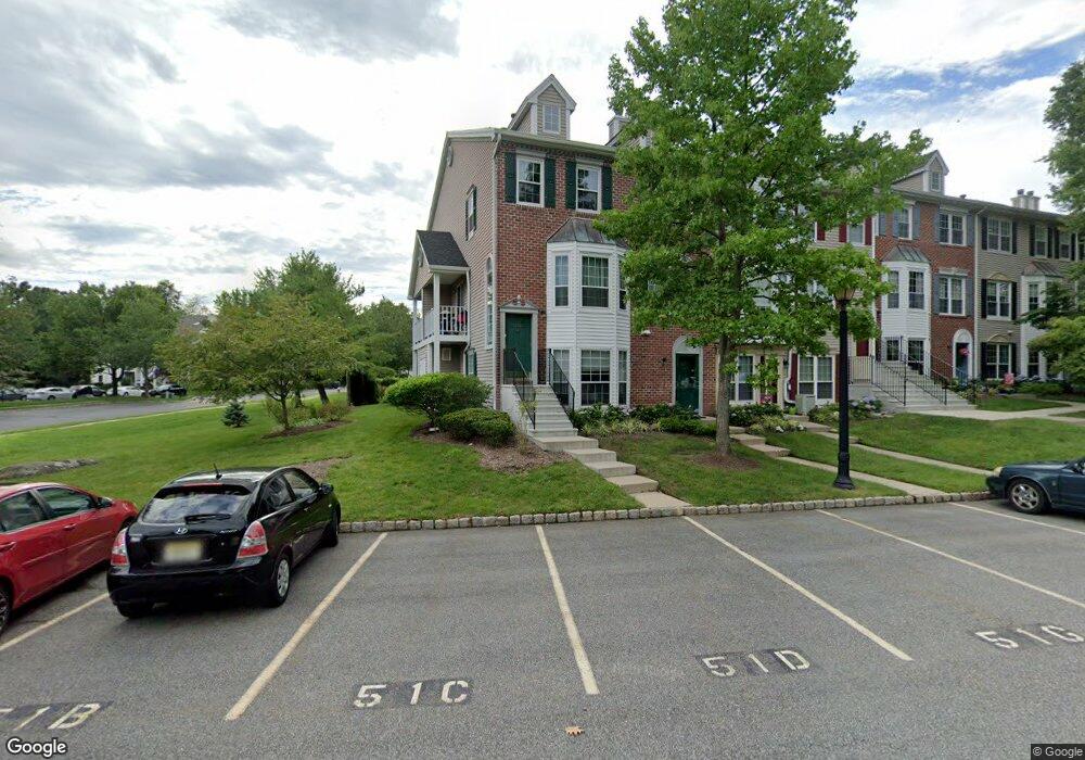
1214 Mulberry Dr Unit 51A Mahwah, NJ 07430
Estimated Value: $495,000 - $543,000
2
Beds
3
Baths
1,286
Sq Ft
$401/Sq Ft
Est. Value
About This Home
This home is located at 1214 Mulberry Dr Unit 51A, Mahwah, NJ 07430 and is currently estimated at $515,933, approximately $401 per square foot. 1214 Mulberry Dr Unit 51A is a home located in Bergen County with nearby schools including Mahwah High School.
Ownership History
Date
Name
Owned For
Owner Type
Purchase Details
Closed on
Aug 25, 2021
Sold by
Lee Kong Ling and Lee Helena Kong
Bought by
Sakchutchawarn Joy
Current Estimated Value
Home Financials for this Owner
Home Financials are based on the most recent Mortgage that was taken out on this home.
Original Mortgage
$288,000
Interest Rate
2.8%
Mortgage Type
New Conventional
Purchase Details
Closed on
Feb 6, 1998
Sold by
Taylor Andrew and Taylor Joan
Bought by
Lee Kong Ling
Home Financials for this Owner
Home Financials are based on the most recent Mortgage that was taken out on this home.
Original Mortgage
$126,700
Interest Rate
6.95%
Purchase Details
Closed on
Nov 1, 1994
Sold by
Conklin Mark
Bought by
Taylor Andrew and Kay Joan
Home Financials for this Owner
Home Financials are based on the most recent Mortgage that was taken out on this home.
Original Mortgage
$85,000
Interest Rate
8.9%
Create a Home Valuation Report for This Property
The Home Valuation Report is an in-depth analysis detailing your home's value as well as a comparison with similar homes in the area
Home Values in the Area
Average Home Value in this Area
Purchase History
| Date | Buyer | Sale Price | Title Company |
|---|---|---|---|
| Sakchutchawarn Joy | $369,000 | Realsafe Title Llc | |
| Lee Kong Ling | $169,000 | -- | |
| Taylor Andrew | $157,000 | -- |
Source: Public Records
Mortgage History
| Date | Status | Borrower | Loan Amount |
|---|---|---|---|
| Previous Owner | Sakchutchawarn Joy | $288,000 | |
| Previous Owner | Lee Kong Ling | $126,700 | |
| Previous Owner | Taylor Andrew | $85,000 |
Source: Public Records
Tax History Compared to Growth
Tax History
| Year | Tax Paid | Tax Assessment Tax Assessment Total Assessment is a certain percentage of the fair market value that is determined by local assessors to be the total taxable value of land and additions on the property. | Land | Improvement |
|---|---|---|---|---|
| 2025 | $6,107 | $295,900 | $175,000 | $120,900 |
| 2024 | $6,027 | $295,900 | $175,000 | $120,900 |
| 2023 | $5,835 | $295,900 | $175,000 | $120,900 |
| 2022 | $5,835 | $295,900 | $175,000 | $120,900 |
| 2021 | $5,773 | $295,900 | $175,000 | $120,900 |
| 2020 | $5,634 | $295,900 | $175,000 | $120,900 |
| 2019 | $5,448 | $295,900 | $175,000 | $120,900 |
| 2018 | $5,371 | $295,900 | $175,000 | $120,900 |
| 2017 | $5,285 | $295,900 | $175,000 | $120,900 |
| 2016 | $5,169 | $295,900 | $175,000 | $120,900 |
| 2015 | $5,098 | $295,900 | $175,000 | $120,900 |
| 2014 | $5,013 | $295,900 | $175,000 | $120,900 |
Source: Public Records
Map
Nearby Homes
- 807 Sassafras Ct
- 689 Plum Terrace Unit 31E
- 1295 Hibiscus Ct
- 561 Holly Ct Unit B3
- 42 Peterson Place
- 309 Linden St
- 188 Grandview Ln
- 366 Cottonwood Way
- 206 Peterson Place
- 3304 Whittier Ct
- 2009 Hawthorne Ln Unit 2009
- 135 Raintree Ln
- 1904 Faulkner Ct
- 88 Manor Dr
- 1006 Thoreau Ct
- 1006 Thoreau Ct Unit Bldg 10
- 1007 Thoreau Ct
- 1008 Thoreau Ct
- 916 Thoreau Ct
- 609 Glasmere Rd
- 1215 Mulberry Dr
- 1111 Sage Ct
- 1112 Sage Ct
- 1113 Sage Ct
- 1217 Mulberry Dr
- 1114 Sage Ct
- 1218 Mulberry Dr
- 1115 Sage Ct
- 1219 Mulberry Dr
- 1116 Sage Ct
- 1220 Mulberry Dr
- 1117 Sage Ct
- 1221 Mulberry Dr
- 1118 Sage Ct
- 1222 Mulberry Dr
- 1119 Sage Ct
- 1223 Mulberry Dr Unit 51J
- 1120 Sage Ct
- 1224 Mulberry Dr
- 1121 Sage Ct