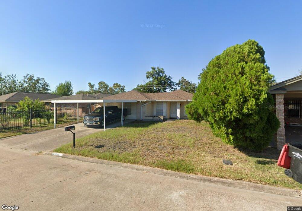
1214 Pilot Point Dr Houston, TX 77038
North Houston NeighborhoodEstimated Value: $183,885 - $223,000
3
Beds
2
Baths
1,441
Sq Ft
$145/Sq Ft
Est. Value
About This Home
This home is located at 1214 Pilot Point Dr, Houston, TX 77038 and is currently estimated at $208,721, approximately $144 per square foot. 1214 Pilot Point Dr is a home located in Harris County with nearby schools including Jerry Keeble Ec/Pre-K, Gray Elementary School, and Aldine Ninth Grade School.
Ownership History
Date
Name
Owned For
Owner Type
Purchase Details
Closed on
May 8, 2013
Sold by
Ramos Antonio
Bought by
Collins Patricia and Ramos Patricia
Current Estimated Value
Purchase Details
Closed on
Aug 4, 2004
Sold by
Ramos Patricia I
Bought by
Ramos Antonio
Purchase Details
Closed on
Mar 6, 2003
Sold by
Ramos Hector
Bought by
Ramos Patricia
Purchase Details
Closed on
Dec 14, 1993
Sold by
Juarez Maria T and Delagarza Maria T
Bought by
Ramos Hector and Ramos Patricia
Purchase Details
Closed on
Dec 10, 1991
Sold by
Delagarza Juan Jose
Bought by
Juarez Maria T and Delagarza Maria T
Create a Home Valuation Report for This Property
The Home Valuation Report is an in-depth analysis detailing your home's value as well as a comparison with similar homes in the area
Home Values in the Area
Average Home Value in this Area
Purchase History
| Date | Buyer | Sale Price | Title Company |
|---|---|---|---|
| Collins Patricia | -- | None Available | |
| Ramos Antonio | -- | -- | |
| Ramos Patricia | -- | Chicago Title | |
| Ramos Hector | -- | -- | |
| Juarez Maria T | -- | -- |
Source: Public Records
Tax History Compared to Growth
Tax History
| Year | Tax Paid | Tax Assessment Tax Assessment Total Assessment is a certain percentage of the fair market value that is determined by local assessors to be the total taxable value of land and additions on the property. | Land | Improvement |
|---|---|---|---|---|
| 2025 | $3,428 | $166,512 | $32,381 | $134,131 |
| 2024 | $3,428 | $177,159 | $32,381 | $144,778 |
| 2023 | $3,584 | $171,836 | $32,381 | $139,455 |
| 2022 | $3,404 | $147,847 | $26,984 | $120,863 |
| 2021 | $3,046 | $126,855 | $26,984 | $99,871 |
| 2020 | $3,122 | $122,132 | $26,984 | $95,148 |
| 2019 | $2,746 | $103,287 | $26,984 | $76,303 |
| 2018 | $1,502 | $104,598 | $12,381 | $92,217 |
| 2017 | $2,695 | $104,598 | $12,381 | $92,217 |
| 2016 | $2,213 | $85,913 | $12,381 | $73,532 |
| 2015 | $1,829 | $85,913 | $12,381 | $73,532 |
| 2014 | $1,829 | $70,884 | $12,381 | $58,503 |
Source: Public Records
Map
Nearby Homes
- 1219 Pilot Point Dr
- 1138 Cherry Spring Dr
- 1327 Fallbrook Dr
- 1022 Progreso Dr
- 00 Fallbrook Dr
- 1019 Castolan Dr
- 10519 Pleasanton Dr
- 939 Point Blank Dr
- 1010 Francitas Dr
- 1506 Wilshire Park Dr
- 1006 Fruitvale Dr
- 0 W Mt Houston Rd Unit 90464120
- 10558 Pleasanton Dr
- 10226 Ella Falls Blvd
- 10134 Lasaber Ct
- 2115 Havencrest Dr
- 2203 Chalet Rd
- 10026 Lasaber Ct
- 12718 Sai Baba Dr
- Whitetail Plan at Forestwood
- 1210 Pilot Point Dr
- 1218 Pilot Point Dr
- 1215 Dellbrook Dr
- 1219 Dellbrook Dr
- 1206 Pilot Point Dr
- 1222 Pilot Point Dr
- 0 Veterans Memorial Dr Unit 8182054
- 0 Veterans Memorial Dr Unit 8856818
- 0 Veterans Memorial Dr Unit 361604
- 0 Veterans Memorial Dr Unit 611327
- 0 Veterans Memorial Dr Unit 6029524
- 0 Veterans Memorial Dr Unit 98362495
- 0 Veterans Memorial Dr Unit 28904779
- 0 Veterans Memorial Dr Unit 95376480
- 0 Veterans Memorial Dr Unit 13557057
- 0 Veterans Memorial Dr Unit 14692145
- 0 Veterans Memorial Dr Unit 73456714
- 0 Veterans Memorial Dr Unit 96060039
- 0 Veterans Memorial Dr Unit 61065331
- 0 Veterans Memorial Dr Unit 30126770