Estimated Value: $295,206 - $323,000
3
Beds
2
Baths
1,448
Sq Ft
$213/Sq Ft
Est. Value
About This Home
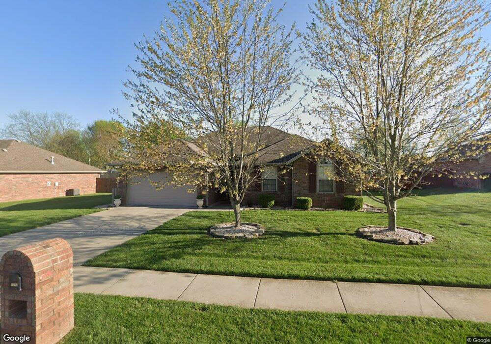
This home is located at 1214 W Judith St, Nixa, MO 65714 and is currently estimated at $308,802, approximately $213 per square foot. 1214 W Judith St is a home located in Christian County with nearby schools including P.S. 40 Samuel Huntington, Espy Elementary School, and Queens Gateway to Health Sciences Secondary School.
Ownership History
Date
Name
Owned For
Owner Type
Purchase Details
Closed on
Aug 25, 2021
Sold by
Roach Gloria A
Bought by
Roach Gloria A and Roach Gloria A
Current Estimated Value
Home Financials for this Owner
Home Financials are based on the most recent Mortgage that was taken out on this home.
Original Mortgage
$131,000
Outstanding Balance
$119,022
Interest Rate
2.7%
Mortgage Type
New Conventional
Estimated Equity
$189,780
Purchase Details
Closed on
Apr 17, 2017
Sold by
Roach Gloria A
Bought by
Roach Gloria A and Gloria A Roach Revocable Living Trust
Purchase Details
Closed on
May 11, 2010
Sold by
Lance Martin Construction Llc
Bought by
Roach Gloria A
Home Financials for this Owner
Home Financials are based on the most recent Mortgage that was taken out on this home.
Original Mortgage
$133,284
Interest Rate
5.12%
Mortgage Type
FHA
Create a Home Valuation Report for This Property
The Home Valuation Report is an in-depth analysis detailing your home's value as well as a comparison with similar homes in the area
Home Values in the Area
Average Home Value in this Area
Purchase History
| Date | Buyer | Sale Price | Title Company |
|---|---|---|---|
| Roach Gloria A | -- | Hogan Land Title Co | |
| Roach Gloria A | -- | Hogan Land Title | |
| Roach Gloria A | -- | None Available | |
| Roach Gloria A | -- | None Available |
Source: Public Records
Mortgage History
| Date | Status | Borrower | Loan Amount |
|---|---|---|---|
| Open | Roach Gloria A | $131,000 | |
| Closed | Roach Gloria A | $131,000 | |
| Previous Owner | Roach Gloria A | $133,284 |
Source: Public Records
Tax History Compared to Growth
Tax History
| Year | Tax Paid | Tax Assessment Tax Assessment Total Assessment is a certain percentage of the fair market value that is determined by local assessors to be the total taxable value of land and additions on the property. | Land | Improvement |
|---|---|---|---|---|
| 2024 | $2,025 | $32,490 | -- | -- |
| 2023 | $2,025 | $32,490 | $0 | $0 |
| 2022 | $1,909 | $30,590 | $0 | $0 |
| 2021 | $1,910 | $30,590 | $0 | $0 |
| 2020 | $1,835 | $28,060 | $0 | $0 |
| 2019 | $1,835 | $28,060 | $0 | $0 |
| 2018 | $1,436 | $23,560 | $0 | $0 |
| 2017 | $1,436 | $23,560 | $0 | $0 |
| 2016 | $1,406 | $23,430 | $0 | $0 |
| 2015 | $1,408 | $23,430 | $23,430 | $0 |
| 2014 | $1,376 | $23,480 | $0 | $0 |
| 2013 | $14 | $23,480 | $0 | $0 |
| 2011 | $14 | $46,960 | $0 | $0 |
Source: Public Records
Map
Nearby Homes
- 415 N Lewis Ct
- 304 N Bonda Way
- 305 Meadow St
- 502 Osage Dr
- 1334 W Mount Vernon St
- 1001 W Bryce Ln
- 907 Denali Dr
- 806 Honeysuckle Ln
- 709 N Milton Dr
- 717 N Milton Dr
- 609 N Elderberry Ln
- 144 Cedar Heights Dr
- 613 N Baywood Dr
- 705 N Baywood Dr
- 711 N Baywood Dr
- 707 N Baywood Dr
- 1216 W Verna Ln
- 601 S Gregg Rd
- 403 S Bryant St
- 848 S Somerset Dr
- 1216 W Judith St
- 1212 W Judith St
- 408 N Bonda Way
- 1210 W Judith St
- 1215 Faye Rd
- 407 N Bonda Way
- 409 N Bonda Way
- 1213 Faye Rd
- 1217 Faye Rd
- 410 N Bonda Way
- 409 N Lewis Ct
- 1221 Faye Rd
- 411 N Bonda Way
- 401 N Marie St
- 411 N Lewis Ct
- 0 N Lewis Ct Unit 11001401
- 0 N Lewis Ct
- 0 N Lewis Ct
- 309 N Marie St
- 412 N Bonda Way