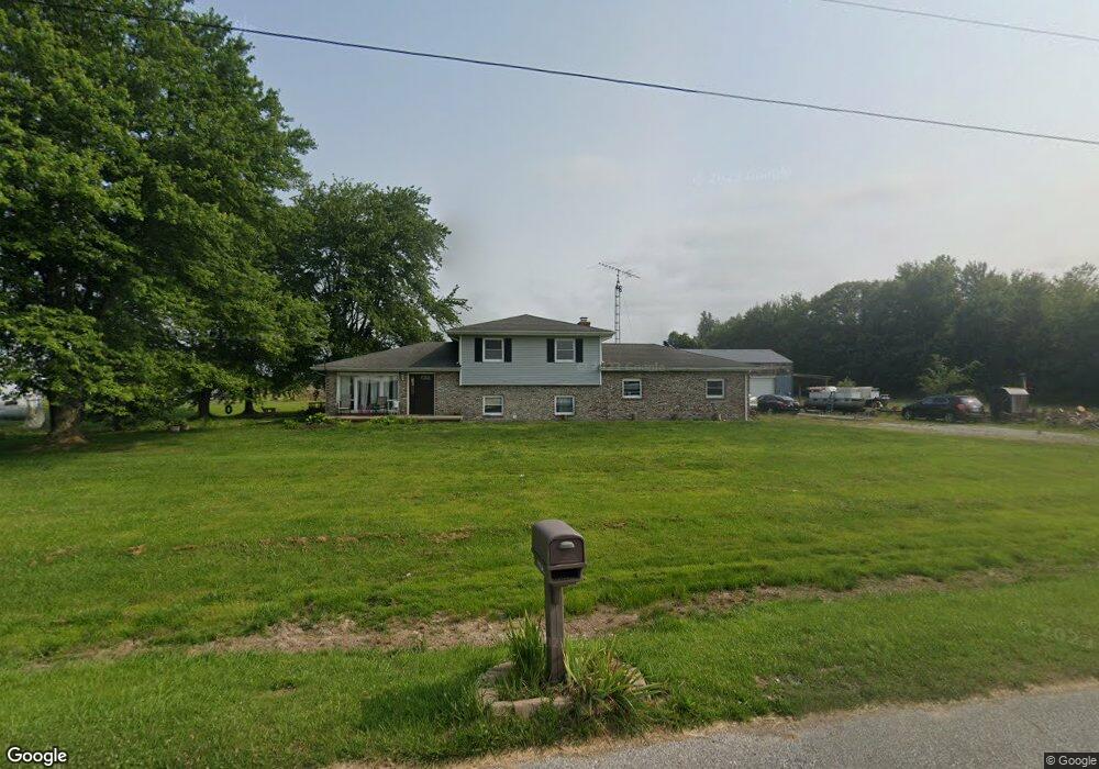
12140 E Base Rd Seymour, IN 47274
Estimated Value: $275,000 - $298,821
3
Beds
3
Baths
1,836
Sq Ft
$154/Sq Ft
Est. Value
About This Home
This home is located at 12140 E Base Rd, Seymour, IN 47274 and is currently estimated at $282,955, approximately $154 per square foot. 12140 E Base Rd is a home located in Jackson County with nearby schools including Crothersville Elementary School and Crothersville Junior/Senior High School.
Ownership History
Date
Name
Owned For
Owner Type
Purchase Details
Closed on
Nov 21, 2011
Sold by
Flight Path Investments Llc
Bought by
Stout Nathan A and Stout Julinda M
Current Estimated Value
Home Financials for this Owner
Home Financials are based on the most recent Mortgage that was taken out on this home.
Original Mortgage
$130,000
Outstanding Balance
$88,647
Interest Rate
4.02%
Mortgage Type
VA
Estimated Equity
$194,308
Purchase Details
Closed on
May 1, 2009
Sold by
Flight Path Investments Llc
Bought by
Stout Nathan and Stout Julinda
Create a Home Valuation Report for This Property
The Home Valuation Report is an in-depth analysis detailing your home's value as well as a comparison with similar homes in the area
Home Values in the Area
Average Home Value in this Area
Purchase History
| Date | Buyer | Sale Price | Title Company |
|---|---|---|---|
| Stout Nathan A | -- | Freibert Title Group Llc | |
| Stout Nathan | $134,000 | -- |
Source: Public Records
Mortgage History
| Date | Status | Borrower | Loan Amount |
|---|---|---|---|
| Open | Stout Nathan A | $130,000 | |
| Closed | Stout Nathan | $0 |
Source: Public Records
Tax History Compared to Growth
Tax History
| Year | Tax Paid | Tax Assessment Tax Assessment Total Assessment is a certain percentage of the fair market value that is determined by local assessors to be the total taxable value of land and additions on the property. | Land | Improvement |
|---|---|---|---|---|
| 2024 | $907 | $196,400 | $21,500 | $174,900 |
| 2023 | $641 | $155,600 | $21,500 | $134,100 |
| 2022 | $625 | $155,300 | $21,500 | $133,800 |
| 2021 | $489 | $139,000 | $21,500 | $117,500 |
| 2020 | $400 | $129,100 | $21,500 | $107,600 |
| 2019 | $339 | $126,300 | $21,500 | $104,800 |
| 2018 | $409 | $126,700 | $21,500 | $105,200 |
| 2017 | $441 | $126,800 | $21,500 | $105,300 |
| 2016 | $264 | $123,400 | $21,500 | $101,900 |
| 2014 | $331 | $120,600 | $21,500 | $99,100 |
| 2013 | $331 | $125,600 | $21,500 | $104,100 |
Source: Public Records
Map
Nearby Homes
- 3700 BLK U S Highway 31
- 434 S County Road 1125 E
- 8200 W County Road 830 S
- 2013 Sandhill Dr
- 2017 Sandhill Dr
- 2019 Sandhill Dr
- 2021 Sandhill Dr
- 2054 Heron Dr
- 2043 Heron Dr
- Tract 10 7530 W Private Road 775 S
- Tract 5 7530 W Private Road 775 S
- Tract 1 7530 W Private Road 775 S
- Tract 4 7530 W Private Road 775 S
- Tract 9 7530 W Private Road 775 S
- Tract 8 7530 W Private Road 775 S
- Tract 2 7530 W Private Road 775 S
- Tract 3 7530 W Private Road 775 S
- Tract 7 7530 W Private Road 775 S
- Tract 12 7530 W Private Road 775 S
- Tract 11 7530 W Private Road 775 S
- 123 N County Road 1240 E
- 31 N Us Highway 31
- 14 S Us Highway 31
- 112 S Us Highway 31
- 132 N Us Highway 31
- 248 N Us Highway 31
- 199 N County Road 1260 E
- 351 S Us Highway 31
- 220 S Us Highway 31
- 220 S Us Highway 31
- 11917 E County Road 50 N
- 12560 E County Road 25 N
- 246 S Us Highway 31
- 354 N Us Highway 31
- 11905 E County Road 50 N
- 378 N County Road 1250 E
- 378 N Co Rd 1250 E
- 312 S Us Highway 31
- 334 S Us Highway 31
- 298 N County Road 1250 E