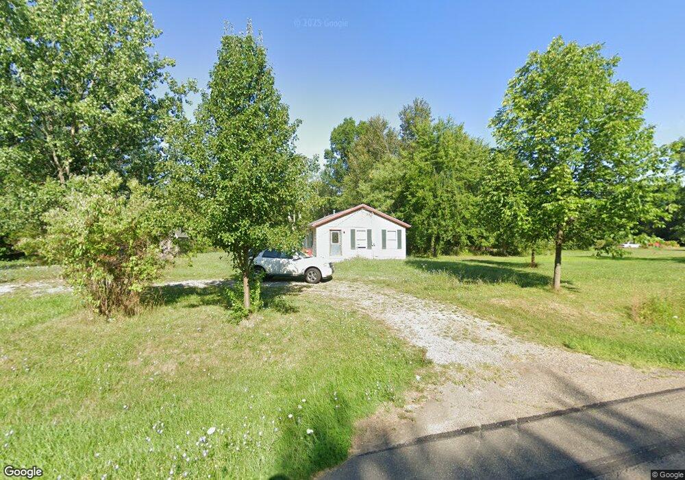
12143 Union Ave NE Alliance, OH 44601
Estimated Value: $76,000 - $157,971
2
Beds
1
Bath
960
Sq Ft
$131/Sq Ft
Est. Value
About This Home
This home is located at 12143 Union Ave NE, Alliance, OH 44601 and is currently estimated at $125,993, approximately $131 per square foot. 12143 Union Ave NE is a home located in Stark County with nearby schools including Marlington High School and Regina Coeli/St Joseph School.
Ownership History
Date
Name
Owned For
Owner Type
Purchase Details
Closed on
Mar 5, 2019
Sold by
Pierson Nancy
Bought by
Mcmahan Daniel L and Daniel L Mcmahan Trust
Current Estimated Value
Purchase Details
Closed on
Feb 8, 2016
Sold by
Stark County Treasurer and Brien Michelle O
Bought by
Pierson Nancy
Purchase Details
Closed on
Apr 27, 1990
Create a Home Valuation Report for This Property
The Home Valuation Report is an in-depth analysis detailing your home's value as well as a comparison with similar homes in the area
Home Values in the Area
Average Home Value in this Area
Purchase History
| Date | Buyer | Sale Price | Title Company |
|---|---|---|---|
| Mcmahan Daniel L | $88,300 | None Available | |
| Pierson Nancy | $10,000 | None Available | |
| -- | $4,500 | -- |
Source: Public Records
Tax History Compared to Growth
Tax History
| Year | Tax Paid | Tax Assessment Tax Assessment Total Assessment is a certain percentage of the fair market value that is determined by local assessors to be the total taxable value of land and additions on the property. | Land | Improvement |
|---|---|---|---|---|
| 2025 | -- | $40,320 | $13,580 | $26,740 |
| 2024 | -- | $40,320 | $13,580 | $26,740 |
| 2023 | $1,611 | $36,900 | $10,680 | $26,220 |
| 2022 | $1,622 | $36,900 | $10,680 | $26,220 |
| 2021 | $1,630 | $36,970 | $10,680 | $26,290 |
| 2020 | $1,466 | $30,770 | $9,210 | $21,560 |
| 2019 | $1,449 | $30,920 | $9,350 | $21,570 |
| 2018 | $1,462 | $30,920 | $9,350 | $21,570 |
| 2017 | $1,366 | $26,750 | $6,760 | $19,990 |
| 2016 | $12,654 | $27,800 | $6,760 | $21,040 |
| 2015 | $964 | $27,800 | $6,760 | $21,040 |
| 2014 | $856 | $25,390 | $6,170 | $19,220 |
| 2013 | $425 | $25,390 | $6,170 | $19,220 |
Source: Public Records
Map
Nearby Homes
- 15520 Coalbank St NE
- 15789 Coalbank St NE
- 15995 Elbrook St NE
- 11344 Walnut Ave NE
- 15832 Waverly St NE
- 11310 Webb Ave NE
- 0 Knoll St NE
- 14723 Bolton St NE
- 0 Homestead Ave NE
- 14422 Sturbridge Rd NE
- 0 Johnson Ave NE Unit 5142926
- 0 Meadowbrook Ave
- 652 N Webb Ave
- 124 E Wayne St
- 000 Meadowbrook Ave
- 710 N Freedom Ave
- 0 Klinger Ave NE
- 505 N Union Ave
- 608 N Freedom Ave
- 263 Franklin Ave
- 12117 Union Ave NE
- 12217 Union Ave NE
- 12217 Union Ave NE
- 12225 Union Ave NE
- 12255 Union Ave NE
- 12045 Union Ave NE
- 12270 Union Ave NE
- 12285 Union Ave NE
- 12300 Union Ave NE
- 12007 Union Ave NE
- 12200 Union Ave NE
- 12350 Union Ave NE
- 12376 Union Ave NE
- 11934 Union Ave NE
- 12385 Union Ave NE
- 11931 Union Ave NE
- 12338 Union Ave NE
- 11887 Union Ave NE
- 12410 Union Ave NE
- 11888 Union Ave NE