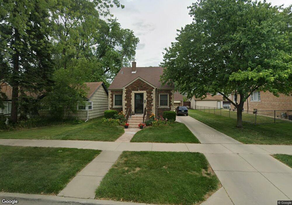
12147 Maple Ave Blue Island, IL 60406
Estimated Value: $184,252 - $233,000
2
Beds
1
Bath
1,000
Sq Ft
$210/Sq Ft
Est. Value
About This Home
This home is located at 12147 Maple Ave, Blue Island, IL 60406 and is currently estimated at $210,063, approximately $210 per square foot. 12147 Maple Ave is a home located in Cook County with nearby schools including Paul Revere Intermediate School, Paul Revere Primary School, and Veterans Memorial Middle School.
Ownership History
Date
Name
Owned For
Owner Type
Purchase Details
Closed on
Dec 31, 2024
Sold by
Romero Luis
Bought by
Romero Luis and Romero Dawn
Current Estimated Value
Purchase Details
Closed on
May 20, 2010
Sold by
Dring Patricia A
Bought by
Romero Luis and Romero Dawn
Home Financials for this Owner
Home Financials are based on the most recent Mortgage that was taken out on this home.
Original Mortgage
$111,498
Interest Rate
5.25%
Mortgage Type
FHA
Create a Home Valuation Report for This Property
The Home Valuation Report is an in-depth analysis detailing your home's value as well as a comparison with similar homes in the area
Home Values in the Area
Average Home Value in this Area
Purchase History
| Date | Buyer | Sale Price | Title Company |
|---|---|---|---|
| Romero Luis | -- | None Listed On Document | |
| Romero Luis | $113,000 | Atgf Inc |
Source: Public Records
Mortgage History
| Date | Status | Borrower | Loan Amount |
|---|---|---|---|
| Previous Owner | Romero Luis | $111,498 |
Source: Public Records
Tax History Compared to Growth
Tax History
| Year | Tax Paid | Tax Assessment Tax Assessment Total Assessment is a certain percentage of the fair market value that is determined by local assessors to be the total taxable value of land and additions on the property. | Land | Improvement |
|---|---|---|---|---|
| 2024 | $2,469 | $6,947 | $1,826 | $5,121 |
| 2023 | $1,826 | $8,000 | $1,826 | $6,174 |
| 2022 | $1,826 | $5,537 | $1,588 | $3,949 |
| 2021 | $1,743 | $5,535 | $1,587 | $3,948 |
| 2020 | $1,745 | $5,535 | $1,587 | $3,948 |
| 2019 | $1,497 | $5,038 | $1,428 | $3,610 |
| 2018 | $1,430 | $5,038 | $1,428 | $3,610 |
| 2017 | $1,461 | $5,038 | $1,428 | $3,610 |
| 2016 | $1,474 | $4,477 | $1,190 | $3,287 |
| 2015 | $1,407 | $4,477 | $1,190 | $3,287 |
| 2014 | $1,392 | $4,477 | $1,190 | $3,287 |
| 2013 | $1,310 | $4,553 | $1,190 | $3,363 |
Source: Public Records
Map
Nearby Homes
- 2636 121st Place
- 12200 Highland Ave
- 12250 Greenwood Ave
- 12045 Greenwood Ave
- 2610 Grunewald St
- 2630 Grunewald St
- 12235 Fairway Cir Unit A
- 2330 121st St
- 11900 Ann St
- 2529 Collins St
- 11834 S Campbell Ave
- 2528 Cochran St
- 12452 Fairview Ave
- 12456 Fairview Ave
- 2521 Lewis St
- 2212 123rd Place
- 12547 Greenwood Ave
- 12217 Longwood Dr
- 2209 123rd Place
- 12544 Fairview Ave Unit 2G
- 12147 Maple Ave
- 12153 Maple Ave
- 12153 Maple Ave
- 12143 Maple Ave
- 12143 Maple Ave
- 12157 Maple Ave
- 12137 Maple Ave
- 12148 Ann St
- 12144 Ann St
- 12131 Maple Ave
- 12131 Maple Ave
- 12152 Ann St
- 12140 Ann St
- 12158 Ann St
- 12146 Maple Ave
- 12152 Maple Ave
- 12201 Maple Ave
- 12201 Maple Ave
- 12158 Maple Ave
- 12158 Maple Ave