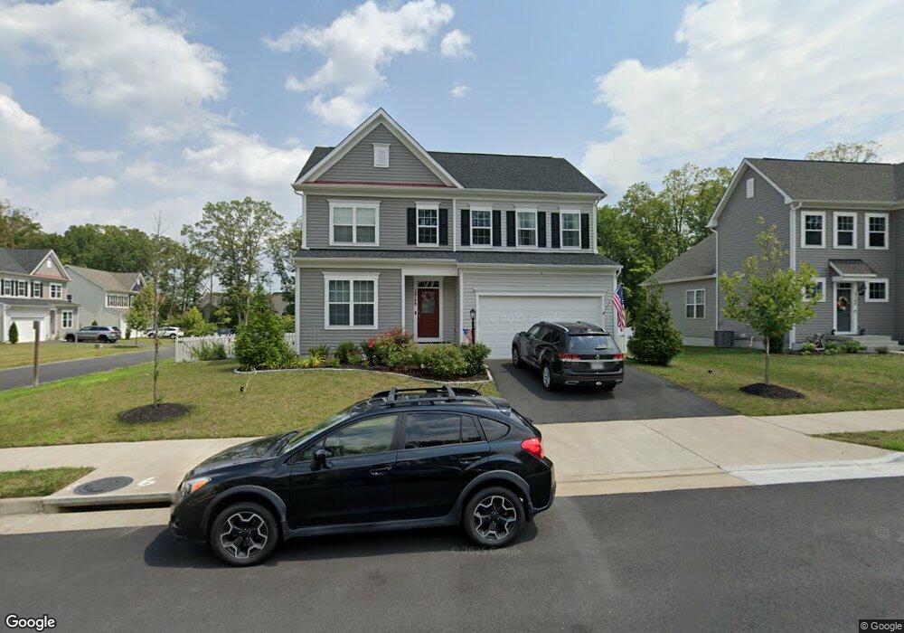
12148 Aster Rd Bristow, VA 20136
Estimated Value: $750,773 - $782,000
4
Beds
4
Baths
2,192
Sq Ft
$352/Sq Ft
Est. Value
About This Home
This home is located at 12148 Aster Rd, Bristow, VA 20136 and is currently estimated at $771,693, approximately $352 per square foot. 12148 Aster Rd is a home located in Prince William County with nearby schools including The Nokesville School, Brentsville District High School, and Linton Hall School.
Ownership History
Date
Name
Owned For
Owner Type
Purchase Details
Closed on
Jun 28, 2018
Sold by
Brookfield Vint Hill Llc A Virginia Limi
Bought by
Thresher Charles D and Thresher Kelly I
Current Estimated Value
Home Financials for this Owner
Home Financials are based on the most recent Mortgage that was taken out on this home.
Original Mortgage
$434,404
Outstanding Balance
$377,308
Interest Rate
4.6%
Mortgage Type
New Conventional
Estimated Equity
$394,385
Create a Home Valuation Report for This Property
The Home Valuation Report is an in-depth analysis detailing your home's value as well as a comparison with similar homes in the area
Home Values in the Area
Average Home Value in this Area
Purchase History
| Date | Buyer | Sale Price | Title Company |
|---|---|---|---|
| Thresher Charles D | $543,005 | Premier Title Inc |
Source: Public Records
Mortgage History
| Date | Status | Borrower | Loan Amount |
|---|---|---|---|
| Open | Thresher Charles D | $434,404 |
Source: Public Records
Tax History
| Year | Tax Paid | Tax Assessment Tax Assessment Total Assessment is a certain percentage of the fair market value that is determined by local assessors to be the total taxable value of land and additions on the property. | Land | Improvement |
|---|---|---|---|---|
| 2025 | $6,785 | $693,400 | $188,700 | $504,700 |
| 2024 | $6,785 | $682,300 | $186,000 | $496,300 |
| 2023 | $6,670 | $641,000 | $184,000 | $457,000 |
| 2022 | $6,358 | $563,800 | $160,700 | $403,100 |
| 2021 | $6,226 | $510,800 | $145,600 | $365,200 |
| 2020 | $7,483 | $482,800 | $143,400 | $339,400 |
| 2019 | $7,211 | $465,200 | $142,900 | $322,300 |
| 2018 | $689 | $57,100 | $57,100 | $0 |
Source: Public Records
Map
Nearby Homes
- 12172 Aster Rd
- 12203 Aster Rd
- 10351 Spring Iris Dr
- 12217 Wheat Mill Loop
- 12458 Hadrians Ct
- 10582 Poagues Battery Dr
- 12511 Heykens Ln
- 12360 Corncrib Ct
- 12151 Drum Salute Place
- 12149 Drum Salute Place
- 10615 Bristow Station Dr
- 11701 Town Green Rd
- 11650 Iron Brigade Unit Ave
- 11747 Alexander Hays Rd
- 10410 Kettle Run Rd
- 11712 Robert e Lee Dr
- 12017 Youngtree Ct
- 9822 Maitland Loop
- 9856 Maitland Loop
- 11821 Arcari Dr
- 12144 Aster Rd
- 12164 Aster Rd
- 0 Aster Rd Unit 1002135432
- 0 Aster Rd Unit PW10221651
- 0 Aster Rd Unit PW10153161
- 0 Aster Rd Unit VAPW322970
- 0 Aster Rd Unit 1009958056
- 0 Aster Rd Unit 1000450136
- 0 Aster Rd Unit 1000137044
- 12160 Aster Rd
- 12140 Aster Rd
- 12156 Aster Rd
- 12149 Aster Rd
- 12153 Aster Rd
- 12168 Aster Rd
- 12145 Aster Rd
- 12136 Aster Rd
- 12163 Aster Rd
- 12132 Aster Rd
- 12137 Aster Rd
Your Personal Tour Guide
Ask me questions while you tour the home.