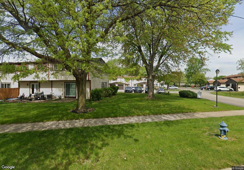
1215 Cedarwood Dr Unit A Crest Hill, IL 60403
Estimated Value: $193,000 - $220,000
3
Beds
2
Baths
1,274
Sq Ft
$159/Sq Ft
Est. Value
About This Home
This home is located at 1215 Cedarwood Dr Unit A, Crest Hill, IL 60403 and is currently estimated at $202,333, approximately $158 per square foot. 1215 Cedarwood Dr Unit A is a home located in Will County with nearby schools including Troy Craughwell Elementary School, Troy Middle School, and Orenic Intermediate School.
Ownership History
Date
Name
Owned For
Owner Type
Purchase Details
Closed on
May 18, 2022
Sold by
Sheriff Of Will County
Current Estimated Value
Purchase Details
Closed on
Apr 7, 2003
Sold by
Cook Ceola
Bought by
Smith Brenda J
Home Financials for this Owner
Home Financials are based on the most recent Mortgage that was taken out on this home.
Original Mortgage
$101,310
Interest Rate
5.37%
Mortgage Type
FHA
Purchase Details
Closed on
Jan 9, 2003
Sold by
Clay Jermaine
Bought by
Cook Ceola
Purchase Details
Closed on
Apr 30, 2002
Sold by
Cook Ceola
Bought by
Clay Jermaine and Trust #1215-A
Purchase Details
Closed on
Jul 6, 2000
Sold by
Reeder Harold and Reeder Arthetta C
Bought by
Cook Ceola
Purchase Details
Closed on
Jul 11, 1997
Sold by
Cook Charles E
Bought by
Cook Crola
Create a Home Valuation Report for This Property
The Home Valuation Report is an in-depth analysis detailing your home's value as well as a comparison with similar homes in the area
Home Values in the Area
Average Home Value in this Area
Purchase History
| Date | Buyer | Sale Price | Title Company |
|---|---|---|---|
| -- | $79,100 | None Listed On Document | |
| Smith Brenda J | $103,000 | Atg | |
| Cook Ceola | -- | -- | |
| Clay Jermaine | -- | -- | |
| Cook Ceola | $23,000 | -- | |
| Cook Crola | -- | -- |
Source: Public Records
Mortgage History
| Date | Status | Borrower | Loan Amount |
|---|---|---|---|
| Previous Owner | Smith Brenda J | $101,310 |
Source: Public Records
Tax History Compared to Growth
Tax History
| Year | Tax Paid | Tax Assessment Tax Assessment Total Assessment is a certain percentage of the fair market value that is determined by local assessors to be the total taxable value of land and additions on the property. | Land | Improvement |
|---|---|---|---|---|
| 2024 | $4,066 | $55,566 | $3,714 | $51,852 |
| 2023 | $4,066 | $49,925 | $3,337 | $46,588 |
| 2022 | $3,772 | $45,546 | $3,158 | $42,388 |
| 2021 | $3,505 | $42,847 | $2,971 | $39,876 |
| 2020 | $3,518 | $42,847 | $2,971 | $39,876 |
| 2019 | $3,365 | $41,100 | $2,850 | $38,250 |
| 2018 | $2,537 | $31,750 | $2,850 | $28,900 |
| 2017 | $2,444 | $30,351 | $2,850 | $27,501 |
| 2016 | $2,528 | $30,351 | $2,850 | $27,501 |
| 2015 | $2,394 | $28,250 | $2,850 | $25,400 |
| 2014 | $2,394 | $28,329 | $2,850 | $25,479 |
| 2013 | $2,394 | $33,725 | $2,850 | $30,875 |
Source: Public Records
Map
Nearby Homes
- 1221 Cedarwood Dr Unit F
- 2525 Park Ridge Ct Unit 2525
- 7 Rock Run Dr
- 2390 Bicentennial Ave
- 8 Rock Run Dr
- 1206 Pleasant Knoll Dr
- 1472 N Rock Run Dr Unit 1B
- 1521 Pioneer Rd Unit 7
- 2908 Wake Island Dr
- 1812 Wake Island Dr
- 3001 Theodore St
- 1007 Pearson Dr
- 3107 Ingalls Ave Unit 1D
- 3107 Ingalls Ave Unit 3B
- 901 Gael Dr Unit B
- 1810 Foxfield Dr
- 1804 Maserati Dr
- 3111 Ingalls Ave Unit 1B
- 905 Brentwood Dr
- 1625 Bunker Hill Dr
- 1215 Cedarwood Dr Unit F
- 1215 Cedarwood Dr Unit D
- 1215 Cedarwood Dr
- 1215 Cedarwood Dr Unit C
- 1215 Cedarwood Dr Unit B
- 1215 Cedarwood Dr Unit E
- 1217 Cedarwood Dr Unit C
- 1217 Cedarwood Dr Unit B
- 1217 Cedarwood Dr Unit A
- 1217 Cedarwood Dr Unit D
- 1217 Cedarwood Dr
- 1217 Cedarwood Dr Unit F
- 1301 Cedarwood Dr Unit B
- 1301 Cedarwood Dr Unit C
- 1301 Cedarwood Dr Unit F
- 1301 Cedarwood Dr Unit 1155
- 1301 Cedarwood Dr Unit D
- 1301 Cedarwood Dr Unit A
- 1209 Cedarwood Dr Unit D
- 1209 Cedarwood Dr Unit A