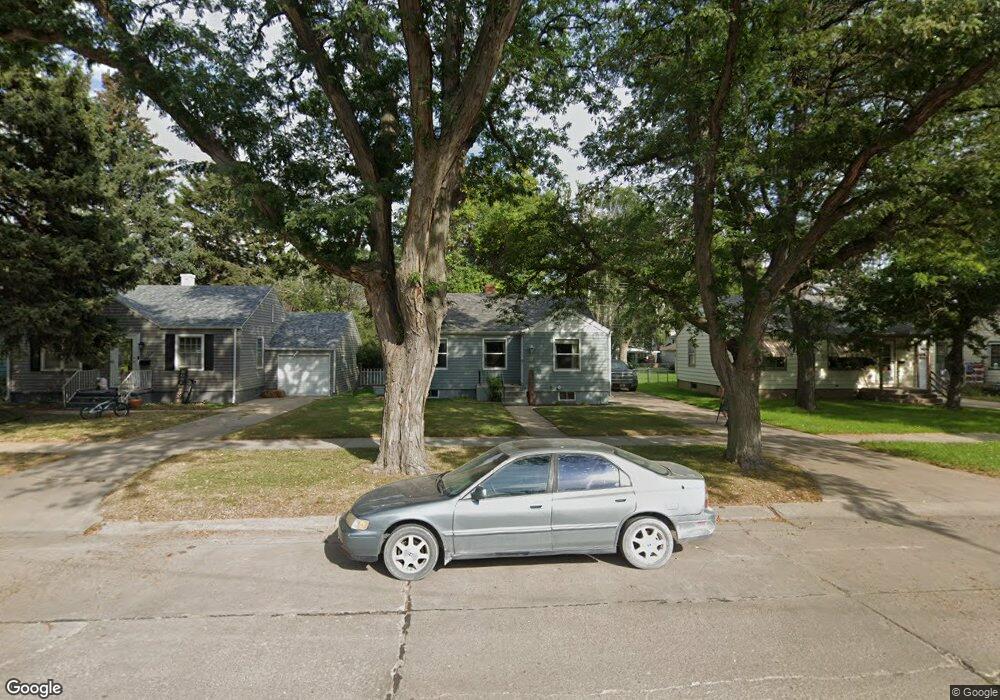
1215 Cheyenne Ave Alliance, NE 69301
Estimated Value: $115,000 - $144,000
2
Beds
1
Bath
852
Sq Ft
$146/Sq Ft
Est. Value
About This Home
This home is located at 1215 Cheyenne Ave, Alliance, NE 69301 and is currently estimated at $124,336, approximately $145 per square foot. 1215 Cheyenne Ave is a home located in Box Butte County with nearby schools including Alliance High School, St. Agnes Academy, and Immanuel Evangelical Lutheran School.
Ownership History
Date
Name
Owned For
Owner Type
Purchase Details
Closed on
Apr 20, 2020
Sold by
Christopher Brafford
Bought by
Moller Lauren J
Current Estimated Value
Purchase Details
Closed on
Oct 15, 2015
Sold by
Peterson Ingrid G
Bought by
Brafford Christopher
Purchase Details
Closed on
Apr 18, 2011
Sold by
Perxival Thomas E
Bought by
Peterson Ingrid G
Home Financials for this Owner
Home Financials are based on the most recent Mortgage that was taken out on this home.
Original Mortgage
$14,999
Interest Rate
4.82%
Mortgage Type
Credit Line Revolving
Purchase Details
Closed on
Mar 22, 2011
Sold by
Percival Thomas E
Bought by
Peterson Ingrid G
Home Financials for this Owner
Home Financials are based on the most recent Mortgage that was taken out on this home.
Original Mortgage
$14,999
Interest Rate
4.82%
Mortgage Type
Credit Line Revolving
Create a Home Valuation Report for This Property
The Home Valuation Report is an in-depth analysis detailing your home's value as well as a comparison with similar homes in the area
Home Values in the Area
Average Home Value in this Area
Purchase History
| Date | Buyer | Sale Price | Title Company |
|---|---|---|---|
| Moller Lauren J | $106,000 | -- | |
| Brafford Christopher | $55,000 | -- | |
| Peterson Ingrid G | -- | -- | |
| Peterson Ingrid G | -- | Kunzman Title |
Source: Public Records
Mortgage History
| Date | Status | Borrower | Loan Amount |
|---|---|---|---|
| Previous Owner | Peterson Ingrid G | $14,999 | |
| Previous Owner | Peterson Ingrid G | $44,000 | |
| Previous Owner | Peterson Ingrid G | $44,000 |
Source: Public Records
Tax History Compared to Growth
Tax History
| Year | Tax Paid | Tax Assessment Tax Assessment Total Assessment is a certain percentage of the fair market value that is determined by local assessors to be the total taxable value of land and additions on the property. | Land | Improvement |
|---|---|---|---|---|
| 2024 | $1,158 | $92,480 | $7,280 | $85,200 |
| 2023 | $1,590 | $92,480 | $7,280 | $85,200 |
| 2022 | $1,211 | $66,482 | $6,552 | $59,930 |
| 2021 | $1,225 | $66,482 | $6,552 | $59,930 |
| 2020 | $1,222 | $66,482 | $6,552 | $59,930 |
| 2019 | $1,194 | $66,482 | $6,552 | $59,930 |
| 2018 | $1,188 | $66,482 | $6,552 | $59,930 |
| 2017 | $1,094 | $58,956 | $4,732 | $54,224 |
| 2016 | $1,082 | $58,954 | $4,730 | $54,224 |
| 2015 | $1,078 | $55,905 | $4,730 | $51,175 |
| 2014 | $1,078 | $56,202 | $4,732 | $51,470 |
Source: Public Records
Map
Nearby Homes
- 1232 Cheyenne Ave
- 1019 Laramie Ave
- 1239 Toluca Ave
- 924 Big Horn Ave
- 904 Laramie Ave
- 907 Toluca Ave
- 911 Emerson Ave
- 936 Platte Ave
- 719 Toluca Ave
- 1004 Missouri Ave
- 819 Black Hills Ave
- 621 Emerson Ave
- 917 Missouri Ave
- 1021 Dakota Ave
- 20th St Emerson Ave To Colorado Ave
- 615 Sweetwater Ave
- 420 Laramie Ave
- 2039 Niobrara Ave
- 1120 Potash Ave
- 672 W 20th St
- 1219 Cheyenne Ave
- 1211 Cheyenne Ave
- 1223 Cheyenne Ave
- 1207 Cheyenne Ave
- 1227 Cheyenne Ave
- 1203 Cheyenne Ave
- 1212 Laramie Ave
- 1216 Laramie Ave
- 1208 Laramie Ave
- 1220 Laramie Ave
- 1231 Cheyenne Ave
- 1204 Laramie Ave
- 1220 Cheyenne Ave
- 1224 Laramie Ave
- 1210 Cheyenne Ave
- 1224 Cheyenne Ave
- 1204 Cheyenne Ave
- 1235 Cheyenne Ave
- 1228 Laramie Ave
- 219 W 12th St