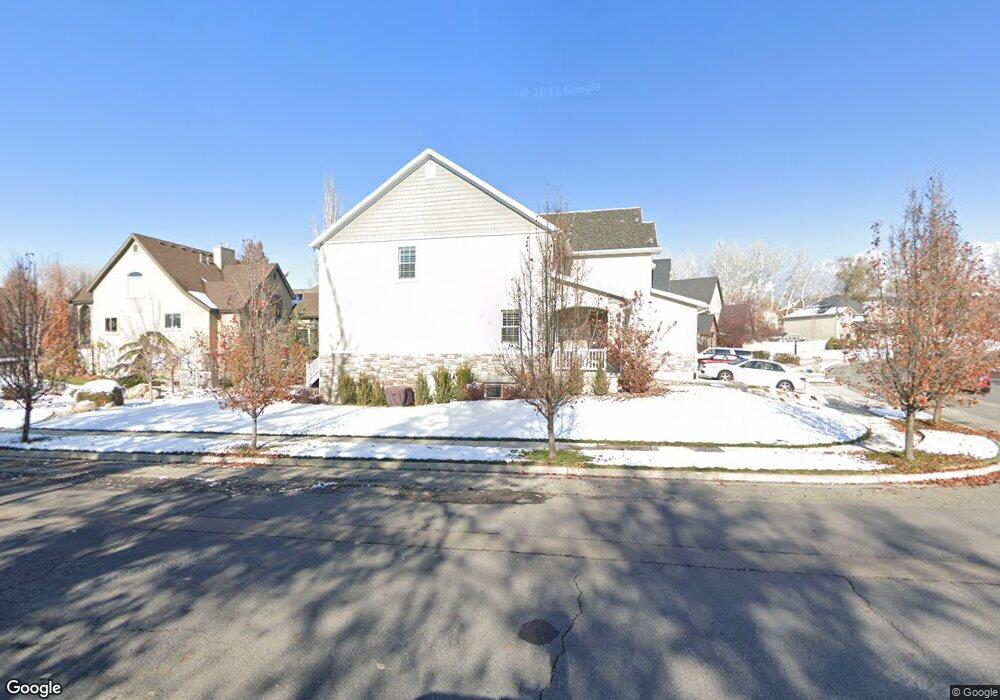
1215 E 530 N Unit 39 American Fork, UT 84003
Estimated Value: $859,000 - $1,184,000
5
Beds
3
Baths
5,024
Sq Ft
$196/Sq Ft
Est. Value
About This Home
This home is located at 1215 E 530 N Unit 39, American Fork, UT 84003 and is currently estimated at $985,526, approximately $196 per square foot. 1215 E 530 N Unit 39 is a home located in Utah County with nearby schools including Barratt Elementary School, American Fork Junior High School, and American Fork High School.
Ownership History
Date
Name
Owned For
Owner Type
Purchase Details
Closed on
Jun 3, 2014
Sold by
Anderson Deann B
Bought by
Chappell Scott
Current Estimated Value
Purchase Details
Closed on
Apr 3, 2014
Sold by
Chappell Scott
Bought by
Statham Jeremiah H and Statham Brandie L
Home Financials for this Owner
Home Financials are based on the most recent Mortgage that was taken out on this home.
Original Mortgage
$344,900
Interest Rate
3.8%
Mortgage Type
New Conventional
Purchase Details
Closed on
May 23, 2011
Sold by
Western Community Bank
Bought by
Anderson Deann B and Deann B Anderson Trust
Purchase Details
Closed on
Jul 15, 2010
Sold by
Carson Brad
Bought by
Western Community Bank
Purchase Details
Closed on
Mar 22, 2007
Sold by
Timpanogos Land & Development Llc
Bought by
Carson Brad
Purchase Details
Closed on
Feb 16, 2006
Sold by
Temple Investors Llc
Bought by
Timpanogos Land & Development Llc
Home Financials for this Owner
Home Financials are based on the most recent Mortgage that was taken out on this home.
Original Mortgage
$174,000
Interest Rate
6.04%
Mortgage Type
Construction
Purchase Details
Closed on
Nov 23, 2005
Sold by
Development Associates Inc
Bought by
Temple Investors Llc
Create a Home Valuation Report for This Property
The Home Valuation Report is an in-depth analysis detailing your home's value as well as a comparison with similar homes in the area
Home Values in the Area
Average Home Value in this Area
Purchase History
| Date | Buyer | Sale Price | Title Company |
|---|---|---|---|
| Chappell Scott | -- | Security Title Ins Agency | |
| Statham Jeremiah H | -- | Backman Title Services Ltd | |
| Anderson Deann B | -- | None Available | |
| Western Community Bank | -- | None Available | |
| Carson Brad | -- | First American Title Boun | |
| Timpanogos Land & Development Llc | -- | Integrated Title Insurance | |
| Temple Investors Llc | -- | Integrated Title Insurance |
Source: Public Records
Mortgage History
| Date | Status | Borrower | Loan Amount |
|---|---|---|---|
| Previous Owner | Statham Jeremiah H | $344,900 | |
| Previous Owner | Timpanogos Land & Development Llc | $174,000 |
Source: Public Records
Tax History Compared to Growth
Tax History
| Year | Tax Paid | Tax Assessment Tax Assessment Total Assessment is a certain percentage of the fair market value that is determined by local assessors to be the total taxable value of land and additions on the property. | Land | Improvement |
|---|---|---|---|---|
| 2025 | $3,861 | $429,000 | $252,600 | $527,400 |
| 2024 | $3,861 | $429,000 | $0 | $0 |
| 2023 | $3,836 | $451,825 | $0 | $0 |
| 2022 | $3,851 | $447,700 | $0 | $0 |
| 2021 | $3,374 | $612,700 | $176,900 | $435,800 |
| 2020 | $3,287 | $578,800 | $163,800 | $415,000 |
| 2019 | $2,879 | $524,400 | $156,900 | $367,500 |
| 2018 | $2,656 | $462,500 | $142,900 | $319,600 |
| 2017 | $2,557 | $240,295 | $0 | $0 |
| 2016 | $2,614 | $228,305 | $0 | $0 |
| 2015 | $2,317 | $192,060 | $0 | $0 |
| 2014 | $883 | $72,200 | $0 | $0 |
Source: Public Records
Map
Nearby Homes
- 598 N 1280 E
- 649 N 1280 E
- 1121 E 580 N
- 2254 N 1560 W
- 636 N 1280 E
- 2969 N 1350 W
- 1228 E 1030 N
- 435 N 800 E
- 980 W 1800 N
- 1897 N 900 W
- 1045 N 930 E Unit 58
- 1141 E 50 N
- The McKenzie Plan at Autumn Crest
- The Christine Plan at Autumn Crest
- The Avery Plan at Autumn Crest
- The Madison Plan at Autumn Crest
- The Roosevelt Plan at Autumn Crest
- The Annie Plan at Autumn Crest
- The Michelle Plan at Autumn Crest
- 170 N 825 E
- 1215 E 530 N Unit 49
- 1215 E 530 N
- 1215 Meadow Woods Ln
- 1215 Meadow Woods Ln Unit 39
- 1227 E 530 N
- 1227 E 530 N Unit 40
- 538 N 1200 E
- 1239 E 530 N
- 530 N 1200 E
- 554 N 1200 E
- 554 N 1200 E Unit 36
- 1248 E 530 N
- 562 N 1200 E
- 562 N 1200 E Unit 133
- 562 N 1200 E Unit 35
- 539 N 1200 E
- 539 N 1200 E Unit 13
- 1251 E 530 N
- 1252 E 530 N
- 1252 E 530 N Unit 47