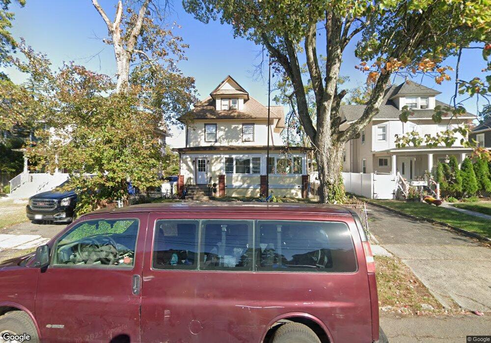
1215 Lenox Ave Unit 17 Plainfield, NJ 07060
Estimated Value: $342,000 - $595,000
--
Bed
--
Bath
1,986
Sq Ft
$249/Sq Ft
Est. Value
About This Home
This home is located at 1215 Lenox Ave Unit 17, Plainfield, NJ 07060 and is currently estimated at $494,854, approximately $249 per square foot. 1215 Lenox Ave Unit 17 is a home located in Union County with nearby schools including Cedarbrook K-8 Center, Hubbard Middle School, and Plainfield High School.
Ownership History
Date
Name
Owned For
Owner Type
Purchase Details
Closed on
Mar 10, 2021
Sold by
Jackson Arvis E
Bought by
Bolvito Transito Cojon and Decojon Vilma M
Current Estimated Value
Home Financials for this Owner
Home Financials are based on the most recent Mortgage that was taken out on this home.
Original Mortgage
$172,500
Interest Rate
2.9%
Mortgage Type
New Conventional
Purchase Details
Closed on
Oct 6, 1992
Bought by
Jackson Arvis
Create a Home Valuation Report for This Property
The Home Valuation Report is an in-depth analysis detailing your home's value as well as a comparison with similar homes in the area
Home Values in the Area
Average Home Value in this Area
Purchase History
| Date | Buyer | Sale Price | Title Company |
|---|---|---|---|
| Bolvito Transito Cojon | $230,000 | Investors First Title | |
| Bolvito Transito Cojon | $230,000 | Investors First Title | |
| Jackson Arvis | $74,000 | -- |
Source: Public Records
Mortgage History
| Date | Status | Borrower | Loan Amount |
|---|---|---|---|
| Previous Owner | Bolvito Transito Cojon | $172,500 |
Source: Public Records
Tax History Compared to Growth
Tax History
| Year | Tax Paid | Tax Assessment Tax Assessment Total Assessment is a certain percentage of the fair market value that is determined by local assessors to be the total taxable value of land and additions on the property. | Land | Improvement |
|---|---|---|---|---|
| 2025 | $10,024 | $114,800 | $40,800 | $74,000 |
| 2024 | $9,926 | $114,800 | $40,800 | $74,000 |
| 2023 | $9,926 | $114,800 | $40,800 | $74,000 |
| 2022 | $9,711 | $114,800 | $40,800 | $74,000 |
| 2021 | $9,626 | $114,800 | $40,800 | $74,000 |
| 2020 | $9,598 | $114,800 | $40,800 | $74,000 |
| 2019 | $9,598 | $114,800 | $40,800 | $74,000 |
| 2018 | $9,398 | $114,800 | $40,800 | $74,000 |
| 2017 | $9,168 | $114,800 | $40,800 | $74,000 |
| 2016 | $8,981 | $114,800 | $40,800 | $74,000 |
| 2015 | $8,716 | $114,800 | $40,800 | $74,000 |
| 2014 | $8,479 | $114,800 | $40,800 | $74,000 |
Source: Public Records
Map
Nearby Homes
- 115 Ellsworth Ct Unit 17
- 1143 Stilford Ave Unit 45
- 1143-45 Stilford Ave
- 1339 Park Ave Unit 41
- 1349 Park Ave Unit 53
- 1358 Marlborough Ave Unit 60
- 77 Parkside Rd Unit 89
- 1354 Chetwynd Ave Unit 58
- 1028 Evergreen Ave
- 132 Parkside Rd
- 1360 Belleview Ave Unit 64
- 947 Madison Ave
- 1388 Belleview Ave Unit 90
- 1454 S End Pkwy Unit 56
- 1019-23 Prospect Ave
- 1336 Sloane Blvd Unit 38
- 1215 Prospect Ave Unit 19
- 1358 Prospect Ave Unit 64
- 127 Remington Ave Unit 31
- 946 Central Ave
- 1219 Lenox Ave Unit 21
- 1211 Lenox Ave Unit 13
- 1207 Lenox Ave Unit 9
- 1223 Lenox Ave Unit 2
- 1223 Lenox Ave Unit 25
- 1227 Lenox Ave Unit 29
- 1201 Lenox Ave Unit 5
- 1231 Lenox Ave Unit 33
- 1208 Lenox Ave Unit 10
- 1216 Lenox Ave Unit 18
- 1212 Lenox Ave Unit 14
- 1220 Lenox Ave Unit 22
- 1224-26 Lenox Ave
- 1204-06 Lenox Ave
- 1235 Lenox Ave Unit 37
- 1224 Lenox Ave Unit 26
- 1204 Lenox Ave Unit 6
- 1204 Lenox Ave Unit 1
- 1200 Lenox Ave Unit 2
- 12 Randolph Rd