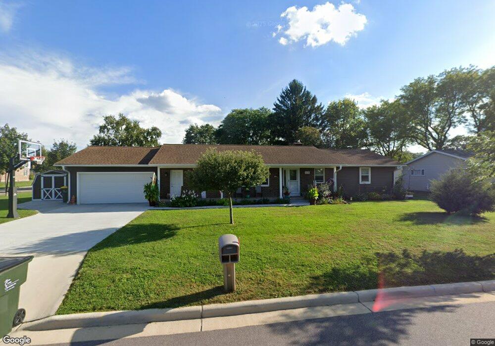
1215 Locust Ln Prairie Du Sac, WI 53578
Estimated Value: $327,000 - $381,486
3
Beds
3
Baths
1,485
Sq Ft
$238/Sq Ft
Est. Value
About This Home
This home is located at 1215 Locust Ln, Prairie Du Sac, WI 53578 and is currently estimated at $353,122, approximately $237 per square foot. 1215 Locust Ln is a home located in Sauk County with nearby schools including Sauk Prairie Middle School, Sauk Prairie High School, and St Aloysius Grade School.
Ownership History
Date
Name
Owned For
Owner Type
Purchase Details
Closed on
Sep 16, 2011
Sold by
Sprecher Virginia H
Bought by
Lueck Kenneth R and Lueck Robin Kay
Current Estimated Value
Home Financials for this Owner
Home Financials are based on the most recent Mortgage that was taken out on this home.
Original Mortgage
$105,000
Outstanding Balance
$72,382
Interest Rate
4.4%
Mortgage Type
New Conventional
Estimated Equity
$280,740
Purchase Details
Closed on
May 10, 2006
Sold by
Sprecher Virginia H
Bought by
Sprecher Virginia H
Create a Home Valuation Report for This Property
The Home Valuation Report is an in-depth analysis detailing your home's value as well as a comparison with similar homes in the area
Home Values in the Area
Average Home Value in this Area
Purchase History
| Date | Buyer | Sale Price | Title Company |
|---|---|---|---|
| Lueck Kenneth R | $155,000 | None Available | |
| Sprecher Virginia H | -- | None Available |
Source: Public Records
Mortgage History
| Date | Status | Borrower | Loan Amount |
|---|---|---|---|
| Open | Lueck Kenneth R | $105,000 |
Source: Public Records
Tax History Compared to Growth
Tax History
| Year | Tax Paid | Tax Assessment Tax Assessment Total Assessment is a certain percentage of the fair market value that is determined by local assessors to be the total taxable value of land and additions on the property. | Land | Improvement |
|---|---|---|---|---|
| 2024 | $4,840 | $335,000 | $65,400 | $269,600 |
| 2023 | $4,921 | $223,300 | $38,600 | $184,700 |
| 2022 | $4,914 | $218,900 | $38,600 | $180,300 |
| 2021 | $4,688 | $218,900 | $38,600 | $180,300 |
| 2020 | $4,397 | $218,900 | $38,600 | $180,300 |
| 2019 | $4,059 | $209,900 | $38,600 | $171,300 |
| 2018 | $3,984 | $209,900 | $38,600 | $171,300 |
| 2017 | $3,308 | $158,000 | $43,800 | $114,200 |
| 2016 | $3,300 | $158,000 | $43,800 | $114,200 |
| 2015 | $3,400 | $158,000 | $43,800 | $114,200 |
| 2014 | $3,405 | $158,000 | $43,800 | $114,200 |
Source: Public Records
Map
Nearby Homes
- 227 9th St
- 1550 Locust Ln
- 104 Ash St Unit 106
- 640 8th St
- 138 Fox Run
- 405 Hemlock St
- 151 Chestnut St
- 1209 N Forest Ln Unit 1
- 217 Cardinal Ln
- 253 Cardinal Ln
- 241 Cardinal Ln
- 229 Cardinal Ln
- 228 Cardinal Ln
- 216 Cardinal Ln
- 1905 Mulberry St
- 1909 Mulberry St
- 1917 Mulberry St
- 2025 Mulberry St
- 2000 Mulberry St
- 2004 Mulberry St
- 209 12th St
- 1220 Grand Ave
- 1210 Locust Ln
- 1220 Locust Ln
- 1235 Locust Ln
- 1230 Grand Ave
- 1120 Grand Ave
- 1120 Grand Ave
- 1230 Locust Ln
- 1215 Fairview Dr
- 1225 Fairview Dr
- 1245 Locust Ln
- 1240 Grand Ave
- 1235 Fairview Dr
- 1240 Locust Ln
- 1110 Grand Ave
- 274 13th St
- 1210 Fairview Dr
- 1220 Fairview Dr
- 1230 Fairview Dr