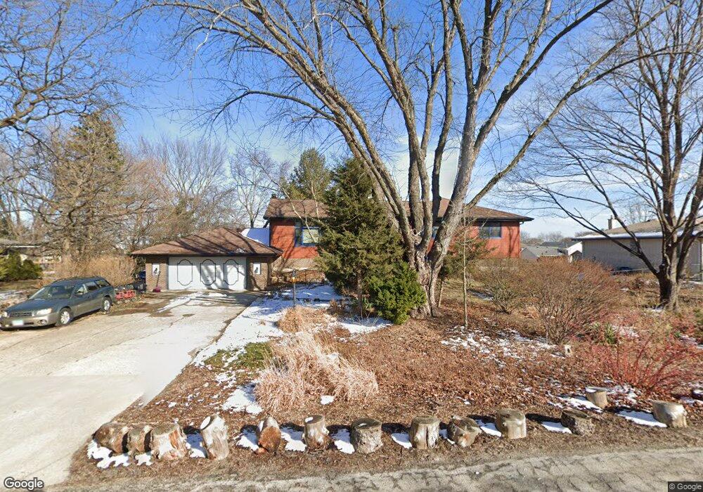
1215 Mohawk Ct Schaumburg, IL 60193
South Schaumburg NeighborhoodEstimated Value: $467,000 - $546,000
4
Beds
3
Baths
1,752
Sq Ft
$283/Sq Ft
Est. Value
About This Home
This home is located at 1215 Mohawk Ct, Schaumburg, IL 60193 and is currently estimated at $496,644, approximately $283 per square foot. 1215 Mohawk Ct is a home located in Cook County with nearby schools including Frederick Nerge Elementary School, Margaret Mead Junior High School, and J B Conant High School.
Ownership History
Date
Name
Owned For
Owner Type
Purchase Details
Closed on
May 25, 2023
Sold by
1215 S Mohawk Court Trust and Beisiegel William S
Bought by
Beisiegel William S and Beisiegel Stephen P
Current Estimated Value
Purchase Details
Closed on
May 17, 2018
Sold by
Beisiegel Irene
Bought by
Beisiegel Irene and 1215 Mohawk Court Trust
Create a Home Valuation Report for This Property
The Home Valuation Report is an in-depth analysis detailing your home's value as well as a comparison with similar homes in the area
Home Values in the Area
Average Home Value in this Area
Purchase History
| Date | Buyer | Sale Price | Title Company |
|---|---|---|---|
| Beisiegel William S | -- | None Listed On Document | |
| Beisiegel Irene | -- | Attorney |
Source: Public Records
Tax History
| Year | Tax Paid | Tax Assessment Tax Assessment Total Assessment is a certain percentage of the fair market value that is determined by local assessors to be the total taxable value of land and additions on the property. | Land | Improvement |
|---|---|---|---|---|
| 2025 | $8,973 | $42,000 | $9,027 | $32,973 |
| 2024 | $8,973 | $38,000 | $8,024 | $29,976 |
| 2023 | $8,650 | $38,000 | $8,024 | $29,976 |
| 2022 | $8,650 | $38,000 | $8,024 | $29,976 |
| 2021 | $6,339 | $26,909 | $22,567 | $4,342 |
| 2020 | $6,352 | $26,909 | $22,567 | $4,342 |
| 2019 | $6,359 | $29,899 | $22,567 | $7,332 |
| 2018 | $7,932 | $32,613 | $19,057 | $13,556 |
| 2017 | $7,839 | $32,613 | $19,057 | $13,556 |
| 2016 | $8,505 | $32,613 | $19,057 | $13,556 |
| 2015 | $7,519 | $27,529 | $16,048 | $11,481 |
| 2014 | $7,465 | $27,529 | $16,048 | $11,481 |
| 2013 | $7,240 | $27,529 | $16,048 | $11,481 |
Source: Public Records
Map
Nearby Homes
- 518 E Niagara Ave
- 620 S Point Dr
- 1055 Hampton Harbor Unit 1055
- 1100 Boston Harbor Unit 7004
- 615 Newberry Dr
- 826 Thornton Ct Unit 2AL
- 539 Newberry Dr
- 1323 S Roselle Rd
- 647 Cumberland Trail Unit AA1
- 13 W Monterey Ave
- 277 Greensboro Ct Unit 4
- 609 Deborah Ct
- 517 E Weathersfield Way
- 970 Yosemite Trail Unit A5
- 1749 Vermont Dr
- 1630 Myrtle Park St
- 1617 Nebraska Dr
- 134 Lunt Ave
- 100 Pratt Blvd
- 1500 Illinois St
- 1221 Mohawk Ct
- 1201 Mohawk Ct
- 1204 Salford Dr
- 1208 Salford Dr
- 1212 Salford Dr
- 1200 Salford Dr
- 1227 Mohawk Ct
- 1216 Salford Dr
- 1212 Mohawk Ct
- 1218 Mohawk Ct
- 1200 Mohawk Ct
- 608 Scott Dr
- 1220 Salford Dr
- 1224 Mohawk Ct
- 611 Scott Dr
- 1235 Mohawk Ct
- 612 Scott Dr
- 1147 Blackhawk Ct
- 1224 Salford Dr
- 1215 Salford Dr
Your Personal Tour Guide
Ask me questions while you tour the home.