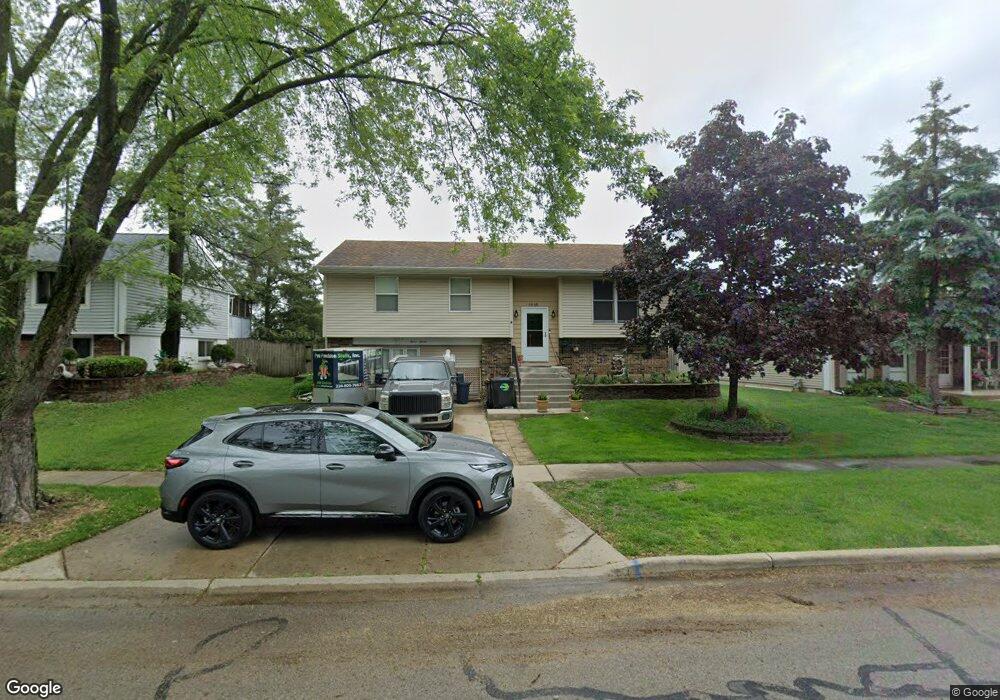
1215 Nippert Dr Streamwood, IL 60107
Woodland Heights NeighborhoodEstimated Value: $306,000 - $340,000
3
Beds
2
Baths
1,139
Sq Ft
$289/Sq Ft
Est. Value
About This Home
This home is located at 1215 Nippert Dr, Streamwood, IL 60107 and is currently estimated at $329,174, approximately $289 per square foot. 1215 Nippert Dr is a home located in Cook County with nearby schools including Heritage Elementary School, Tefft Middle School, and Streamwood High School.
Ownership History
Date
Name
Owned For
Owner Type
Purchase Details
Closed on
Feb 24, 2005
Sold by
Lasalle Bank Na
Bought by
Ricci Mike and Ricci Debbie
Current Estimated Value
Home Financials for this Owner
Home Financials are based on the most recent Mortgage that was taken out on this home.
Original Mortgage
$140,000
Interest Rate
5.67%
Mortgage Type
Purchase Money Mortgage
Create a Home Valuation Report for This Property
The Home Valuation Report is an in-depth analysis detailing your home's value as well as a comparison with similar homes in the area
Home Values in the Area
Average Home Value in this Area
Purchase History
| Date | Buyer | Sale Price | Title Company |
|---|---|---|---|
| Ricci Mike | -- | Cti |
Source: Public Records
Mortgage History
| Date | Status | Borrower | Loan Amount |
|---|---|---|---|
| Closed | Ricci Mike | $140,000 |
Source: Public Records
Tax History Compared to Growth
Tax History
| Year | Tax Paid | Tax Assessment Tax Assessment Total Assessment is a certain percentage of the fair market value that is determined by local assessors to be the total taxable value of land and additions on the property. | Land | Improvement |
|---|---|---|---|---|
| 2024 | $6,063 | $23,000 | $4,785 | $18,215 |
| 2023 | $5,873 | $23,000 | $4,785 | $18,215 |
| 2022 | $5,873 | $23,000 | $4,785 | $18,215 |
| 2021 | $5,557 | $18,530 | $3,349 | $15,181 |
| 2020 | $5,544 | $18,530 | $3,349 | $15,181 |
| 2019 | $5,557 | $20,821 | $3,349 | $17,472 |
| 2018 | $5,342 | $18,603 | $2,871 | $15,732 |
| 2017 | $5,289 | $18,603 | $2,871 | $15,732 |
| 2016 | $5,217 | $18,603 | $2,871 | $15,732 |
| 2015 | $5,143 | $17,123 | $2,631 | $14,492 |
| 2014 | $5,084 | $17,123 | $2,631 | $14,492 |
| 2013 | $4,906 | $17,123 | $2,631 | $14,492 |
Source: Public Records
Map
Nearby Homes
- 406 Library Ln
- 617 Arnold Ave
- 511 Freeman Ave
- 1019 Stratford Cir
- 1005 S Park Blvd
- 113 Samuel Ct Unit 263
- 821 Surrey Dr
- 121 E Briarwood Dr
- 700 Pleasant Place
- 719 Lacy Ave
- 55 Samuel Dr Unit 162
- 434 Locksley Dr
- 53 Samuel Dr Unit 163
- 406 Locksley Dr
- 803 Forest Dr
- 4018 Oxford Ct
- 819 Robinson Ave
- 804 Bussey Ct
- 2056 Essex Ct
- 7411 Astor Ave
- 1213 Nippert Dr Unit 11
- 1217 Nippert Dr
- 1219 Nippert Dr
- 1211 Nippert Dr
- 1214 Nippert Dr Unit 11
- 1216 Nippert Dr
- 1221 Nippert Dr
- 412 Library Ln
- 1208 Nippert Dr
- 1223 Nippert Dr
- 410 Library Ln
- 1206 Nippert Dr
- 1205 Nippert Dr
- 1225 Nippert Dr
- 413 Library Ln
- 408 Library Ln
- 1204 Nippert Dr
- 411 Library Ln
- 1203 Nippert Dr