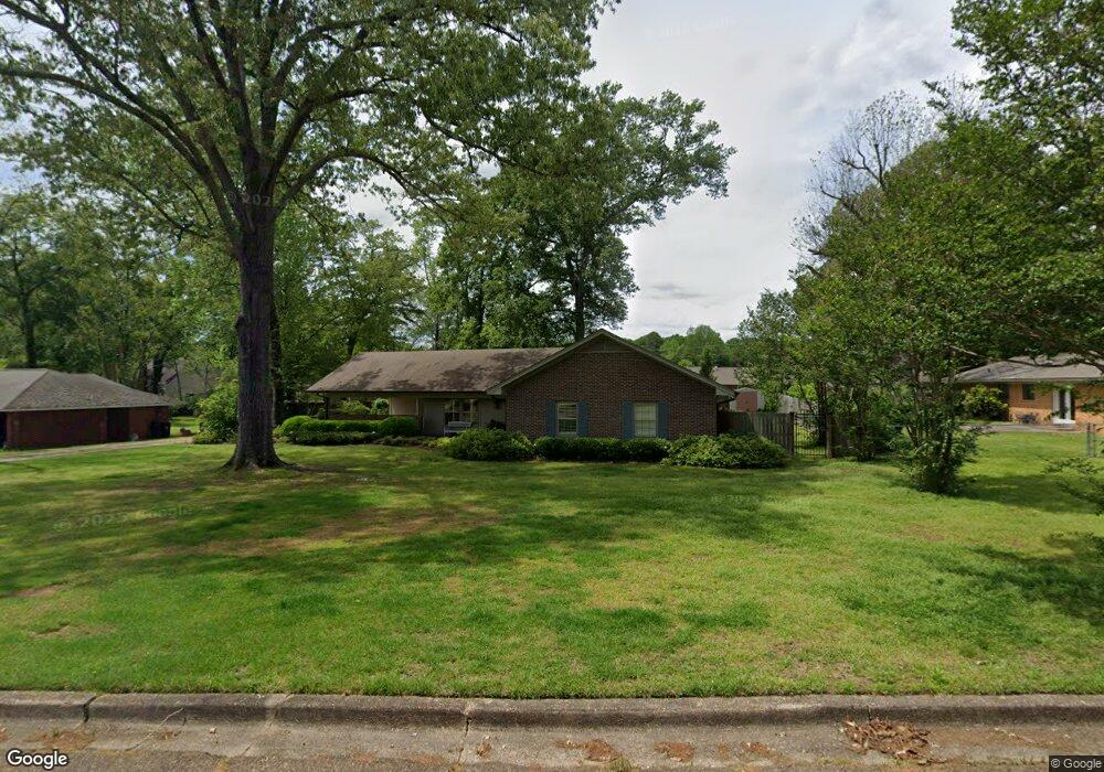
1215 Pecan Ln West Point, MS 39773
Estimated Value: $194,447 - $233,000
3
Beds
--
Bath
1,904
Sq Ft
$115/Sq Ft
Est. Value
About This Home
This home is located at 1215 Pecan Ln, West Point, MS 39773 and is currently estimated at $219,362, approximately $115 per square foot. 1215 Pecan Ln is a home located in Clay County with nearby schools including East Side Elementary School, West Clay Elementary School, and Church Hill Elementary School.
Ownership History
Date
Name
Owned For
Owner Type
Purchase Details
Closed on
Feb 18, 2025
Sold by
Trolio Victor John and Trolio Allison C
Bought by
White Hillary Meredith and White Steven L
Current Estimated Value
Home Financials for this Owner
Home Financials are based on the most recent Mortgage that was taken out on this home.
Original Mortgage
$205,200
Outstanding Balance
$203,262
Interest Rate
6.91%
Mortgage Type
New Conventional
Estimated Equity
$16,100
Purchase Details
Closed on
Oct 31, 2008
Sold by
Shipley Karen F
Bought by
Trolio Victor John and Trolio Allison C
Home Financials for this Owner
Home Financials are based on the most recent Mortgage that was taken out on this home.
Original Mortgage
$100,000
Interest Rate
6.11%
Create a Home Valuation Report for This Property
The Home Valuation Report is an in-depth analysis detailing your home's value as well as a comparison with similar homes in the area
Purchase History
We collect this data history from publicly available records. To have your information removed, we recommend requesting removal directly through your county’s website.
| Date | Buyer | Sale Price | Title Company |
|---|---|---|---|
| White Hillary Meredith | -- | None Listed On Document | |
| Trolio Victor John | -- | -- |
Source: Public Records
Mortgage History
We collect this data history from publicly available records. To have your information removed, we recommend requesting removal directly through your county’s website.
| Date | Status | Borrower | Loan Amount |
|---|---|---|---|
| Open | White Hillary Meredith | $205,200 | |
| Previous Owner | Trolio Victor John | $100,000 |
Source: Public Records
Tax History
| Year | Tax Paid | Tax Assessment Tax Assessment Total Assessment is a certain percentage of the fair market value that is determined by local assessors to be the total taxable value of land and additions on the property. | Land | Improvement |
|---|---|---|---|---|
| 2025 | $667 | $14,332 | $2,500 | $11,832 |
| 2024 | $627 | $14,332 | $2,500 | $11,832 |
| 2023 | $1,527 | $12,208 | $2,500 | $9,708 |
| 2022 | $515 | $12,208 | $2,500 | $9,708 |
| 2021 | $514 | $12,208 | $2,500 | $9,708 |
| 2020 | $514 | $12,208 | $2,500 | $9,708 |
| 2019 | $476 | $12,119 | $2,500 | $9,619 |
| 2018 | $450 | $12,119 | $2,500 | $9,619 |
| 2017 | $450 | $12,119 | $2,500 | $9,619 |
| 2016 | $427 | $12,119 | $2,500 | $9,619 |
| 2015 | $395 | $11,062 | $2,500 | $8,562 |
| 2014 | $177 | $11,062 | $2,500 | $8,562 |
| 2013 | $177 | $11,062 | $2,500 | $8,562 |
Source: Public Records
Map
Nearby Homes
- 389 Mapleview Rd
- 264 Mapleview Rd
- Lot 2 Waverly Rd
- Lot 6 Waverly Rd
- Lot 5 Waverly Rd
- Lot 3 Waverly Rd
- Lot 10 Waverly Rd
- Lot 8 Waverly Rd
- Lot 7 Waverly Rd
- Lot 9 Waverly Rd
- Lot 4 Waverly Rd
- Lot 11 Waverly Rd
- 229 Clark Cir
- 112 Meadow Hill Rd
- 170 Meadow Hill Rd
- 1414 E Brame Ave
- 405 S Eshman Ave
- 44 Torbert Dr
- 472 S Eshman Ave
- 329 Converse Dr
Your Personal Tour Guide
Ask me questions while you tour the home.