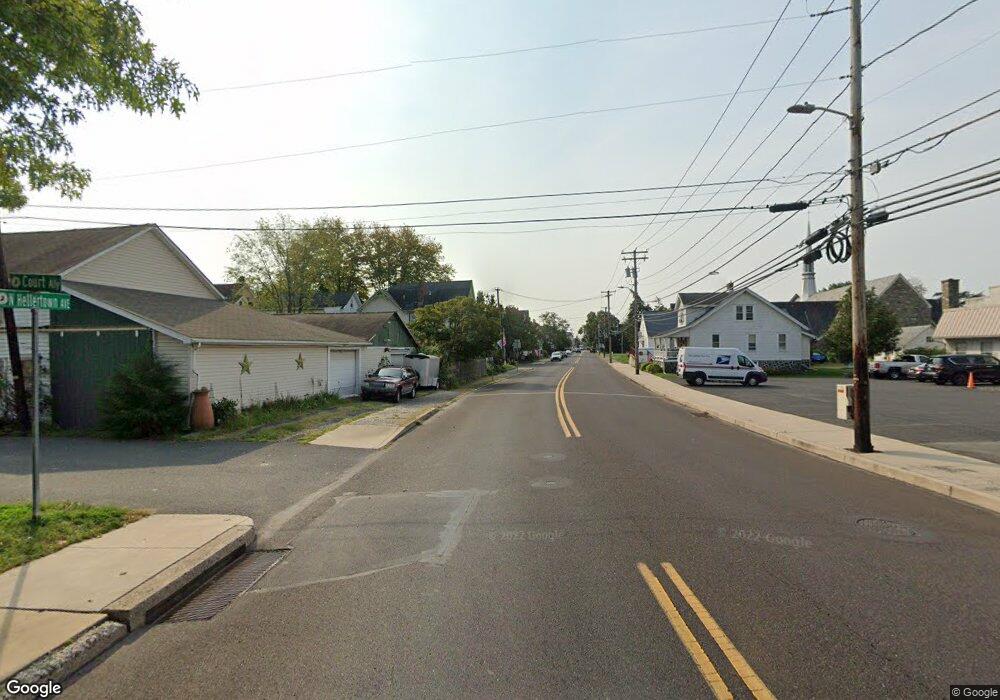
1215 Route 212 Quakertown, PA 18951
Estimated Value: $410,000 - $828,964
3
Beds
1
Bath
2,176
Sq Ft
$285/Sq Ft
Est. Value
About This Home
This home is located at 1215 Route 212, Quakertown, PA 18951 and is currently estimated at $619,482, approximately $284 per square foot. 1215 Route 212 is a home located in Bucks County with nearby schools including Springfield Elementary School, Palisades Middle School, and Palisades High School.
Ownership History
Date
Name
Owned For
Owner Type
Purchase Details
Closed on
Feb 23, 2023
Sold by
Atherholt Gary G
Bought by
Atherholt Gary G and Atherholt Shane S
Current Estimated Value
Purchase Details
Closed on
Jun 28, 2001
Sold by
Atherholt Gary G and Atherholt Judith G
Bought by
Atherholt Gary G
Purchase Details
Closed on
Jul 14, 1998
Sold by
Atherholt Gary G and Atherholt Judith G
Bought by
Atherholt Mary
Create a Home Valuation Report for This Property
The Home Valuation Report is an in-depth analysis detailing your home's value as well as a comparison with similar homes in the area
Home Values in the Area
Average Home Value in this Area
Purchase History
| Date | Buyer | Sale Price | Title Company |
|---|---|---|---|
| Atherholt Gary G | -- | Pride Abstract & Settlement Se | |
| Atherholt Gary G | -- | -- | |
| Atherholt Mary | -- | -- |
Source: Public Records
Tax History Compared to Growth
Tax History
| Year | Tax Paid | Tax Assessment Tax Assessment Total Assessment is a certain percentage of the fair market value that is determined by local assessors to be the total taxable value of land and additions on the property. | Land | Improvement |
|---|---|---|---|---|
| 2025 | $7,286 | $44,920 | $1,840 | $43,080 |
| 2024 | $7,286 | $44,920 | $1,840 | $43,080 |
| 2023 | $7,196 | $44,920 | $1,840 | $43,080 |
| 2022 | $6,983 | $44,920 | $1,840 | $43,080 |
| 2021 | $6,848 | $60,800 | $17,720 | $43,080 |
| 2020 | $6,848 | $60,800 | $17,720 | $43,080 |
| 2019 | $3,250 | $60,800 | $17,720 | $43,080 |
| 2018 | $6,727 | $60,800 | $17,720 | $43,080 |
| 2017 | $6,623 | $60,800 | $17,720 | $43,080 |
| 2016 | $6,623 | $60,800 | $17,720 | $43,080 |
| 2015 | $4,956 | $60,800 | $17,720 | $43,080 |
| 2014 | $4,956 | $60,800 | $17,720 | $43,080 |
Source: Public Records
Map
Nearby Homes
- 2332 Kunsman Rd
- 0 Winding Rd Unit PABU2102828
- 0 State Rd Unit PABU2058618
- 2275 Rowland Rd
- 1995 Peppermint Rd
- 2389 Route 212
- 325 Pullen Station Rd
- 1526 Parkland Rd
- 0 Bursonville Rd Unit PABU2091440
- 175 Pullen Station Rd
- 2511 Hickory Ln
- 2804 Route Unit 212
- 2804 Route 212
- 1107 Hickory Ln
- 0 NONE Bursonville Rd
- 2047 Sunrise Dr Unit 8
- 2047 Sunrise Dr
- 0 Sunrise Dr Unit PABU2066864
- 2061 Sunrise Dr Unit Lot 6
- 2061 Sunrise Dr
- 1225 Route 212
- 1245 Route 212
- 1275 Route 212
- 1277 Route 212
- 1279 Route 212
- 2075 Old Bethlehem Rd
- 2075 Old Bethlehem Rd Unit LOT 6
- 2030 Old Bethlehem Rd
- 2095 Old Bethlehem Rd
- 1867 Route 212
- 0 Route 212 Unit 5308571
- 0 Route 212 Unit 5662590
- 0 Route 212 Unit 5712727
- 0 Route 212 Unit 6098578
- 0 Route 212 Unit 6320131
- 0 Route 212 Unit 6463649
- 0 Route 212 Unit PABU2027514
- 0 Route 212 Unit PABU2026030
- 0 Route 212 Unit 692574
- 0 Route 212 Unit 692573
