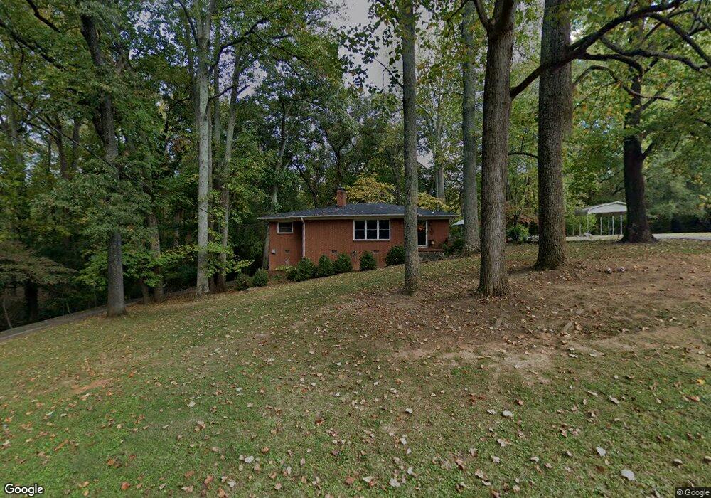
1215 S Poplar St Landis, NC 28088
Estimated Value: $248,000 - $350,000
--
Bed
2
Baths
1,800
Sq Ft
$172/Sq Ft
Est. Value
About This Home
This home is located at 1215 S Poplar St, Landis, NC 28088 and is currently estimated at $309,161, approximately $171 per square foot. 1215 S Poplar St is a home located in Rowan County with nearby schools including Landis Elementary School, Corriher Lipe Middle School, and South Rowan High School.
Ownership History
Date
Name
Owned For
Owner Type
Purchase Details
Closed on
Jan 14, 2009
Sold by
Wilkes Billy J and Wilkes Phyllis P
Bought by
Solomon Skylia W
Current Estimated Value
Home Financials for this Owner
Home Financials are based on the most recent Mortgage that was taken out on this home.
Original Mortgage
$75,000
Outstanding Balance
$47,558
Interest Rate
5.24%
Mortgage Type
Unknown
Estimated Equity
$261,603
Purchase Details
Closed on
Jul 9, 2007
Sold by
Price Hazeleen C
Bought by
Solomon Skylia W and Wilkes Billy J
Home Financials for this Owner
Home Financials are based on the most recent Mortgage that was taken out on this home.
Original Mortgage
$60,000
Interest Rate
6.37%
Mortgage Type
Unknown
Create a Home Valuation Report for This Property
The Home Valuation Report is an in-depth analysis detailing your home's value as well as a comparison with similar homes in the area
Home Values in the Area
Average Home Value in this Area
Purchase History
| Date | Buyer | Sale Price | Title Company |
|---|---|---|---|
| Solomon Skylia W | -- | None Available | |
| Solomon Skylia W | $150,000 | None Available |
Source: Public Records
Mortgage History
| Date | Status | Borrower | Loan Amount |
|---|---|---|---|
| Open | Solomon Skylia W | $75,000 | |
| Previous Owner | Solomon Skylia W | $60,000 |
Source: Public Records
Tax History Compared to Growth
Tax History
| Year | Tax Paid | Tax Assessment Tax Assessment Total Assessment is a certain percentage of the fair market value that is determined by local assessors to be the total taxable value of land and additions on the property. | Land | Improvement |
|---|---|---|---|---|
| 2025 | $2,627 | $245,545 | $54,188 | $191,357 |
| 2024 | $2,627 | $245,545 | $54,188 | $191,357 |
| 2023 | $2,627 | $245,545 | $54,188 | $191,357 |
| 2022 | $1,778 | $149,733 | $43,350 | $106,383 |
| 2021 | $1,778 | $149,733 | $43,350 | $106,383 |
| 2020 | $1,778 | $149,733 | $43,350 | $106,383 |
| 2019 | $1,778 | $149,733 | $43,350 | $106,383 |
| 2018 | $1,512 | $128,725 | $43,350 | $85,375 |
| 2017 | $1,449 | $128,725 | $43,350 | $85,375 |
| 2016 | $1,449 | $128,725 | $43,350 | $85,375 |
| 2015 | $1,471 | $128,725 | $43,350 | $85,375 |
| 2014 | $1,498 | $132,598 | $43,350 | $89,248 |
Source: Public Records
Map
Nearby Homes
- 2909 Glendale Ave
- 2885 Vale Ave
- 515 Rosemont Ave
- 859 Irish Creek Dr
- 813 S Zion St
- 2274 Tullymore Dr Unit 14
- 2319 Tullymore Dr Unit 39
- 0 Vale Ave
- 2401 Brookview Ave
- 843 Fairway Dr Unit 44
- 0 S Chapel St
- 959 Tamary Way Unit 29/30
- 604 S Zion St
- 0 Summit Ave
- 411 S Central Ave
- 233 E Rice St Unit 9
- 991 Fairway Dr
- 203 E 22nd St
- 204 E 27th St
- 2003 Plaza Ave
- 1219 S Poplar St
- 400 Pine St
- 1214 S Poplar St
- 1301 S Poplar St
- 1208 S Poplar St
- 416 Pine St
- 315 W Davis St
- 412 Pine St
- 317 W Davis St
- 401 Pine St
- 1202 S Poplar St
- 404 Airport Rd
- 413 Pine St
- 305 W Davis St
- 410 Airport Rd Unit OLD
- 506 Pine St
- 400 Airport Rd
- 407 W Davis St
- 502 Airport Rd
- 316 W Davis St