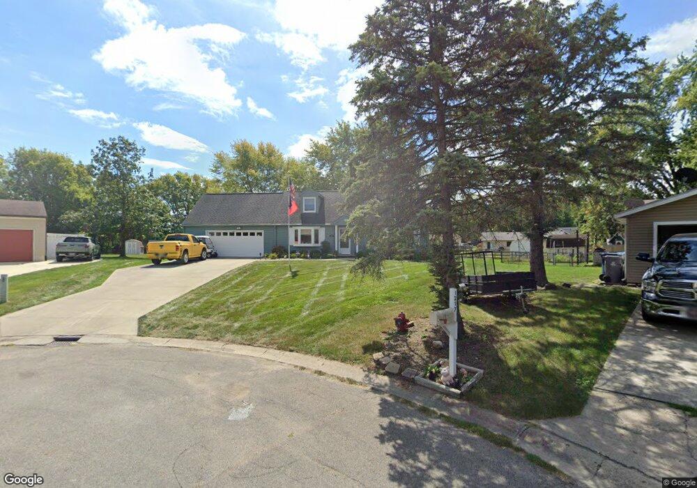
1215 Stuart Ct Cicero, IN 46034
Estimated Value: $350,000 - $537,000
3
Beds
2
Baths
1,872
Sq Ft
$220/Sq Ft
Est. Value
About This Home
This home is located at 1215 Stuart Ct, Cicero, IN 46034 and is currently estimated at $412,479, approximately $220 per square foot. 1215 Stuart Ct is a home located in Hamilton County with nearby schools including Legacy Christian School, Cicero Sda Elementary, and Indiana Academy.
Ownership History
Date
Name
Owned For
Owner Type
Purchase Details
Closed on
Jul 1, 2024
Sold by
Neill Warren R and Neill Carol A
Bought by
Bcd Trust and Neill
Current Estimated Value
Purchase Details
Closed on
Jun 7, 2024
Sold by
Neill Warren R and Neill Carol A
Bought by
Bcd Trust and Neill
Create a Home Valuation Report for This Property
The Home Valuation Report is an in-depth analysis detailing your home's value as well as a comparison with similar homes in the area
Home Values in the Area
Average Home Value in this Area
Purchase History
| Date | Buyer | Sale Price | Title Company |
|---|---|---|---|
| Bcd Trust | -- | None Listed On Document | |
| Bcd Trust | -- | None Listed On Document |
Source: Public Records
Tax History
| Year | Tax Paid | Tax Assessment Tax Assessment Total Assessment is a certain percentage of the fair market value that is determined by local assessors to be the total taxable value of land and additions on the property. | Land | Improvement |
|---|---|---|---|---|
| 2025 | $2,620 | $348,500 | $126,100 | $222,400 |
| 2024 | $2,458 | $312,500 | $126,100 | $186,400 |
| 2023 | $2,458 | $303,400 | $126,100 | $177,300 |
| 2022 | $2,779 | $303,400 | $75,000 | $228,400 |
| 2021 | $2,167 | $249,500 | $75,000 | $174,500 |
| 2020 | $1,834 | $223,000 | $75,000 | $148,000 |
| 2019 | $1,563 | $200,700 | $32,700 | $168,000 |
| 2018 | $1,583 | $200,900 | $32,700 | $168,200 |
| 2017 | $1,296 | $178,900 | $32,700 | $146,200 |
| 2016 | $1,156 | $169,600 | $32,700 | $136,900 |
| 2014 | $927 | $155,200 | $35,200 | $120,000 |
| 2013 | $927 | $158,200 | $34,900 | $123,300 |
Source: Public Records
Map
Nearby Homes
- 1940 Nantucket Dr
- 3028 Stilton Dr
- 3055 Sholty Ct
- 1020 Sunset Bay
- 8440 E 216th St
- 709 Pleasant Point Cir
- 100 Confidential Dr
- 88 Cedar Ln
- 96 Cedar Ln
- 82 Hovden Dr
- 30 Lively Place
- 243 Alvor Ct
- 129 Armitage St
- 206 Verdant Dr
- 140 Wiley St
- 104 Perlican Dr
- 26 Verdant Dr
- 449 S Peru St
- 15 Morse Ct
- 31 Bluewater Dr
- 1217 Stuart Ct
- 1211 Stuart Ct
- 2327 Lincoln Dr
- 1210 Stuart Ct
- 2337 Lincoln Dr
- 1208 Stuart Ct
- 0 Stringtown Pike Unit MBR2726993
- 2347 Lincoln Dr
- 1320 Waterbury Ct
- 2240 Stringtown Pike
- 2177 Stringtown Pike
- 1269 Casco Bay Cir
- 1329 Waterbury Ct
- 17A Stringtown Pike
- 2630-2 Stringtown Pike
- L17 Stringtown Pike
- 2320 Lincoln Dr
- 1340 Waterbury Ct
- 2357 Lincoln Dr
- 1289 Casco Bay Cir
Your Personal Tour Guide
Ask me questions while you tour the home.