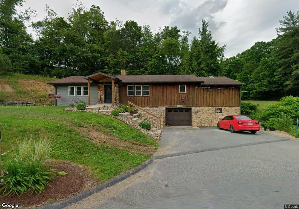
1215 Upper Mateer Rd Vandergrift, PA 15690
Estimated Value: $145,000 - $217,000
2
Beds
1
Bath
1,232
Sq Ft
$149/Sq Ft
Est. Value
About This Home
This home is located at 1215 Upper Mateer Rd, Vandergrift, PA 15690 and is currently estimated at $183,087, approximately $148 per square foot. 1215 Upper Mateer Rd is a home with nearby schools including Kiski Area High School.
Ownership History
Date
Name
Owned For
Owner Type
Purchase Details
Closed on
Sep 6, 2019
Sold by
Karns Ralph E and Karns Sarah M
Bought by
Department Of Transportation
Current Estimated Value
Purchase Details
Closed on
Oct 24, 2002
Bought by
Karns Ralph E and Karns Sarah M
Create a Home Valuation Report for This Property
The Home Valuation Report is an in-depth analysis detailing your home's value as well as a comparison with similar homes in the area
Home Values in the Area
Average Home Value in this Area
Purchase History
| Date | Buyer | Sale Price | Title Company |
|---|---|---|---|
| Department Of Transportation | -- | None Available | |
| Karns Ralph E | $47,000 | -- |
Source: Public Records
Tax History
| Year | Tax Paid | Tax Assessment Tax Assessment Total Assessment is a certain percentage of the fair market value that is determined by local assessors to be the total taxable value of land and additions on the property. | Land | Improvement |
|---|---|---|---|---|
| 2025 | $2,632 | $35,350 | $21,630 | $13,720 |
| 2024 | $2,432 | $35,350 | $21,630 | $13,720 |
| 2023 | $2,206 | $35,350 | $21,630 | $13,720 |
| 2022 | $2,206 | $35,350 | $21,630 | $13,720 |
| 2021 | $2,227 | $35,580 | $21,860 | $13,720 |
| 2020 | $2,255 | $35,580 | $21,860 | $13,720 |
| 2019 | $2,254 | $31,230 | $11,630 | $19,600 |
| 2018 | $2,210 | $31,230 | $11,630 | $19,600 |
| 2017 | $2,159 | $35,580 | $21,860 | $13,720 |
| 2016 | $2,096 | $35,580 | $21,860 | $13,720 |
| 2015 | $1,879 | $35,580 | $21,860 | $13,720 |
| 2014 | $1,879 | $35,580 | $21,860 | $13,720 |
Source: Public Records
Map
Nearby Homes
- 1212 Gravel Bar Rd
- 1116 Grant St
- 1252 Jefferson St
- 247 Sherman Ave
- 139 Maple Dr
- 137 Sherman Ave
- 133 Sherman Ave
- 107 Sumner Ave
- 122 Hamilton Ave
- 172 Franklin Ave
- 28 Clark Ave
- 820 Third Ave
- 817 3rd St
- 166 Grant Ave
- 109 Washington Ave
- 219 Quay St
- 250 Kennedy Ave
- 411 Center St
- 419 Vandergrift Ln
- 1299 Old State Rd
- 1289 Piper Hill Rd
- 1222 Upper Mateer Rd
- 1106 Schaeffer Ln
- 1234 Upper Mateer Rd
- 1276 Piper Hill Rd
- 1271 Piper Hill Rd
- 1109 Schaeffer Ln
- 1104 Angel Ln
- 1110 Matthis Ln
- 1250 Upper Mateer Rd
- 1131 Stone Ln
- 1140 Ash Rd
- 1107 Keim Ln
- 1252 Upper Mateer Rd
- 1173 Upper Mateer Rd
- 1232 Piper Hill Rd
- 1108 Angel Ln
- 1163 Upper Mateer Rd
- 1155 Upper Mateer Rd
- 1174 Ash Rd
Your Personal Tour Guide
Ask me questions while you tour the home.