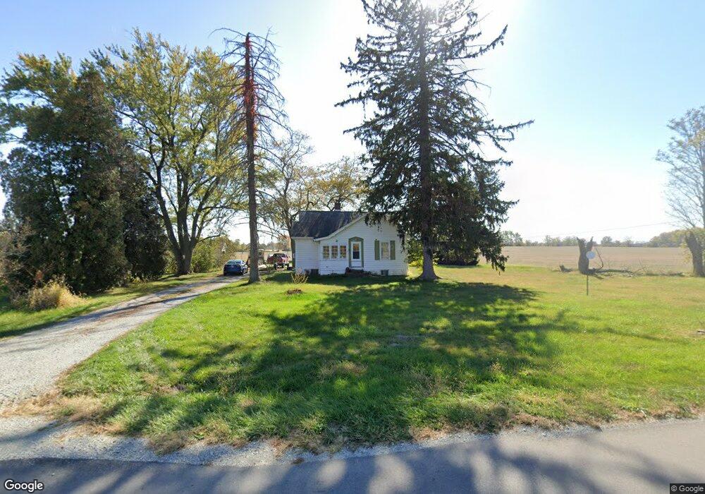
1215 W 193rd St Sheridan, IN 46069
Estimated Value: $362,000 - $595,548
2
Beds
1
Bath
840
Sq Ft
$538/Sq Ft
Est. Value
About This Home
This home is located at 1215 W 193rd St, Sheridan, IN 46069 and is currently estimated at $451,516, approximately $537 per square foot. 1215 W 193rd St is a home located in Hamilton County with nearby schools including Monon Trail Elementary School, Westfield Intermediate School, and Westfield Middle School.
Ownership History
Date
Name
Owned For
Owner Type
Purchase Details
Closed on
Aug 28, 2024
Sold by
Michael E King Revocable Trust and Lou Ann King Revocable Trust
Bought by
Winterburg Developer Llc
Current Estimated Value
Purchase Details
Closed on
May 28, 2008
Sold by
King Michael E and King Lou Ann
Bought by
Michael E King Revocable Trust
Purchase Details
Closed on
May 11, 2007
Sold by
King Lou Ann
Bought by
King Lou Ann and King Michael E
Create a Home Valuation Report for This Property
The Home Valuation Report is an in-depth analysis detailing your home's value as well as a comparison with similar homes in the area
Home Values in the Area
Average Home Value in this Area
Purchase History
| Date | Buyer | Sale Price | Title Company |
|---|---|---|---|
| Winterburg Developer Llc | $4,831,800 | First American Title | |
| Michael E King Revocable Trust | -- | None Available | |
| King Lou Ann | -- | None Available |
Source: Public Records
Tax History Compared to Growth
Tax History
| Year | Tax Paid | Tax Assessment Tax Assessment Total Assessment is a certain percentage of the fair market value that is determined by local assessors to be the total taxable value of land and additions on the property. | Land | Improvement |
|---|---|---|---|---|
| 2024 | $3,831 | $216,500 | $140,200 | $76,300 |
| 2023 | $3,911 | $195,300 | $124,300 | $71,000 |
| 2022 | $3,384 | $171,900 | $107,600 | $64,300 |
| 2021 | $3,303 | $152,400 | $98,800 | $53,600 |
| 2020 | $3,320 | $149,800 | $98,400 | $51,400 |
| 2019 | $3,496 | $148,800 | $90,100 | $58,700 |
| 2018 | $3,604 | $148,900 | $92,200 | $56,700 |
| 2017 | $3,509 | $155,800 | $102,200 | $53,600 |
| 2016 | $3,581 | $159,000 | $106,800 | $52,200 |
| 2014 | $3,595 | $161,000 | $110,600 | $50,400 |
| 2013 | $3,595 | $147,600 | $98,400 | $49,200 |
Source: Public Records
Map
Nearby Homes
- 1335 Mahoning Rd
- Bradford Plan at Atwater - Paired Villas
- V-1653 Adagio Plan at Atwater - Single Family Villas
- V-1443 Sonata Plan at Atwater - Single Family Villas
- V-1776 Harmony Plan at Atwater - Single Family Villas
- S-3142-3 Willow Plan at Atwater - Single Family Homes
- D-1515-2 Cordoba Plan at Atwater - Paired Villas
- S-2444-3 Sedona Plan at Atwater - Single Family Homes
- S-2182-3 Lakewood Plan at Atwater - Single Family Homes
- S-2397-2 Olympia Plan at Atwater - Single Family Homes
- S-2353-3 Aspen Plan at Atwater - Single Family Homes
- S-2820-3 Rowan Plan at Atwater - Single Family Homes
- D-1532-2 Brighton Plan at Atwater - Paired Villas
- 19644 Atwater Ave
- 19824 Atwater Ave
- 19542 Atwater Ave
- 19568 Atwater Ave
- 19377 Astoria Ave
- 986 Cowley Dr
- 19749 Highclere Ln
- 1198 W 193rd St
- 1306 W 193rd St
- 1470 W 193rd St
- 1163 Mccray Ln
- 1163 Mccray Ln
- 1149 Mccray Ln
- 1135 Mccray Ln
- 19498 Astoria Ave
- 19387 Astoria Ave
- 19428 Astoria Ave
- 19397 Astoria Ave
- 1121 Mccray Ln
- 19407 Astoria Ave
- 19252 Foley Dr
- 19448 Astoria Ave
- 19246 Foley Dr
- 19417 Astoria Ave
- 19238 Foley Dr
- 19427 Astoria Ave