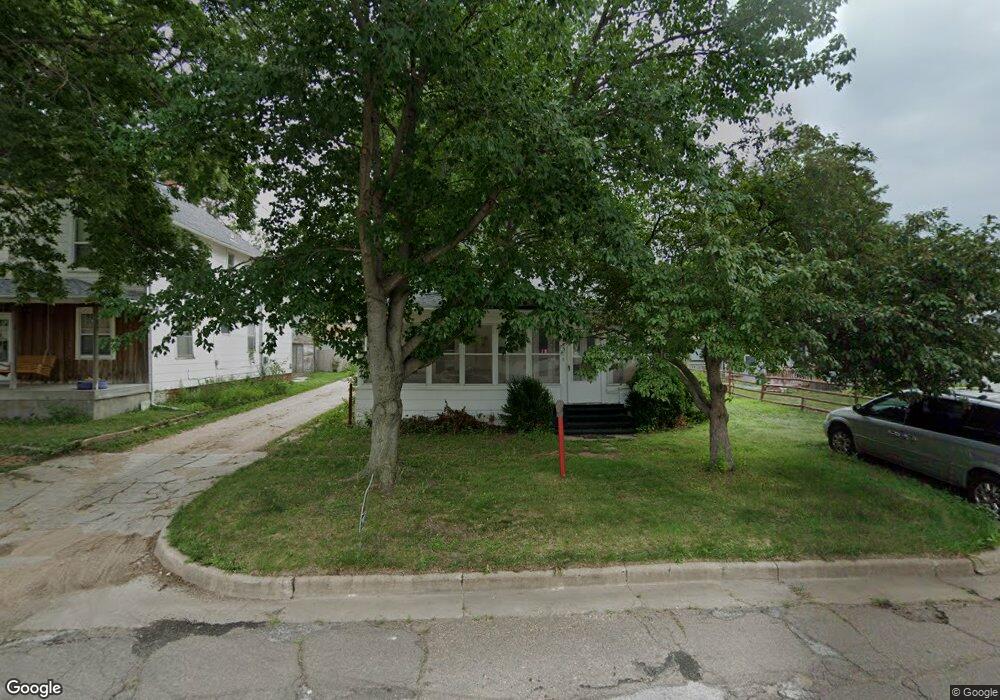
1215 W 5th St Hastings, NE 68901
Estimated Value: $141,000 - $174,000
3
Beds
2
Baths
1,596
Sq Ft
$99/Sq Ft
Est. Value
About This Home
This home is located at 1215 W 5th St, Hastings, NE 68901 and is currently estimated at $158,493, approximately $99 per square foot. 1215 W 5th St is a home located in Adams County with nearby schools including Hastings Senior High School, St. Michael's Preschool & Elementary School, and St. Cecilia High School.
Ownership History
Date
Name
Owned For
Owner Type
Purchase Details
Closed on
Aug 20, 2020
Sold by
S & W International Llc
Bought by
Ambrose John Dalton and Mendoza Vivian Perez
Current Estimated Value
Home Financials for this Owner
Home Financials are based on the most recent Mortgage that was taken out on this home.
Original Mortgage
$90,250
Outstanding Balance
$80,058
Interest Rate
3%
Mortgage Type
New Conventional
Estimated Equity
$78,435
Create a Home Valuation Report for This Property
The Home Valuation Report is an in-depth analysis detailing your home's value as well as a comparison with similar homes in the area
Home Values in the Area
Average Home Value in this Area
Purchase History
| Date | Buyer | Sale Price | Title Company |
|---|---|---|---|
| Ambrose John Dalton | $95,000 | Charter T&E Svcs Inc |
Source: Public Records
Mortgage History
| Date | Status | Borrower | Loan Amount |
|---|---|---|---|
| Open | Ambrose John Dalton | $90,250 |
Source: Public Records
Tax History Compared to Growth
Tax History
| Year | Tax Paid | Tax Assessment Tax Assessment Total Assessment is a certain percentage of the fair market value that is determined by local assessors to be the total taxable value of land and additions on the property. | Land | Improvement |
|---|---|---|---|---|
| 2024 | $1,627 | $101,007 | $14,040 | $86,967 |
| 2023 | $1,882 | $91,191 | $14,040 | $77,151 |
| 2022 | $1,025 | $45,491 | $14,040 | $31,451 |
| 2021 | $902 | $41,111 | $11,440 | $29,671 |
| 2020 | $856 | $39,698 | $11,440 | $28,258 |
| 2019 | $802 | $37,605 | $11,440 | $26,165 |
| 2018 | $678 | $31,625 | $5,460 | $26,165 |
| 2017 | $656 | $30,620 | $0 | $0 |
| 2016 | $657 | $30,620 | $5,460 | $25,160 |
| 2010 | $628 | $28,000 | $5,200 | $22,800 |
Source: Public Records
Map
Nearby Homes
- 310 N Saunders Ave
- 619 N Briggs Ave
- 618 N Saunders Ave
- 1114-1116 W 6th St
- 1011 W 4th St
- 727 N Williams Ave
- 714 N Baltimore Ave
- 1615 W 7th St
- 313 Jefferson Ave
- 1733 W 5th St
- 514 Oswego Ave
- 1734 W 2nd St
- 1619 Boyce St
- 1001 N Webster Ave
- 814 N Lincoln Ave
- 1801 W 7th St
- 850 N Burlington Ave
- 904 N Washington Ave
- 1011 N Bellevue Ave
- 1423 W B St
- 1211 W 5th St
- 420 N Briggs Ave
- 415 N Saunders Ave
- 417 N Saunders Ave
- 409 N Saunders Ave
- 1218 W 4th St
- 1206 W 4th St Unit 1208
- 1202 W 4th St Unit 1204
- 419 N Briggs Ave
- 503 N Briggs Ave
- 408 N Briggs Ave
- 411 N Briggs Ave
- 415 N Briggs Ave
- 401 N Briggs Ave
- 507 N Briggs Ave
- 408 N Saunders Ave
- 1135 W 5th St
- 1311 W 5th St
- 1138 W 5th St
- 1306 W 5th St