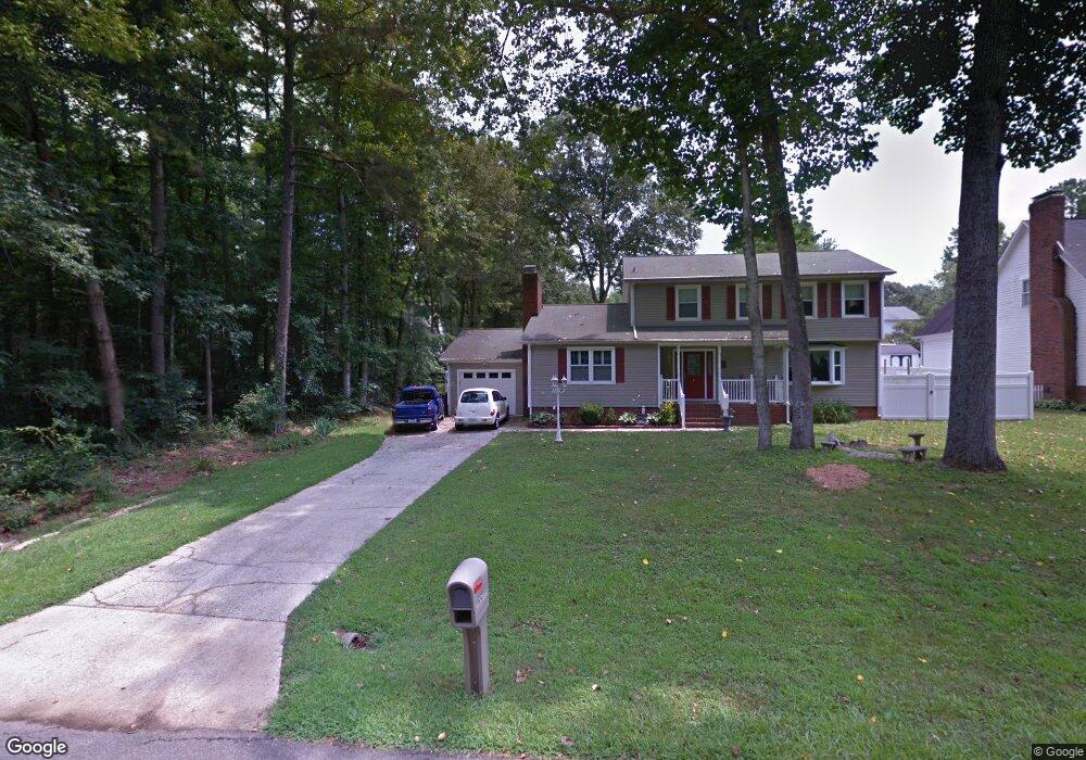
1215 Wiltshire Dr Kannapolis, NC 28081
Estimated Value: $326,000 - $362,710
4
Beds
3
Baths
2,310
Sq Ft
$151/Sq Ft
Est. Value
About This Home
This home is located at 1215 Wiltshire Dr, Kannapolis, NC 28081 and is currently estimated at $349,928, approximately $151 per square foot. 1215 Wiltshire Dr is a home located in Cabarrus County with nearby schools including Shady Brook Elementary School, Kannapolis Middle, and A.L. Brown High School.
Ownership History
Date
Name
Owned For
Owner Type
Purchase Details
Closed on
Mar 26, 1999
Sold by
Rubright Wilbur H and Rubright Monika Sue Anne
Bought by
Middlemiss Donald and Middlemiss Elizabeth Anne
Current Estimated Value
Home Financials for this Owner
Home Financials are based on the most recent Mortgage that was taken out on this home.
Original Mortgage
$113,400
Outstanding Balance
$27,422
Interest Rate
6.74%
Estimated Equity
$322,506
Purchase Details
Closed on
Sep 1, 1995
Purchase Details
Closed on
Jun 1, 1990
Purchase Details
Closed on
Mar 1, 1984
Create a Home Valuation Report for This Property
The Home Valuation Report is an in-depth analysis detailing your home's value as well as a comparison with similar homes in the area
Home Values in the Area
Average Home Value in this Area
Purchase History
| Date | Buyer | Sale Price | Title Company |
|---|---|---|---|
| Middlemiss Donald | $126,000 | -- | |
| -- | $121,000 | -- | |
| -- | $99,500 | -- | |
| -- | $80,000 | -- |
Source: Public Records
Mortgage History
| Date | Status | Borrower | Loan Amount |
|---|---|---|---|
| Open | Middlemiss Donald | $113,400 |
Source: Public Records
Tax History Compared to Growth
Tax History
| Year | Tax Paid | Tax Assessment Tax Assessment Total Assessment is a certain percentage of the fair market value that is determined by local assessors to be the total taxable value of land and additions on the property. | Land | Improvement |
|---|---|---|---|---|
| 2025 | $3,073 | $270,630 | $63,000 | $207,630 |
| 2024 | $3,073 | $270,630 | $63,000 | $207,630 |
| 2023 | $2,335 | $170,470 | $34,000 | $136,470 |
| 2022 | $2,335 | $170,470 | $34,000 | $136,470 |
| 2021 | $2,335 | $170,470 | $34,000 | $136,470 |
| 2020 | $2,335 | $170,470 | $34,000 | $136,470 |
| 2019 | $2,045 | $149,300 | $25,000 | $124,300 |
| 2018 | $2,016 | $149,300 | $25,000 | $124,300 |
| 2017 | $1,986 | $149,300 | $25,000 | $124,300 |
| 2016 | $1,930 | $147,360 | $32,000 | $115,360 |
| 2015 | $1,857 | $147,360 | $32,000 | $115,360 |
| 2014 | $1,857 | $147,360 | $32,000 | $115,360 |
Source: Public Records
Map
Nearby Homes
- 1208 Berkshire Dr
- 1209 Derbyshire Rd
- 1200 Berkshire Dr
- 1110 Rogers Lake Rd
- 1620 Longbow Dr
- 1010 Sprucewood St
- 915 Sprucewood St
- 1408 Nottingham Rd
- 1003 Robinhood Ln
- 00 Sapp Rd
- 3833 Crossbane St
- 804 Evergreen Ave
- 1441 Sherwood Dr
- 1418 Oakwood Ave
- 809 Walker St
- 4150 Longmore Ln
- 1229 Brecken Ct
- 1828 Independence Square
- 1410 Oakwood Ave
- 1599 Bethpage Rd
- 1217 Wiltshire Dr
- 1211 Wiltshire Dr
- 1208 Hampshire Dr
- 1210 Hampshire Dr
- 1206 Hampshire Dr
- 1218 Wiltshire Dr
- 1409 Derbyshire Rd
- 1411 Derbyshire Rd
- 1405 Derbyshire Rd
- 1504 Derbyshire Rd
- 1209 Hampshire Dr
- 1211 Hampshire Dr
- 1207 Hampshire Dr
- 1503 Derbyshire Rd
- 1199 Wiltshire Dr
- 1303 Derbyshire Rd
- 1197 Hampshire Dr
- 1301 Derbyshire Rd
- 1216 Berkshire Dr
- 1505 Derbyshire Rd