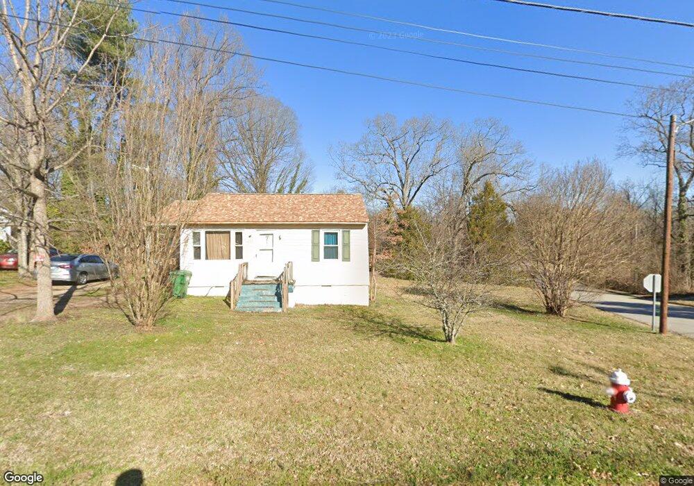
1215 Wise Ave High Point, NC 27260
Greater High Point NeighborhoodEstimated Value: $102,762 - $141,000
2
Beds
1
Bath
1,014
Sq Ft
$120/Sq Ft
Est. Value
About This Home
This home is located at 1215 Wise Ave, High Point, NC 27260 and is currently estimated at $121,691, approximately $120 per square foot. 1215 Wise Ave is a home located in Guilford County with nearby schools including Fairview Elementary School, Ferndale Middle School, and High Point Central High School.
Ownership History
Date
Name
Owned For
Owner Type
Purchase Details
Closed on
Sep 24, 2019
Sold by
Sabir Mohammad and Shaheen Musarat
Bought by
Ms Family Properties Inc
Current Estimated Value
Purchase Details
Closed on
May 20, 2008
Sold by
Sestito Pete
Bought by
Sabir Mohammad and Shaheen Musarat
Purchase Details
Closed on
Sep 4, 2001
Sold by
Reece Marie K
Bought by
Sestito Peter
Create a Home Valuation Report for This Property
The Home Valuation Report is an in-depth analysis detailing your home's value as well as a comparison with similar homes in the area
Home Values in the Area
Average Home Value in this Area
Purchase History
| Date | Buyer | Sale Price | Title Company |
|---|---|---|---|
| Ms Family Properties Inc | -- | None Available | |
| Ms Family Properties Inc | -- | None Available | |
| Sabir Mohammad | $25,000 | None Available | |
| Sestito Peter | -- | -- |
Source: Public Records
Tax History
| Year | Tax Paid | Tax Assessment Tax Assessment Total Assessment is a certain percentage of the fair market value that is determined by local assessors to be the total taxable value of land and additions on the property. | Land | Improvement |
|---|---|---|---|---|
| 2025 | $502 | $36,400 | $7,000 | $29,400 |
| 2024 | $502 | $36,400 | $7,000 | $29,400 |
| 2023 | $502 | $36,400 | $7,000 | $29,400 |
| 2022 | $491 | $36,400 | $7,000 | $29,400 |
| 2021 | $349 | $25,300 | $4,000 | $21,300 |
| 2020 | $349 | $25,300 | $4,000 | $21,300 |
| 2019 | $349 | $25,300 | $0 | $0 |
| 2018 | $347 | $25,300 | $0 | $0 |
| 2017 | $347 | $25,300 | $0 | $0 |
| 2016 | $470 | $33,500 | $0 | $0 |
| 2015 | $472 | $33,500 | $0 | $0 |
| 2014 | $480 | $33,500 | $0 | $0 |
Source: Public Records
Map
Nearby Homes
- 650 Wesley Dr
- 640 Wesley Dr
- 1103 Jefferson St
- 1012 Jefferson St
- 1914 E Russell Ave
- 1010 Grace St
- 812 E Russell Ave
- 1422 Valley Ridge Dr
- 1114 Richland St
- 1021 Asheboro St
- 705 Wise Ave
- 909 Randolph St
- 1314 Franklin Ave
- 925 Randolph St
- 1015 Sharon St
- 1110 Worth St
- 1423 E Commerce Ave
- 526 White Oak St
- 809 E Green Dr
- 518 Whiteoak St
- 1211 Wise Ave
- 828 Hines St
- 1301 Wise Ave
- 1201 Wise Ave
- 826 Hines St
- 1303 Wise Ave
- 1305 Wise Ave
- 1607 Pershing St
- 1609 Pershing St
- 1605 Pershing St
- 1601 Pershing St Unit 1603
- 1611 Pershing St
- 1519 Pershing St
- 1615 Pershing St
- 1701 Pershing St
- 1517 Pershing St
- 1705 Pershing St
- 1515 Pershing St
- 1707 Pershing St
- 656 Wesley Dr
Your Personal Tour Guide
Ask me questions while you tour the home.