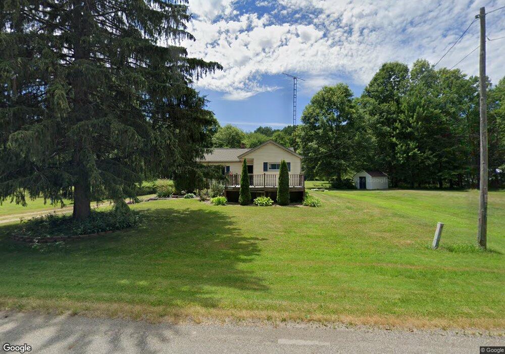
12150 Oyster Rd Alliance, OH 44601
Estimated Value: $120,000 - $157,000
2
Beds
1
Bath
948
Sq Ft
$153/Sq Ft
Est. Value
About This Home
This home is located at 12150 Oyster Rd, Alliance, OH 44601 and is currently estimated at $145,153, approximately $153 per square foot. 12150 Oyster Rd is a home located in Mahoning County with nearby schools including West Branch Middle School, West Branch Early Learning Center, and West Branch High School.
Ownership History
Date
Name
Owned For
Owner Type
Purchase Details
Closed on
Aug 5, 2019
Sold by
Heestand Lee K and Heestand Deborah L
Bought by
Mabry Tera M
Current Estimated Value
Home Financials for this Owner
Home Financials are based on the most recent Mortgage that was taken out on this home.
Original Mortgage
$59,500
Outstanding Balance
$39,352
Interest Rate
3.8%
Mortgage Type
Future Advance Clause Open End Mortgage
Estimated Equity
$105,801
Purchase Details
Closed on
Nov 21, 1990
Bought by
Yanok Marceline M
Create a Home Valuation Report for This Property
The Home Valuation Report is an in-depth analysis detailing your home's value as well as a comparison with similar homes in the area
Home Values in the Area
Average Home Value in this Area
Purchase History
| Date | Buyer | Sale Price | Title Company |
|---|---|---|---|
| Mabry Tera M | $85,000 | Heritage Union Title Co Ltd | |
| Yanok Marceline M | $20,000 | -- |
Source: Public Records
Mortgage History
| Date | Status | Borrower | Loan Amount |
|---|---|---|---|
| Open | Mabry Tera M | $59,500 |
Source: Public Records
Tax History Compared to Growth
Tax History
| Year | Tax Paid | Tax Assessment Tax Assessment Total Assessment is a certain percentage of the fair market value that is determined by local assessors to be the total taxable value of land and additions on the property. | Land | Improvement |
|---|---|---|---|---|
| 2024 | $1,608 | $44,230 | $15,010 | $29,220 |
| 2023 | $1,577 | $44,230 | $15,010 | $29,220 |
| 2022 | $994 | $24,980 | $12,010 | $12,970 |
| 2021 | $996 | $24,980 | $12,010 | $12,970 |
| 2020 | $1,000 | $24,980 | $12,010 | $12,970 |
| 2019 | $856 | $20,330 | $9,520 | $10,810 |
| 2018 | $853 | $20,330 | $9,520 | $10,810 |
| 2017 | $850 | $20,330 | $9,520 | $10,810 |
| 2016 | $909 | $21,870 | $10,680 | $11,190 |
| 2015 | $882 | $21,870 | $10,680 | $11,190 |
| 2014 | $887 | $21,870 | $10,680 | $11,190 |
| 2013 | $877 | $21,870 | $10,680 | $11,190 |
Source: Public Records
Map
Nearby Homes
- 15995 Elbrook St NE
- 11310 Webb Ave NE
- 11680 Walnut Ave NE
- 15789 Coalbank St NE
- 11344 Walnut Ave NE
- 652 N Webb Ave
- 15520 Coalbank St NE
- 263 Franklin Ave
- 1214 Jersey St
- 124 E Wayne St
- 608 N Freedom Ave
- 710 N Freedom Ave
- 0 Knoll St NE
- 505 N Union Ave
- 361 E Main St
- 442 S Liberty Ave
- V/L S Fredeom Ave
- 356 E Broadway St
- 13600 Caldwell Ave
- 432 S Linden Ave
- 12100 Oyster Rd
- 12210 Oyster Rd
- 12250 Oyster Rd
- 12274 Oyster Rd
- 22447 W South Range Rd
- 22447 W South Range Rd
- 22505 W South Range Rd
- 12296 Oyster Rd
- 17846 W South Range Rd
- 12310 Oyster Rd
- 22559 W South Range Rd
- 0 Oyster Rd Unit 4138532
- 0 Oyster Rd
- 22601 W South Range Rd
- 11925 Oyster Rd
- 22663 W South Range Rd
- 22733 W South Range Rd
- 22905 W South Range Rd
- 0 Mahoning Ave
- 11867 Mahoning Ave NE