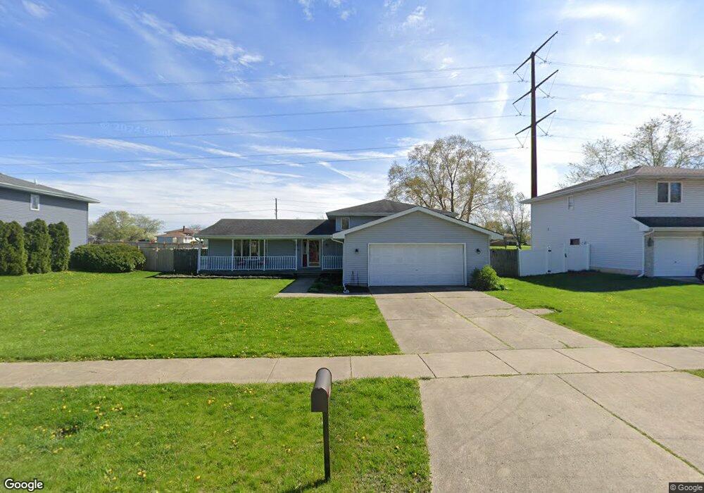
12151 W 102nd Ave Saint John, IN 46373
Saint John NeighborhoodEstimated Value: $374,000 - $395,000
3
Beds
3
Baths
2,070
Sq Ft
$186/Sq Ft
Est. Value
About This Home
This home is located at 12151 W 102nd Ave, Saint John, IN 46373 and is currently estimated at $384,098, approximately $185 per square foot. 12151 W 102nd Ave is a home located in Lake County with nearby schools including Lincoln Elementary School, Hanover Central Middle School, and Hanover Central High School.
Ownership History
Date
Name
Owned For
Owner Type
Purchase Details
Closed on
Feb 16, 2024
Sold by
Indiana Land Trust and Trust No P-5215
Bought by
Deyoung Matthew G and Deyoung Katherine M
Current Estimated Value
Purchase Details
Closed on
Feb 13, 2024
Sold by
Indiana Land Trust and Trust No P-5215
Bought by
Deyoung Matthew G and Deyoung Katherine M
Purchase Details
Closed on
May 23, 2023
Sold by
Sheriff Of Lake County
Bought by
Indiana Land Trust Company P5215
Purchase Details
Closed on
Sep 15, 2006
Sold by
Dykstra Timothy A and Dyke Rebecca L
Bought by
Hatfield David R and Hatfield Amy
Home Financials for this Owner
Home Financials are based on the most recent Mortgage that was taken out on this home.
Original Mortgage
$221,500
Interest Rate
6.7%
Mortgage Type
Purchase Money Mortgage
Create a Home Valuation Report for This Property
The Home Valuation Report is an in-depth analysis detailing your home's value as well as a comparison with similar homes in the area
Home Values in the Area
Average Home Value in this Area
Purchase History
| Date | Buyer | Sale Price | Title Company |
|---|---|---|---|
| Deyoung Matthew G | -- | None Listed On Document | |
| Deyoung Matthew G | $345,000 | None Listed On Document | |
| Indiana Land Trust Company P5215 | $174,000 | None Listed On Document | |
| Hatfield David R | -- | None Available |
Source: Public Records
Mortgage History
| Date | Status | Borrower | Loan Amount |
|---|---|---|---|
| Previous Owner | Hatfield David R | $221,500 |
Source: Public Records
Tax History Compared to Growth
Tax History
| Year | Tax Paid | Tax Assessment Tax Assessment Total Assessment is a certain percentage of the fair market value that is determined by local assessors to be the total taxable value of land and additions on the property. | Land | Improvement |
|---|---|---|---|---|
| 2024 | $6,638 | $306,100 | $49,000 | $257,100 |
| 2023 | $2,958 | $279,800 | $49,000 | $230,800 |
| 2022 | $2,958 | $263,900 | $49,000 | $214,900 |
| 2021 | $2,867 | $253,600 | $35,500 | $218,100 |
| 2020 | $2,875 | $244,300 | $35,500 | $208,800 |
| 2019 | $2,686 | $234,500 | $35,500 | $199,000 |
| 2018 | $2,752 | $224,800 | $35,500 | $189,300 |
| 2017 | $2,924 | $225,100 | $35,500 | $189,600 |
| 2016 | $2,677 | $211,000 | $35,500 | $175,500 |
| 2014 | $2,141 | $194,700 | $35,500 | $159,200 |
| 2013 | $2,210 | $193,500 | $35,500 | $158,000 |
Source: Public Records
Map
Nearby Homes
- 10043 Northcote Ct
- 10463 Olcott Ave
- 9966 Olcott Ave
- 9857 Olcott Ave
- 12305 Alvina Rose Ct
- The Torbet Plan at The Preserve
- The Rainier Plan at The Preserve
- The Princeton Plan at The Preserve
- The Powell II Plan at The Preserve
- The Lincoln Plan at The Preserve
- The Huxley Plan at The Preserve
- The Harper Plan at The Preserve
- The Elbert Plan at The Preserve
- The Bennett Plan at The Preserve
- The Augusta Plan at The Preserve
- The Alverstone Plan at The Preserve
- Devonhurst Custom Plan at The Preserve
- Somerset Custom Plan at The Preserve
- Monroe Custom Plan at The Preserve
- 9792 W Oakridge Dr
- 12151 W 102nd St
- 12211 W 102nd Ave
- 12211 W 102nd St Unit 2
- 12135 W 102nd St
- 12135 W 102nd Ave
- 12202 W 102nd St
- 12221 W 102nd St
- 12123 W 102nd St
- 12202 W 102nd Ave
- 10198 Olcott Ave
- 12235 W 102nd St Unit 2
- 10191 Northcote Ct
- 10196 Northcote Ct
- 10192 Olcott Ave
- 12243 W 102nd St
- 10266 Olcott Ave
- 12243 W 102nd Ave
- 12304 W 102nd St
- 10177 Northcote Ct
- 12244 W 102nd St