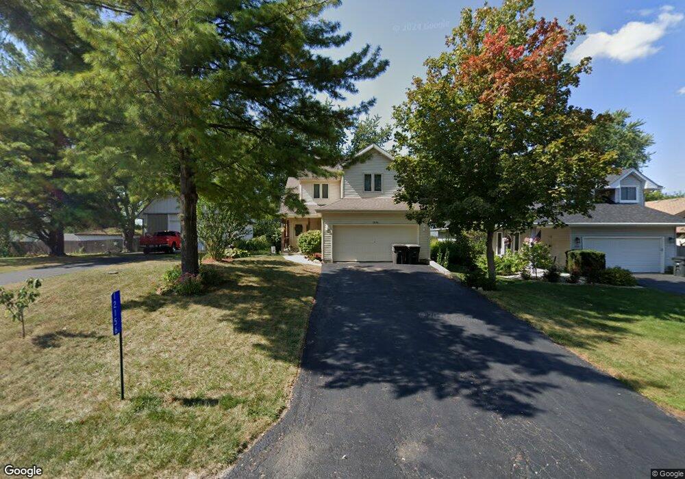
12156 221st Ave Bristol, WI 53104
Estimated Value: $394,000 - $477,000
3
Beds
3
Baths
1,826
Sq Ft
$240/Sq Ft
Est. Value
About This Home
This home is located at 12156 221st Ave, Bristol, WI 53104 and is currently estimated at $437,954, approximately $239 per square foot. 12156 221st Ave is a home located in Kenosha County with nearby schools including Salem Elementary School and Central High School.
Ownership History
Date
Name
Owned For
Owner Type
Purchase Details
Closed on
May 31, 2017
Sold by
Morgan Jeannie K
Bought by
Sretenovich George and Sretenovich Kriste L
Current Estimated Value
Purchase Details
Closed on
Jun 25, 2014
Sold by
Morgan Jeannie
Bought by
Morgan Jeannie K
Purchase Details
Closed on
Jul 31, 2007
Sold by
Pflueger Jeannie
Bought by
Morgan Jeannie
Purchase Details
Closed on
Mar 29, 2006
Sold by
Dans Carpentry Inc
Bought by
Pflueger Jeannie
Purchase Details
Closed on
Jan 5, 2005
Sold by
Clements James A and Clements Christine M
Bought by
Dans Carpentry Inc
Create a Home Valuation Report for This Property
The Home Valuation Report is an in-depth analysis detailing your home's value as well as a comparison with similar homes in the area
Home Values in the Area
Average Home Value in this Area
Purchase History
| Date | Buyer | Sale Price | Title Company |
|---|---|---|---|
| Sretenovich George | $224,900 | -- | |
| Morgan Jeannie K | $186,092 | -- | |
| Morgan Jeannie | $249,000 | -- | |
| Pflueger Jeannie | $232,900 | Blackhawk Title Services | |
| Dans Carpentry Inc | $38,500 | Blackhawk Title Services |
Source: Public Records
Tax History Compared to Growth
Tax History
| Year | Tax Paid | Tax Assessment Tax Assessment Total Assessment is a certain percentage of the fair market value that is determined by local assessors to be the total taxable value of land and additions on the property. | Land | Improvement |
|---|---|---|---|---|
| 2024 | $6,005 | $354,500 | $43,400 | $311,100 |
| 2023 | $5,808 | $354,500 | $43,400 | $311,100 |
| 2022 | $5,819 | $298,100 | $41,800 | $256,300 |
| 2021 | $5,852 | $298,100 | $41,800 | $256,300 |
| 2020 | $5,349 | $251,900 | $39,500 | $212,400 |
| 2019 | $5,278 | $251,900 | $39,500 | $212,400 |
| 2018 | $4,730 | $204,300 | $37,700 | $166,600 |
| 2017 | $4,300 | $204,300 | $37,700 | $166,600 |
| 2016 | $4,161 | $185,600 | $35,400 | $150,200 |
| 2015 | $4,376 | $185,600 | $35,400 | $150,200 |
| 2014 | $4,325 | $181,700 | $32,900 | $148,800 |
Source: Public Records
Map
Nearby Homes
- 11621 224th Ave
- 22727 126th St
- 12725 228th Ave
- 21605 117th St
- 12789 228th Ave
- Lt35 128th St
- 11736 231st Ct
- 12290 233rd Ave
- 198 Bridgewood Dr
- 188 Oakwood Dr
- 12719 234th Ave
- 23624 124th St
- 23607 125th St
- 324 Elmwood Ln
- 11207 234th Ct
- 394 Birchwood Dr
- 269 Lakewood Dr
- 42909 N Deep Lake Rd
- 11825 243rd Ave
- 602 Anita Ave
- 12131 221st Ave
- 12144 221st Ave
- 12154 221st Ave
- 22110 122nd St
- 12155 221st Ave
- 12161 222nd Ave
- 12155 222nd Ave
- 22114 122nd St
- 12132 220th Ave
- 12128 221st Ave
- 12125 221st Ave
- 12151 222nd Ave
- 22010 122nd St
- 12175 222nd Ave
- 12131 222nd Ave
- 12158 220th Ave
- 12123 221st Ave
- 12160 222nd Ave
- 12124 221st Ave
- 12156 222nd Ave