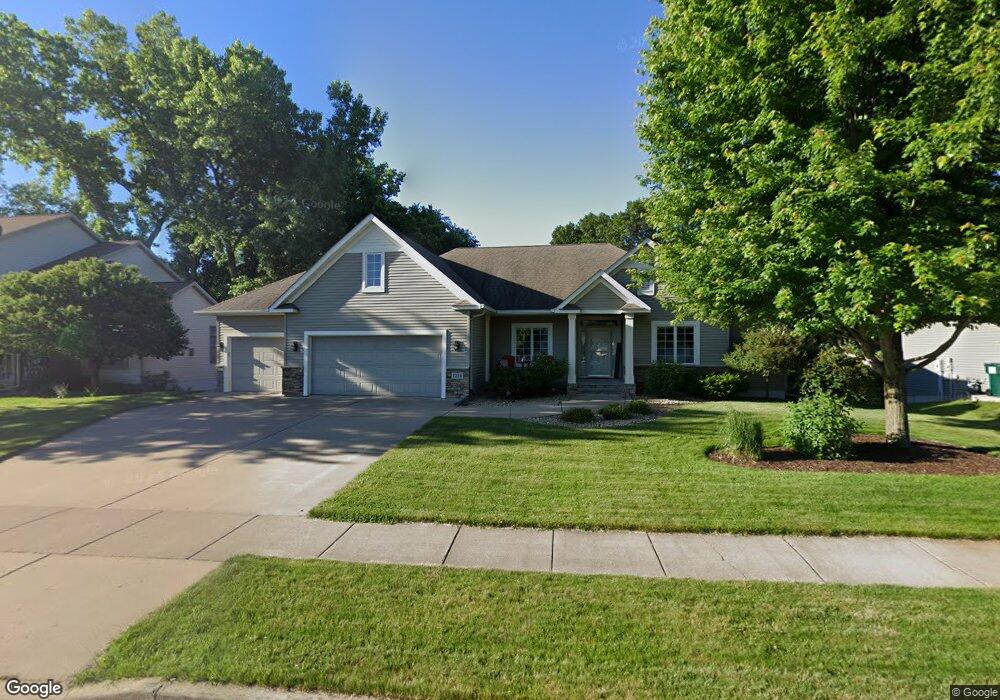
1216 10th St N Hudson, WI 54016
Estimated Value: $594,619 - $695,000
4
Beds
3
Baths
3,320
Sq Ft
$195/Sq Ft
Est. Value
About This Home
This home is located at 1216 10th St N, Hudson, WI 54016 and is currently estimated at $647,655, approximately $195 per square foot. 1216 10th St N is a home located in St. Croix County with nearby schools including North Hudson Elementary School, Hudson Middle School, and Hudson High School.
Ownership History
Date
Name
Owned For
Owner Type
Purchase Details
Closed on
Sep 18, 2020
Sold by
Lebarron Robert H and Lebarron Suzanne C
Bought by
Wessels Richard A and Wessels Dawn M
Current Estimated Value
Home Financials for this Owner
Home Financials are based on the most recent Mortgage that was taken out on this home.
Original Mortgage
$200,000
Outstanding Balance
$177,487
Interest Rate
2.9%
Mortgage Type
New Conventional
Estimated Equity
$470,168
Purchase Details
Closed on
Feb 28, 2005
Sold by
Derrick Homes Llc
Bought by
Lebarron Robert H and Lebarron Suzanne C
Home Financials for this Owner
Home Financials are based on the most recent Mortgage that was taken out on this home.
Original Mortgage
$99,500
Interest Rate
5.71%
Mortgage Type
Future Advance Clause Open End Mortgage
Create a Home Valuation Report for This Property
The Home Valuation Report is an in-depth analysis detailing your home's value as well as a comparison with similar homes in the area
Home Values in the Area
Average Home Value in this Area
Purchase History
| Date | Buyer | Sale Price | Title Company |
|---|---|---|---|
| Wessels Richard A | $525,000 | St Croix County Abstract & T | |
| Lebarron Robert H | $89,500 | None Available |
Source: Public Records
Mortgage History
| Date | Status | Borrower | Loan Amount |
|---|---|---|---|
| Open | Wessels Richard A | $200,000 | |
| Previous Owner | Lebarron Robert H | $99,500 |
Source: Public Records
Tax History Compared to Growth
Tax History
| Year | Tax Paid | Tax Assessment Tax Assessment Total Assessment is a certain percentage of the fair market value that is determined by local assessors to be the total taxable value of land and additions on the property. | Land | Improvement |
|---|---|---|---|---|
| 2024 | $71 | $539,700 | $77,300 | $462,400 |
| 2023 | $7,089 | $539,700 | $77,300 | $462,400 |
| 2022 | $6,961 | $539,700 | $77,300 | $462,400 |
| 2021 | $6,204 | $341,100 | $66,800 | $274,300 |
| 2020 | $5,987 | $311,400 | $67,000 | $244,400 |
| 2019 | $5,594 | $311,400 | $67,000 | $244,400 |
| 2018 | $5,561 | $311,400 | $67,000 | $244,400 |
| 2017 | $5,353 | $311,400 | $67,000 | $244,400 |
| 2016 | $5,353 | $311,400 | $67,000 | $244,400 |
| 2015 | $4,922 | $311,400 | $67,000 | $244,400 |
| 2014 | $4,881 | $311,400 | $67,000 | $244,400 |
| 2013 | $5,543 | $356,000 | $85,000 | $271,000 |
Source: Public Records
Map
Nearby Homes
- 1302 10th St N
- 1110 Partridge Ln N
- 241 Starrwood
- 1115 Willow River Rd N
- 1100 Michaelson St N
- 627 8th St N
- 603 10th St N
- 702 4th St N
- 606 6th St N
- 233 River Heights Trail
- 412 Helen St N
- 1094 Golden Oaks Ln
- 888 Bluebird Ct N
- 1205 Riverside Dr N
- 1205 Riverside Drive N
- 388 Brookwood Dr
- 296 Valley Estates Ct
- 530 Lakeside Bay Dr S
- 989 Priester Ln
- 560 Lakeside Bay Dr S Unit 560
- 1208 10th St N
- 1224 10th St N
- 1215 1215 10th-Street-n
- 1224 1224 10th-Street-n
- 1232 10th St N
- 1200 10th St N
- 1207 10th St N
- 1215 10th St N
- 1203 10 St N
- 1203 10th St N
- 1140 10th St N
- 1231 10th St N
- 1240 10th St N
- 1130 10th St N
- 1150 Vail Way N
- 1292 Krattley Ln
- 1210 Vail Way N
- 1243 10th St N
- 1220 Vail Way N
- 1190 Vail Way N