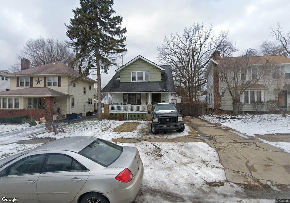
1216 Boston Ave Flint, MI 48503
Southwest Flint NeighborhoodEstimated Value: $98,000 - $130,000
2
Beds
2
Baths
1,758
Sq Ft
$64/Sq Ft
Est. Value
About This Home
This home is located at 1216 Boston Ave, Flint, MI 48503 and is currently estimated at $112,956, approximately $64 per square foot. 1216 Boston Ave is a home located in Genesee County with nearby schools including Eisenhower School, Flint Southwestern Classical Academy, and St John Vianney Catholic School.
Ownership History
Date
Name
Owned For
Owner Type
Purchase Details
Closed on
Apr 30, 2010
Sold by
Donovan Shaun and Secretary Of Housing & Urban D
Bought by
Galloway Mark Andrew
Current Estimated Value
Purchase Details
Closed on
Dec 14, 2009
Sold by
Wells Fargo Bank Na
Bought by
The Secretary Of Housing & Urban Develop
Purchase Details
Closed on
Jun 10, 2009
Sold by
Robinson David and Robinson Kathleen
Bought by
Wells Fargo Bank Na
Purchase Details
Closed on
Apr 25, 2001
Sold by
Schmidt Michael D and Schmidt Sue Ellen
Bought by
Robinson David and Robinson Kathleen
Create a Home Valuation Report for This Property
The Home Valuation Report is an in-depth analysis detailing your home's value as well as a comparison with similar homes in the area
Home Values in the Area
Average Home Value in this Area
Purchase History
| Date | Buyer | Sale Price | Title Company |
|---|---|---|---|
| Galloway Mark Andrew | $15,100 | None Available | |
| The Secretary Of Housing & Urban Develop | -- | None Available | |
| Wells Fargo Bank Na | $96,862 | None Available | |
| Robinson David | -- | Cislo Title Company |
Source: Public Records
Tax History
| Year | Tax Paid | Tax Assessment Tax Assessment Total Assessment is a certain percentage of the fair market value that is determined by local assessors to be the total taxable value of land and additions on the property. | Land | Improvement |
|---|---|---|---|---|
| 2025 | $1,861 | $49,200 | $0 | $0 |
| 2024 | $1,682 | $46,800 | $0 | $0 |
| 2023 | $1,642 | $37,400 | $0 | $0 |
| 2022 | $0 | $26,400 | $0 | $0 |
| 2021 | $1,679 | $26,600 | $0 | $0 |
| 2020 | $681 | $5,188 | $0 | $0 |
| 2019 | $520 | $5,316 | $0 | $0 |
| 2018 | $1,492 | $26,100 | $0 | $0 |
| 2017 | $1,501 | $0 | $0 | $0 |
| 2016 | $500 | $0 | $0 | $0 |
| 2015 | -- | $0 | $0 | $0 |
| 2014 | -- | $0 | $0 | $0 |
| 2012 | -- | $27,300 | $0 | $0 |
Source: Public Records
Map
Nearby Homes
- 1114 Christopher St
- 2112 Miller Rd
- 2124 Swayze St
- 1820 Chelsea Cir
- 2310 Gibson St
- 2410 Corunna Rd
- 2433 Brown St
- 2509 Corunna Rd
- 2437 Zimmerman St
- 2537 Swayze St
- 2464 Gibson St
- 2618 Brown St
- 607 Thayer St
- 2729 Chicago Blvd
- 2663 W Court St
- 2805 Reynolds St
- 932 Bradley Ave
- 1114 Clancy Ave
- 612 Bradley Ave
- 913 Davis St
Your Personal Tour Guide
Ask me questions while you tour the home.